Name/Title
Reynolds Creek and Bourland Creek CountyEntry/Object ID
M13735Description
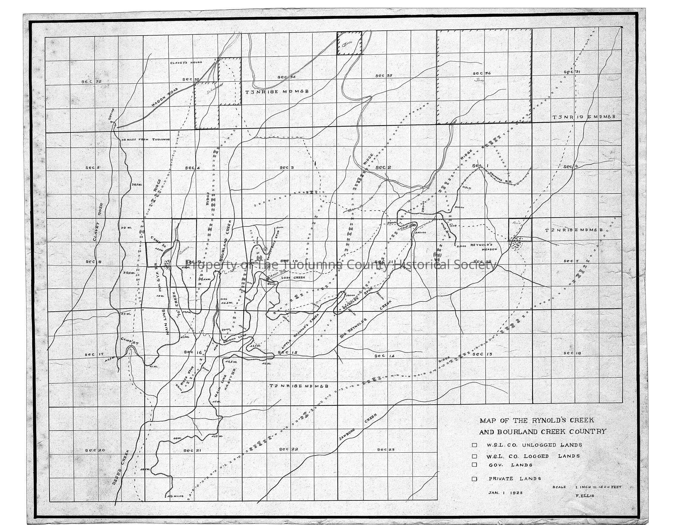
Map showing West Side Lumber Co. lands in the Reynold's creek and Bourland creek area. It also shows the railroad right-of-way from mile post 38 to mile post 49. Drawn by Fred Ellis.
Shows locations of Camps 27, 30, 33 and a grading camp. The grading camp would be where the crew working on extending the track roadbeds would be staying. The other camps are mainly woods crew. (loggers).
The map is in excellent condition.
Note misspell in map title Rynolds instead of Reynolds.
Township/Range/Section: 14, 15, 16
Township/Range/Section: T3N R18E Secs 33, 34, 35, 36 T2N R18E Secs 1, 2, 3, 4, 8, 9, 10, 11, 12, 13Collection
Standard Lumber Company CollectionLexicon
Search Terms
forestry/map, logging, river, streams, Hetch Hetchy & Yosemite Valley Railroad, wagon road to Clavey's house, Clavey River, Reeds Creek, 76 Creek, Bourland Creek, Lost Creek, Little Reynolds Creek, Big Reynolds Creek, Reynolds Meadow, Clavey House, Reynolds Creek