Name/Title
Martin M. Flint's Map of Vermont drawn by MyselfEntry/Object ID
2018.17.1Description
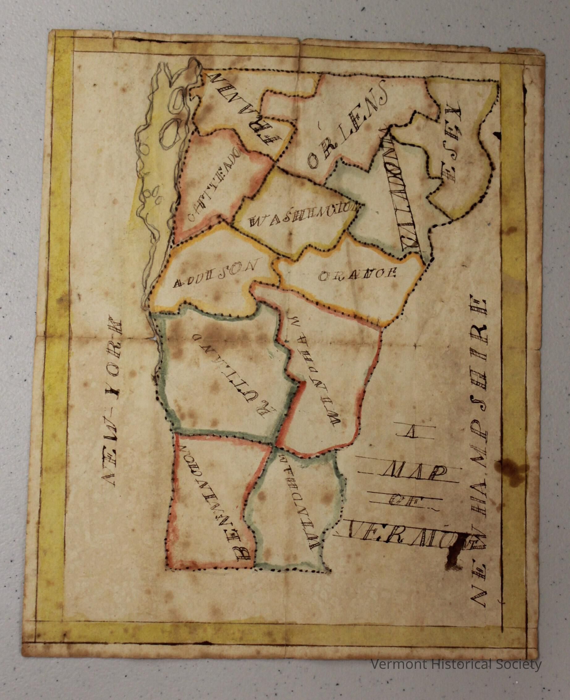
School boy map of Vermont. Map depicts 12 of the 14 Vermont counties with Lamoille county and Grand Isle county both absent, although some oft the islands that constitute Grand Isle county appear to be depicted. The Borders of each county are composed of dotted lines of ink dot with some appearing to have a straight continues line drawn through them. The interiors of the counties close the border have been colored with water color paint but only a small amount and most the county interiors remain colorless. The counties are all labeled with ink but the handwriting and spelling of the labels makes it difficult to tell weather the labels are accurate. The only major physical feature of the state depicted is Lake Champlain, whose border is drawn with curved lines and whose island are shown through the use of round oval like shapes. The New York and New Hampshire borders are both simply labeled with in ink, with no mention of the Canadian or Massachusetts borders. Both states are just Labeled New York and New Hampshire receptively. The map title is located in the lower left corner with it simply reading "A map of Vermont" although T is obscured due to damage that either took place during or after production. Lines used to draw the title are still visible. The edge of the map is composed of two lines encompassing yellow water color, though foxing has caused much of it to turn brown. On the back of the map the artist's name is displayed as reading Martin M Flint, drawn by Myself. An inscription on the back says to "H.M Ditz".
Hand-drawn map of Vermont. The map is separated by county, with the borders drawn in black ink with dotted lines. Within the borders, each county is outlined with a thick line of watercolor in a color different from its neighbors. Pink, blue, yellow, orange, and green are used. The names of the counties are written in large, decorative letters oriented in various ways. The edges of the page are framed with a line a yellow.
The paper has a crease horizontally across the center. The reverse is labeled in ink, ""Martin M. Flint's Map of Vermont drawn by Myself" in script. Beneath the label in pencil are the words, "To H. M. Ditz".Context
Made by Martin Flint of Randolph, VermontAcquisition
Accession
2018.17Source or Donor
Graffagnino, J. KevinAcquisition Method
GiftCredit Line
In memory of J. Brooks BuxtonLexicon
Nomenclature 4.0
Nomenclature Secondary Object Term
MapNomenclature Primary Object Term
DrawingNomenclature Primary Object Term
CartographNomenclature Sub-Class
Graphic DocumentsNomenclature Class
ArtNomenclature Class
Documentary ObjectsNomenclature Category
Category 08: Communication ObjectsDimensions
Dimension Description
OverallHeight
7-7/8 inWidth
6-1/4 in