Name/Title
Road MapEntry/Object ID
2015.19.18Description
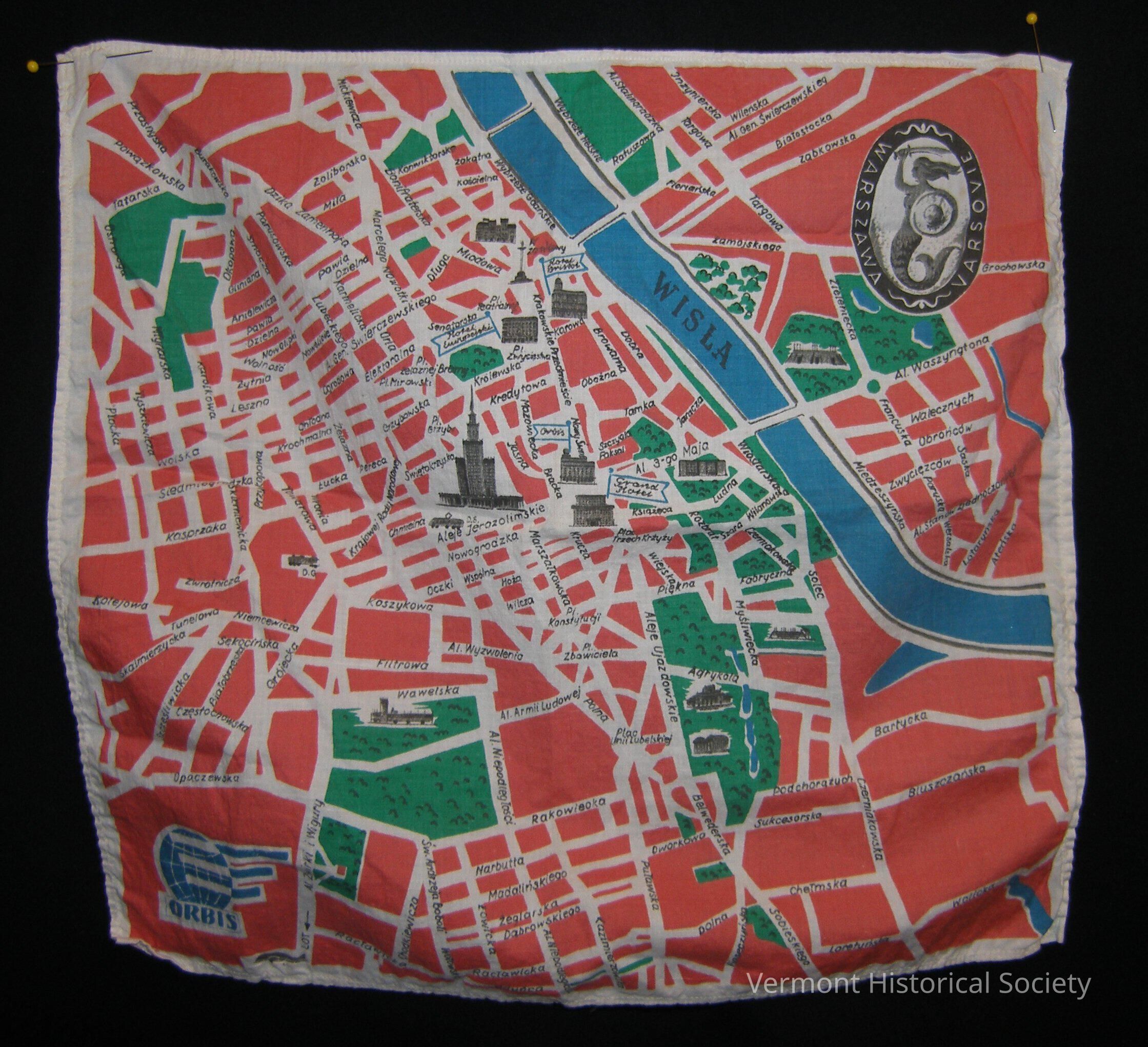
Square piece of cotton printed with a street map of Warsaw, Poland. The ground color of the map is red, with parts in green, roads in white, and the Wisla River in blue. Some prominent landmarks are depicted in black, but are unlabeled. The bottom left corner has a blue logo consisting of a globe, three horizontal lines, and the word "ORBIS". The top right corner has an oval with an image of a mermaid holding a sword and shield with the words, "WARSZAWA VARSOVIE".Context
Used by Lt. Col. James Alan Partridge during World War IIAcquisition
Accession
2015.19Source or Donor
Roy, Ruth PartridgeAcquisition Method
GiftCredit Line
In memory of James Alan Partridge & Isabel MacLeod PartridgeMade/Created
Manufacturer
ORBISDate made
1942 - 1945Lexicon
Nomenclature 4.0
Nomenclature Tertiary Object Term
Map, RoadNomenclature Secondary Object Term
MapNomenclature Primary Object Term
CartographNomenclature Sub-Class
Graphic DocumentsNomenclature Class
Documentary ObjectsNomenclature Category
Category 08: Communication ObjectsDimensions
Dimension Description
OverallHeight
13-3/4 inWidth
14-3/4 inRelationships
Related Person or Organization
Person or Organization
Partridge, James Alan (1915-2014)Related Places
Place
City
Barre CityCounty
Washington CountyState/Province
VermontCountry
United States of AmericaContinent
North AmericaPlace
City
WarsawCountry
PolandContinent
Europe