Name/Title
MapEntry/Object ID
2015.19.19Description
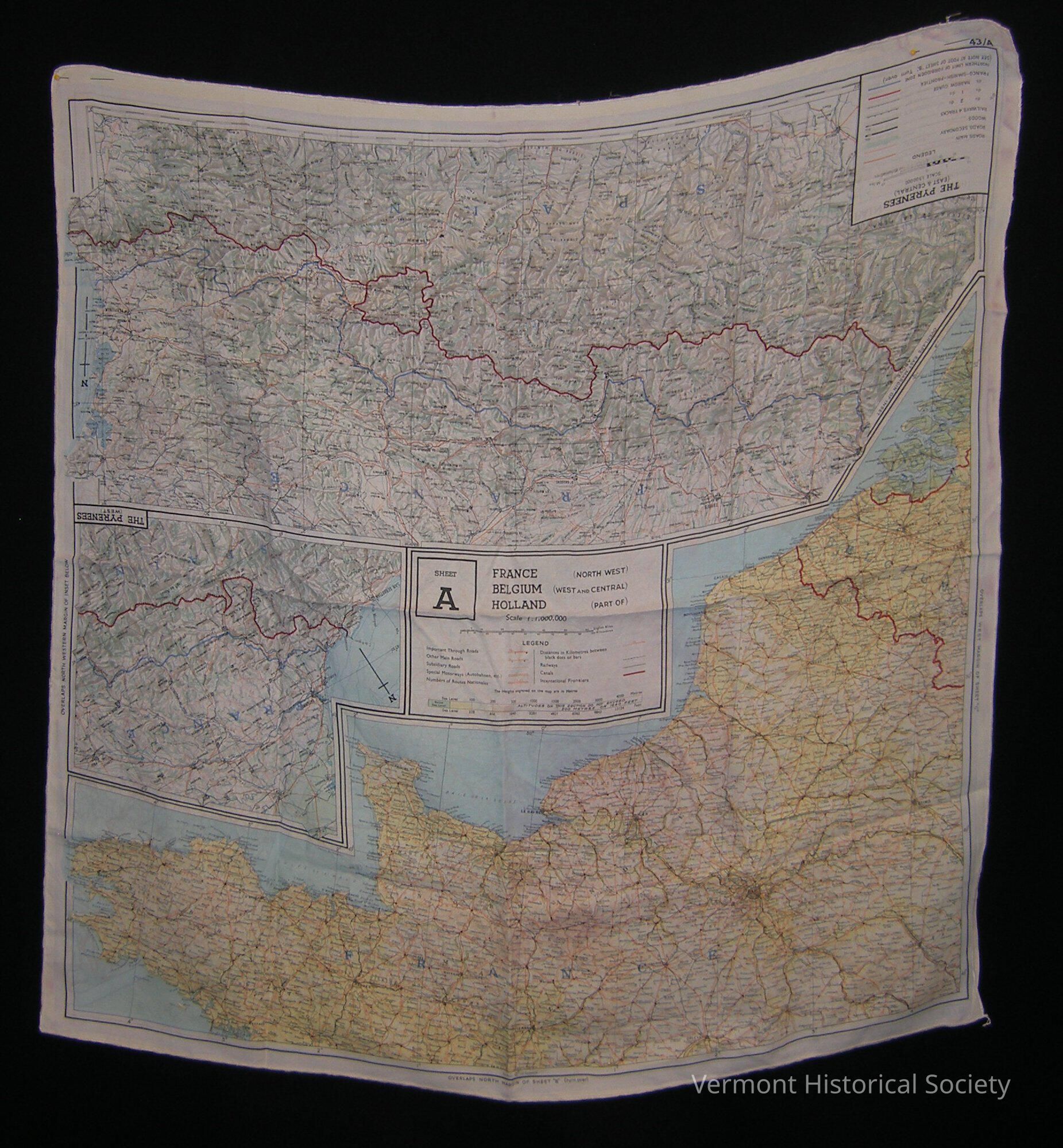
Large two-side map printed on silk. One side shows three maps: "The Pyrenees (West)", "The Pyrenees (East & Central)", and "France (North West) Belgium (West and Central) Hollard (Part of)". The other side shows two maps: "German - Swiss Frontier", and "France (South West) Spain (North)".Context
Used by Lt. Col. James Alan Partridge during World War IIAcquisition
Accession
2015.19Source or Donor
Roy, Ruth PartridgeAcquisition Method
GiftCredit Line
In memory of James Alan Partridge & Isabel MacLeod PartridgeLexicon
Nomenclature 4.0
Nomenclature Secondary Object Term
MapNomenclature Primary Object Term
CartographNomenclature Sub-Class
Graphic DocumentsNomenclature Class
Documentary ObjectsNomenclature Category
Category 08: Communication ObjectsDimensions
Dimension Description
OverallWidth
28-1/2 inLength
28-1/2 inRelationships
Related Person or Organization
Person or Organization
Partridge, James Alan (1915-2014)Related Places
Place
City
Barre CityCounty
Washington CountyState/Province
VermontCountry
United States of AmericaContinent
North AmericaPlace
Country
FranceContinent
EuropePlace
Country
BelgiumContinent
EuropePlace
Country
SpainContinent
EuropePlace
Country
The NetherlandsContinent
Europe