Name/Title
Map of the WorldEntry/Object ID
2007.1.2Description
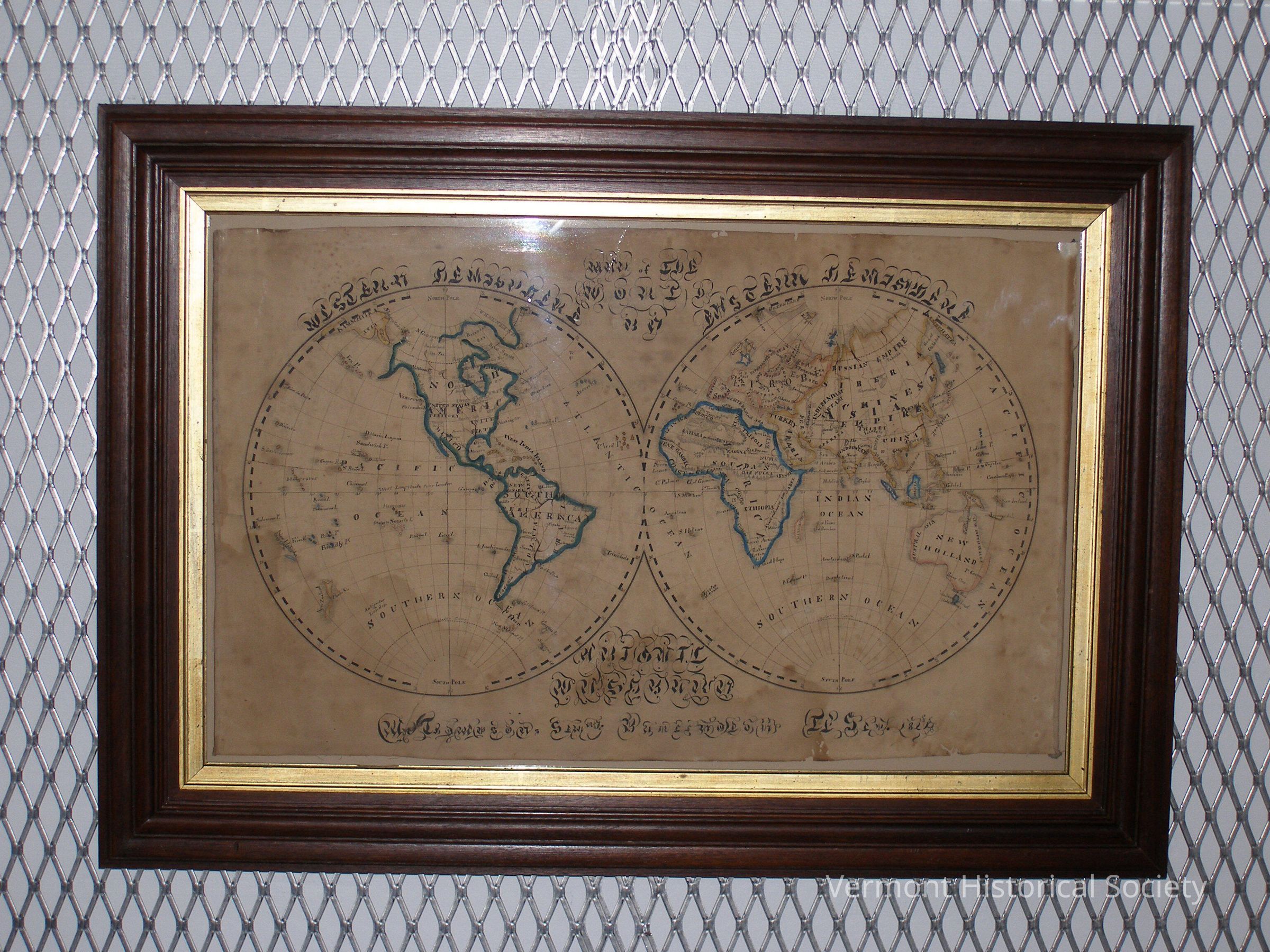
School girl map showing a two-hemisphere map of world. The map displays all seven continents and many islands. Antipode of London is also labeled in the bottom left corner of the western hemisphere. Continent and island borders are painted with watercolors using dark blue, turquoise, red and yellow paint. Inside the continents, several physical features are displayed including rivers, lakes, deserts, and mountain ranges. County names and borders are also displayed in ink with borders being drawn using dotted lines. Several major and regional oceans are also displayed as well as the north and south poles. A series of numbers contained within squares is also visible throughout the map.
A coordinate grid covers both hemispheres, with lines appearing to display latitude and longitude. Numbers for latitude are displayed on a series of black and white lines on the edges of each hemisphere, and numbers for longitude are displayed along the equator line. In the middle of the map and above both hemispheres the text "MAP OF THE WORLD" is written in gothic cursive script. To the left and right of it, the text "WESTERN HEMISPHERE" and "EASTERN HEMISPHERE" are written above the above the western and eastern hemisphere respectively. At the center bottom, the authors name is written. Below that text is written "Mr. Thompson's seminary Burlington, September 1829." The entire map is contained within a frame with the inner layer colored gold and outer brown.Type of Drawing
Ink - BlackContext
Drawn by Abigail Washburn while attending Zadock Thompson's Seminary in Burlington, VermontAcquisition
Accession
2007.1Source or Donor
Buxton, J. Brooks (1934-2018)Acquisition Method
GiftMade/Created
Date made
1829Place
City
BurlingtonCounty
Chittenden CountyState/Province
VermontCountry
United States of AmericaContinent
North AmericaLexicon
Nomenclature 4.0
Nomenclature Secondary Object Term
MapNomenclature Primary Object Term
CartographNomenclature Sub-Class
Graphic DocumentsNomenclature Class
Documentary ObjectsNomenclature Category
Category 08: Communication ObjectsDimensions
Dimension Description
Overall (framed)Height
21-1/4 inWidth
30-1/4 inDepth
1-1/2 inDimension Description
Overall (unframed)Height
14-1/4 inWidth
23-3/4 in