Name/Title
MapEntry/Object ID
2024.6.10Description
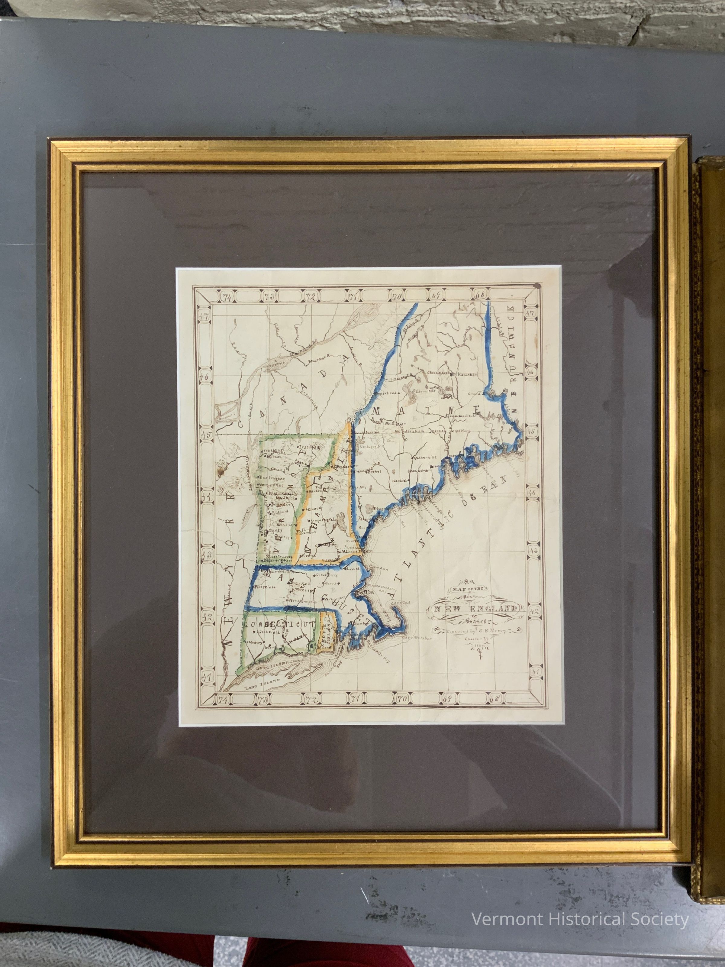
Framed hand-drawn and colored map of New England by S.E. Henry of Chester, Vermont. The pen and ink map shows all six New England states bordered by the Atlantic Ocean, Canada, and New York, and features a decorative ink border denoting degrees of longitude and latitude. The coastline includes coastline depth indicators and the interior of each state includes many of the major rivers and cities or towns. Massachusetts and Maine are outlined in blue, New Hampshire and Rhode Island in yellow, and Connecticut and Vermont in green. There is a decorative cartouche in the lower right space of the ocean that reads, "Map of the Six NEW ENGLAND States Executed by S.E. Henry Chester VT 1867." The map is in a simple gold and black edged frame with a dark brown/gray mat.Artwork Details
Medium
Ink, WatercolorSubject Place
Region
New EnglandCountry
United States of AmericaContinent
North AmericaContext
Most likely drawn by Sarah Elizabeth Henry, age 12 or 13 of Chester, Vermont in 1867. Colloquilay referred to as "School Girl Maps," these copies of example maps were a common school project meant to teach geography. Though certainly produced by both boys and girls, those made by girls seem much more prevalent in museum collections.
Sarah Elizabeth Henry was born July 12, 1854 in Chester, Vermont to Hugh Horatio Henry (1814-1869) and his wife Sarah Henry (1812-1867). Sarah Elizabeth was the youngest of 11 children and lost her parents at a young age. Upon the death of her father in 1869 she joined her older sister's household. She died on July 10, 1882 at her sister's home of consumption (tuberculosis).Acquisition
Accession
2024.6Source or Donor
Brooks Memorial LibraryAcquisition Method
GiftMade/Created
Artist Information
Artist
Henry, Sarah Elizabeth (1854-1882)Role
PainterDate made
1867Place
Town
ChesterCounty
Windsor CountyState/Province
VermontCountry
United States of AmericaContinent
North AmericaLexicon
Nomenclature 4.0
Nomenclature Secondary Object Term
MapNomenclature Primary Object Term
CartographNomenclature Sub-Class
Graphic DocumentsNomenclature Class
Documentary ObjectsNomenclature Category
Category 08: Communication ObjectsDimensions
Dimension Description
Overall (exterior of frame)Height
14 inWidth
12-1/4 inDepth
1/2 inDimension Description
sight size within frame and matHeight
8-3/4 inWidth
7-1/2 inRelationships
Related Person or Organization
Person or Organization
Henry, Sarah Elizabeth (1854-1882)Related Places
Place
Town
ChesterCounty
Windsor CountyState/Province
VermontCountry
United States of AmericaContinent
North America