Name/Title
SignEntry/Object ID
1989.1.2Description
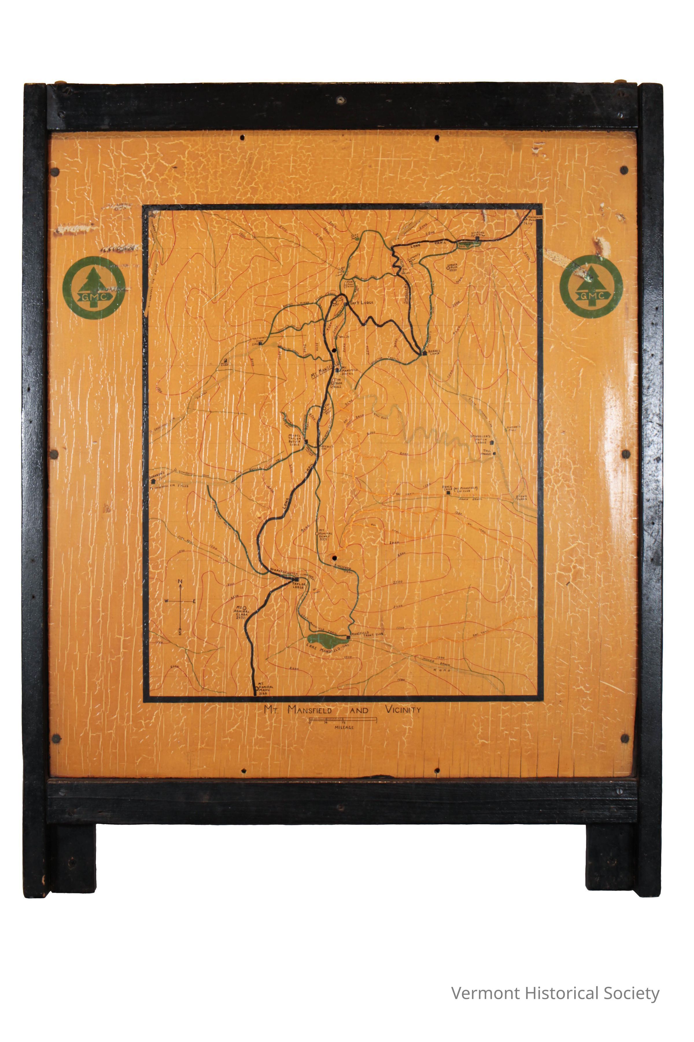
Yellow sign framed in black and printed with an elevation map of Mt. Mansfield with the Long Trail and other trails marked. Taft Lodge and other lodges are also marked. The Green Mountain Club logo--a pine tree in a circle with GMC--is shown twice. A small title under the map reads "MT. Mansfield and Vicinity" The scale for this map is 1/2mile = 1 1/2". Written on the back is the inscription, "This map painted c. 1940 by Elton Ray Beal (1897-1971) of 77 Pomeroy St.., Burlington, VT. He was employed by the Engineering Dept. of the University of Vermont, and was an active member of the GMC."Context
Made by the Green Mountain Club to show trails and lodges in Mount Mansfield, including the Long Trail.Acquisition
Accession
1989.1Source or Donor
Acomb, Merlin LloydAcquisition Method
GiftMade/Created
Date made
1940 - 1950Place
State/Province
VermontCountry
United States of AmericaContinent
North AmericaLexicon
Nomenclature 4.0
Nomenclature Primary Object Term
SignNomenclature Sub-Class
Visual Communication DevicesNomenclature Class
Visual Communication T&ENomenclature Category
Category 06: Tools & Equipment for CommunicationDimensions
Dimension Description
OverallHeight
31-1/2 inWidth
25 inDepth
2 inRelationships
Related Person or Organization
Person or Organization
Green Mountain ClubRelated Places
Place
Mountain
Mount MansfieldTown
UnderhillCounty
Chittenden CountyState/Province
VermontCountry
United States of AmericaContinent
North AmericaPlace
* Untyped Place
Long TrailState/Province
VermontCountry
United States of AmericaContinent
North AmericaInterpretative Labels
Label
Trail Map, 1940
Elton Ray Beal (1897-1971)
Burlington, Vermont
Paint on board
Gift of Merlin Lloyd Acomb, #1989.1.2
An employee of UVM’s engineering school, Elton Beal spent free time as a volunteer with the Green Mountain Club. Though posted trail maps are common at all trail heads today, this type of information was not as readily available in the early years of the Long Trail. This hand-painted sign shows much of the Mount Mansfield section with lodges and side trails noted.