Name/Title
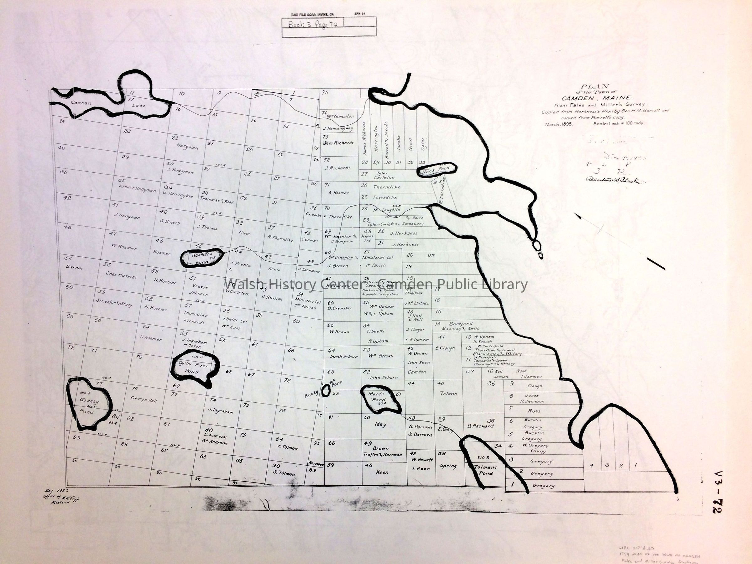
1799 Plan of the Town of Camden from Fales and Miller SurveysEntry/Object ID
WHC 2018.30Scope and Content
1799 PLAN OF THE TOWN OF CAMDEN, ME. Fales and
Miller Surveys. "Copied from Harkness's plan of 1799
by George M. Barrett and copied from Barrett's copy
March 1795." Photocopy of original. Scale of original
1 inch = 100 rods. Lower left hand corner inscribed "May
1923/Office of D. H. Tripp/Rockland." In upper right hand
corner very faded rubber stamp block is inscribed "January
4, 1925, 4 - 6 - P/3 - 72 ." followed by signature "Albertus
W. Clarke. At top, Marginal Block notes "Book 3, page 72."
Right margin stamped "V3-72." Appears as though it might
be from the Knox Co. Registry of Deeds Plan Book.Collection
Camden Public Library Map CollectionCataloged By
Wyatt BerryAcquisition
Accession
WHC 2018.30Source or Donor
CPL Map CollectionAcquisition Method
Found in CollectionLexicon
Nomenclature 4.0
Nomenclature Secondary Object Term
MapNomenclature Primary Object Term
CartographNomenclature Sub-Class
Graphic DocumentsNomenclature Class
Documentary ObjectsNomenclature Category
Category 08: Communication ObjectsArchive Details
Archive Size/Extent
24" X 35 3/8"
Photocopy on white paperArchive Notes
Early Create Date: 1799Location
Location
Walsh History Center
Map Case Folder ACategory
PermanentDate
October 21, 2025Category
PermanentMoved By
Wyatt BerryDate
September 21, 2018Inventory
Inventoried By
Wyatt BerryInventoried Date
Sep 21, 2018Condition
Overall Condition
GoodDate Examined
Sep 7, 2018Examined By
Ken GrossGeneral Notes
Note Type
Cataloging NoteNote
Status: OK
Status By: Wyatt Berry
Status Date: 2018-09-21Note
2 CopiesCreate Date
September 7, 2018Update Date
July 20, 2026