Name/Title
Road Map of Camden and VicinityEntry/Object ID
CHRC 2011.4.5Description
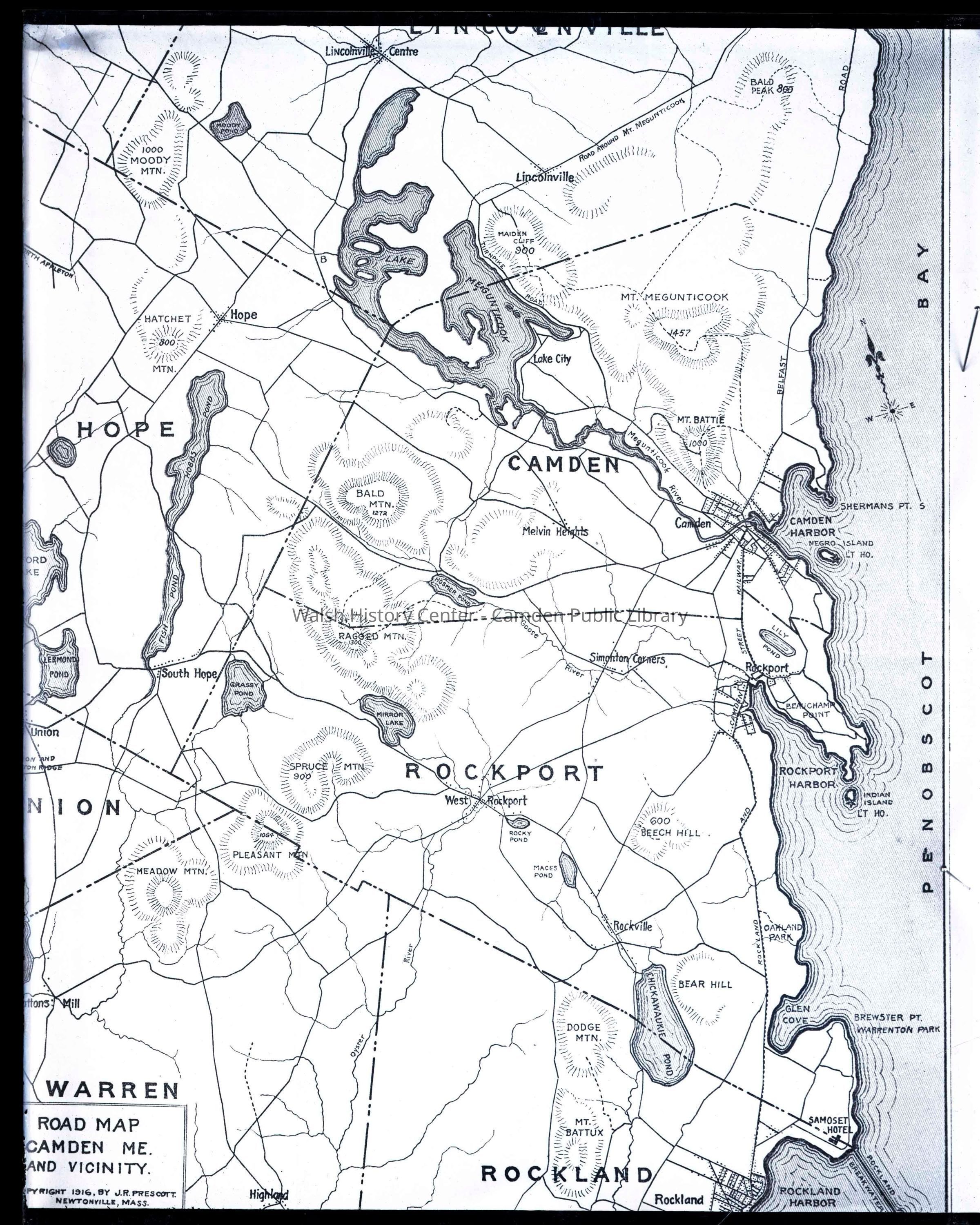
Glass plate negative of a 1916 map of Camden, Maine. Map shows parts of Lincolnville, Hope, Union, Warren, and Rockland, including lakes, ponds, roads and mountains. Copyright by J.R. Prescott of Newtonville, Massachusetts dated 1916. Map was likely used in his "Glimpses of Camden" series of tourism books published at the turn of the century.Collection
CHRC - Town Documents CollectionCataloged By
Heather BilodeauAcquisition
Accession
CHRC 2011.4Source or Donor
Camden Historic Resources CommitteeAcquisition Method
Permanent LoanMade/Created
Date made
1916Place
Location
Maine/ Knox County/ CamdenNotes
Medium: GlassLexicon
LOC Thesaurus for Graphic Materials
Negatives, PhotographsSearch Terms
Camden, Hope, Lincolnville, Maine, Rockland, Union, WarrenLegacy Lexicon
Object Name
Negative, Glass-plateOther Names and Numbers
Other Numbers
Number Type
Other NumberOther Number
1996-TD-005Location
Location
Container
Box 4Cabinet
CHRCRoom
Storage RoomBuilding
Walsh History CenterCategory
PermanentDate
October 21, 2025Condition
Overall Condition
FairDate Examined
Jun 11, 2011Examined By
Heather BilodeauNotes
Corner is broken off; needs to be rehoused.Relationships
Related Person or Organization
Person or Organization
Prescott, John R.Copyright
Copyright Details
J.R. Prescott, Newtonville, MAGeneral Notes
Note
Original or Copy: Original
Status: OK
Status By: Heather Bilodeau
Status Date: 2011-06-11Created By
admin@catalogit.appCreate Date
June 11, 2011Updated By
admin@catalogit.appUpdate Date
October 26, 2025