Name/Title
1875 Map of the Town of Camden, MaineEntry/Object ID
CHRC 2011.4.6Scope and Content
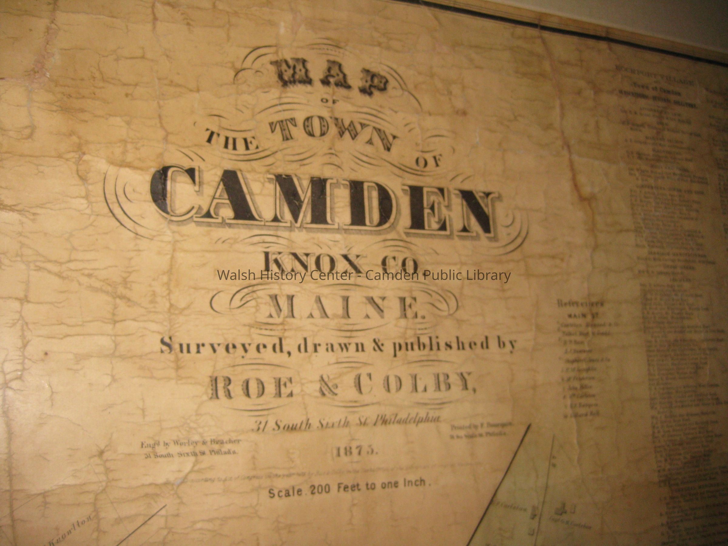
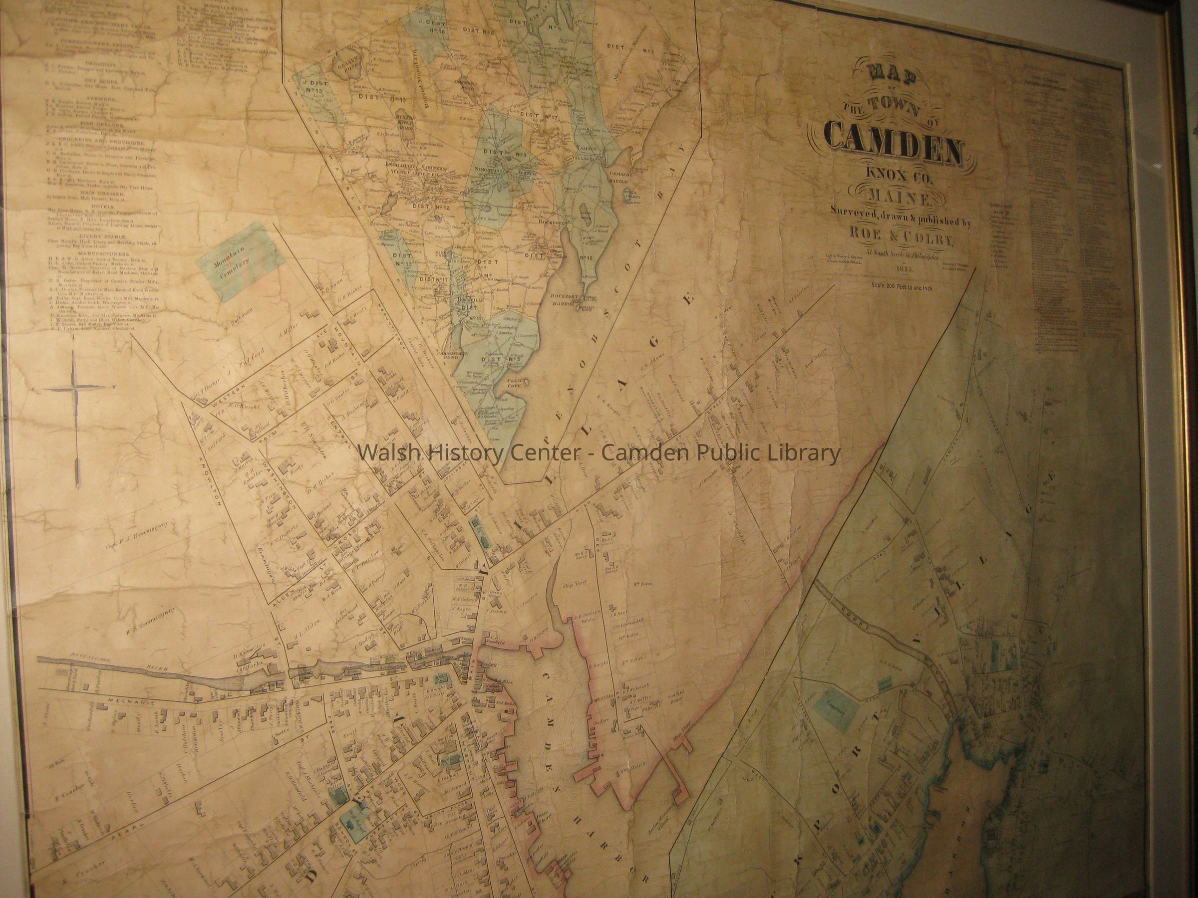
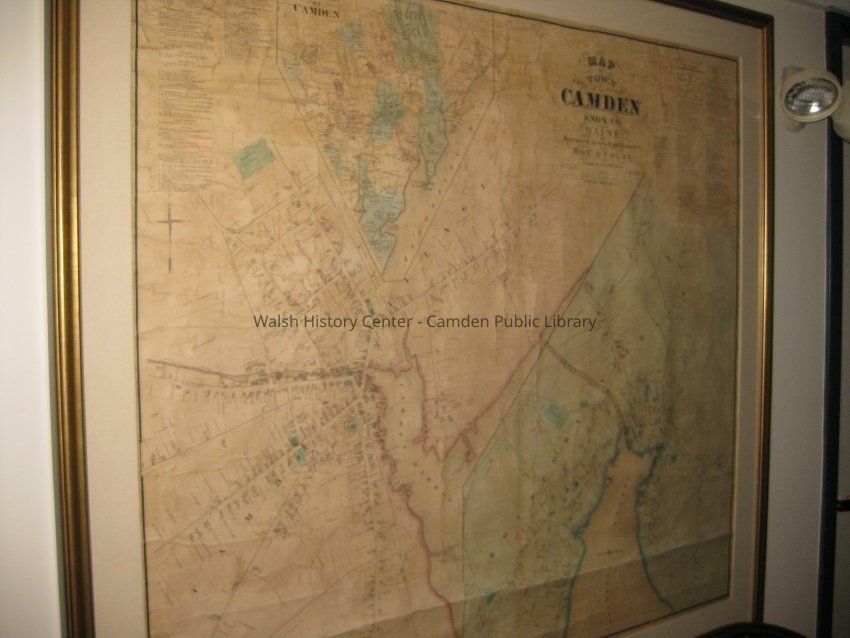
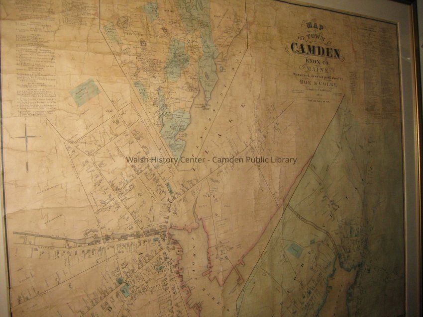
Map of the town of Camden, Maine dated 1875. Surveyed, drawn and published by Roe & Colby, 31 South Sixth Street, Philadelphia, PA. Inset detail of Camden and Rockport villages. Map scale is 1 inch = 200 ft.Collection
CHRC - Town Documents CollectionCataloged By
Heather BilodeauAcquisition
Accession
CHRC 2011.4Source or Donor
Camden Historic Resources CommitteeAcquisition Method
Permanent LoanLexicon
Nomenclature 4.0
Nomenclature Secondary Object Term
MapNomenclature Primary Object Term
CartographNomenclature Sub-Class
Graphic DocumentsNomenclature Class
Documentary ObjectsNomenclature Category
Category 08: Communication ObjectsLOC Thesaurus for Graphic Materials
MapsSearch Terms
Camden, Rockport, MaineArchive Details
Creator
Roe & Colby, PhiladelphiaDate(s) of Creation
1875Archive Size/Extent
44 1/2" x 50"Archive Notes
Date(s): 1875Other Names and Numbers
Other Numbers
Number Type
Other NumberOther Number
1997-TD-006Location
Location
Wall
2nd floor hallwayRoom
On displayBuilding
Walsh History CenterCategory
PermanentDate
October 21, 2025Condition
Overall Condition
GoodDate Examined
Jun 11, 2011Examined By
Heather BilodeauNotes
Restored and framed under archival glass June 2000, cost of restoration shared with Camden Public Library.General Notes
Note
Status: OK
Status By: Heather Bilodeau
Status Date: 2011-06-11Created By
admin@catalogit.appCreate Date
June 11, 2011Updated By
admin@catalogit.appUpdate Date
October 27, 2025