Name/Title
Plan of Lake City, Camden, Maine 1887Entry/Object ID
CAHC 2008.11.7Scope and Content
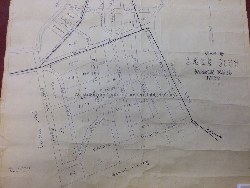
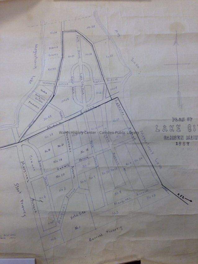
Plan for Lake City Development in Camden circa 1887. Lists lots by number and by name for those already purchased. Includes lot degree angles and street names. Scale is 100 feet = 1 inch. Survey by C. Corliss. Placed on file at the Knox County Registry of Deeds October 11, 1889.
Ink over copy.Collection
Walsh History Center Map CollectionCataloged By
Carrie RossiterAcquisition
Accession
CAHC 2008.11Source or Donor
Mr. Howard S. HuntAcquisition Method
GiftLexicon
Nomenclature 4.0
Nomenclature Secondary Object Term
MapNomenclature Primary Object Term
CartographNomenclature Sub-Class
Graphic DocumentsNomenclature Class
Documentary ObjectsNomenclature Category
Category 08: Communication ObjectsLOC Thesaurus for Graphic Materials
MapsSearch Terms
Camden, Lake CityLocation
Location
Drawer
Camden MapsCabinet
Map CaseBuilding
Walsh History CenterCategory
PermanentDate
October 21, 2025Inventory
Inventoried By
Heather MoranInventoried Date
Feb 22, 2014Condition
Overall Condition
FairDate Examined
Mar 6, 2015Examined By
Heather MoranDeaccession
Deaccession
CAHC 2008.11Notes
Reason for Deaccession: Donor requested item be returned as was only on loan for scanning.General Notes
Note
Status: OK
Status By: Heather Moran
Status Date: 2015-03-06Created By
admin@catalogit.appCreate Date
February 6, 2008Updated By
admin@catalogit.appUpdate Date
October 27, 2025