Name/Title
Road Map, Locality of Camden, MaineEntry/Object ID
WHC 2016.16Scope and Content
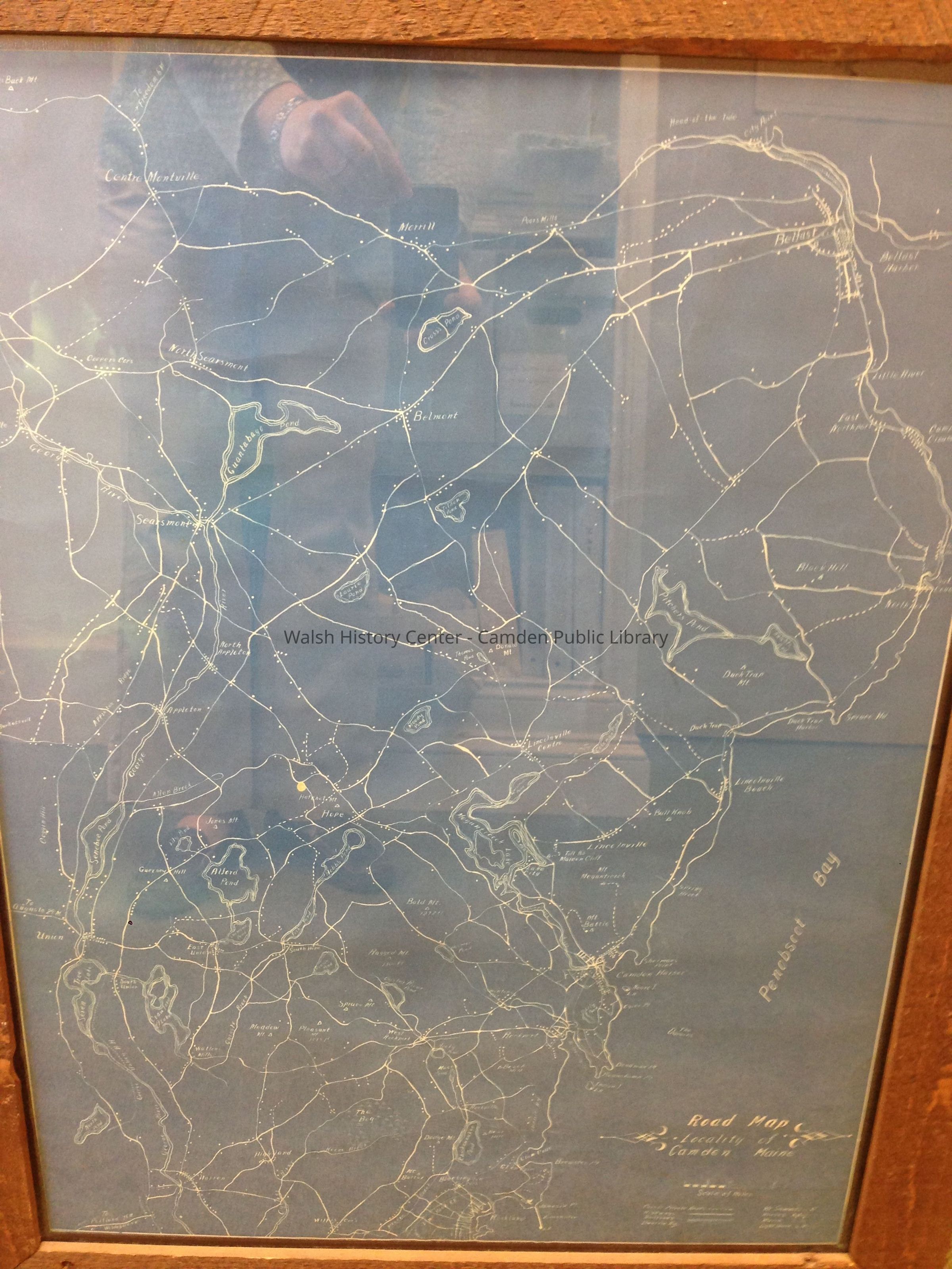
Undated blueprint map titled "Road Map, Locality of Camden, Maine."
Map shows "poor or private roads, highways, railroads, electric
railways, Mt. summits, homes, marsh, and lighthouses." It extends from Rockland in the south to Montville and Belfast in the north, and from Burkettville in the west to Northport in the east. Blueprint mounted on linen. Back side is inscribed in pencil "J.R. Prescott," and "Road Map." LIGHT-SENSITIVE print. No date. Note on folder says "likely 1890-1933."Collection
Camden Public Library Map CollectionCataloged By
Heather MoranAcquisition
Accession
WHC 2016.16Source or Donor
Patricia and Rendle JonesAcquisition Method
GiftLexicon
Nomenclature 4.0
Nomenclature Secondary Object Term
MapNomenclature Primary Object Term
CartographNomenclature Sub-Class
Graphic DocumentsNomenclature Class
Documentary ObjectsNomenclature Category
Category 08: Communication ObjectsArchive Details
Creator
unknownDate(s) of Creation
1892 - 1933Archive Notes
Date(s) Created: UnknownDimensions
Dimension Notes
Size: 18 5/8" x 25"Location
Location
Drawer
2Cabinet
Map CaseBuilding
Walsh History CenterCategory
PermanentDate
October 21, 2025Condition
Overall Condition
FairDate Examined
May 21, 2016Examined By
Heather MoranNotes
Removed from wood frame and plywood backing. Rehoused in archival map folder.General Notes
Note
Status: OK
Status By: Heather Moran
Status Date: 2016-05-21Created By
admin@catalogit.appCreate Date
May 21, 2016Updated By
admin@catalogit.appUpdate Date
October 27, 2025