Name/Title
1904 Sanborn map of Rockport Section 5Entry/Object ID
WHC 2018.32Scope and Content
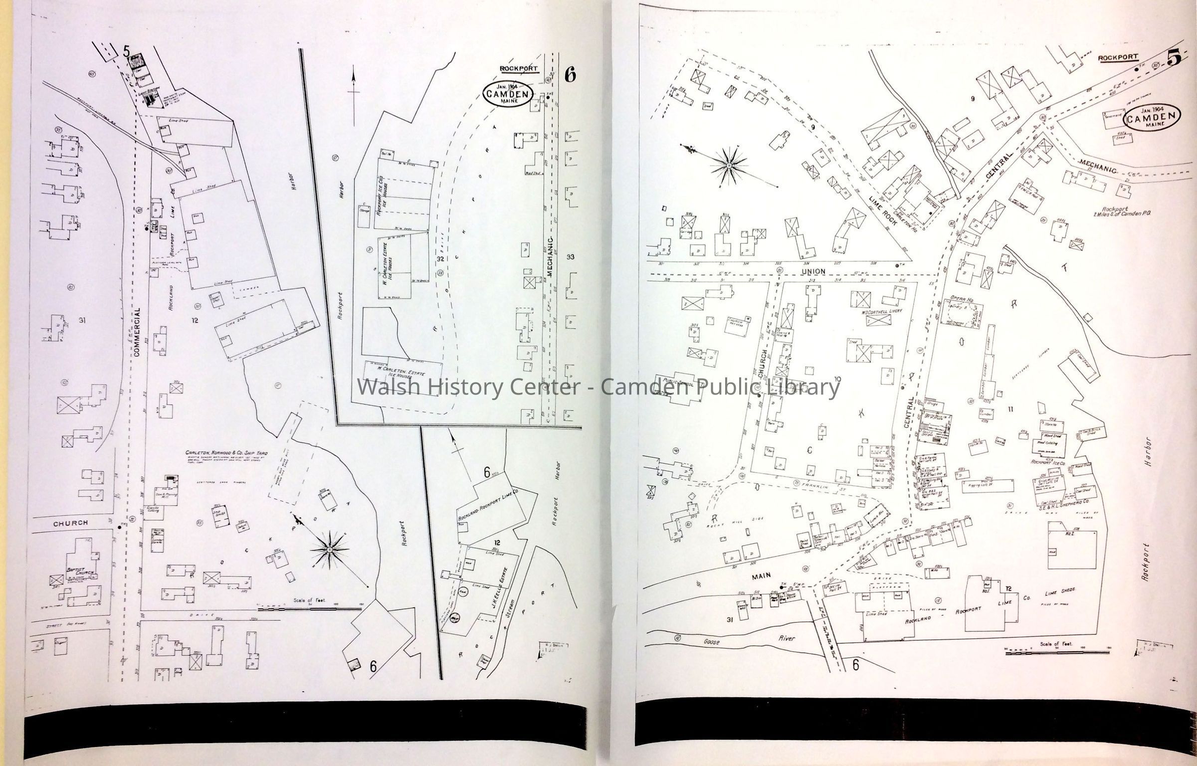
ROCKPORT. Sanborn Insurance Map, 1904. Section 5. It shows the area from the public school on Church Street at the left to Rockport Harbor on the right, and from Goose River at the bottom to Limerock and Central streets at the top. Photocopy on vellum. Tear in left margin.Collection
Camden Public Library Map CollectionCataloged By
Wyatt BerryAcquisition
Accession
WHC 2018.32Source or Donor
CPL Map CollectionAcquisition Method
Found in CollectionLexicon
Nomenclature 4.0
Nomenclature Secondary Object Term
MapNomenclature Primary Object Term
CartographNomenclature Sub-Class
Graphic DocumentsNomenclature Class
Documentary ObjectsNomenclature Category
Category 08: Communication ObjectsSearch Terms
Rockport, Sanborn Insurance Map, Limerock Street, Goose River, Church StreetLocation
Location
Cabinet
Map CaseBuilding
Walsh History CenterCategory
PermanentDate
October 21, 2025Category
PermanentMoved By
Wyatt BerryDate
September 21, 2018Inventory
Inventoried By
Wyatt BerryInventoried Date
Sep 21, 2018Condition
Overall Condition
GoodDate Examined
Sep 7, 2018General Notes
Note
Status: OK
Status By: Wyatt Berry
Status Date: 2018-09-21Created By
admin@catalogit.appCreate Date
September 7, 2018Updated By
admin@catalogit.appUpdate Date
October 27, 2025