Name/Title
CAMDEN, ROCKPORT, AND PART OF LINCOLNVILLEEntry/Object ID
WHC 2018.38Scope and Content
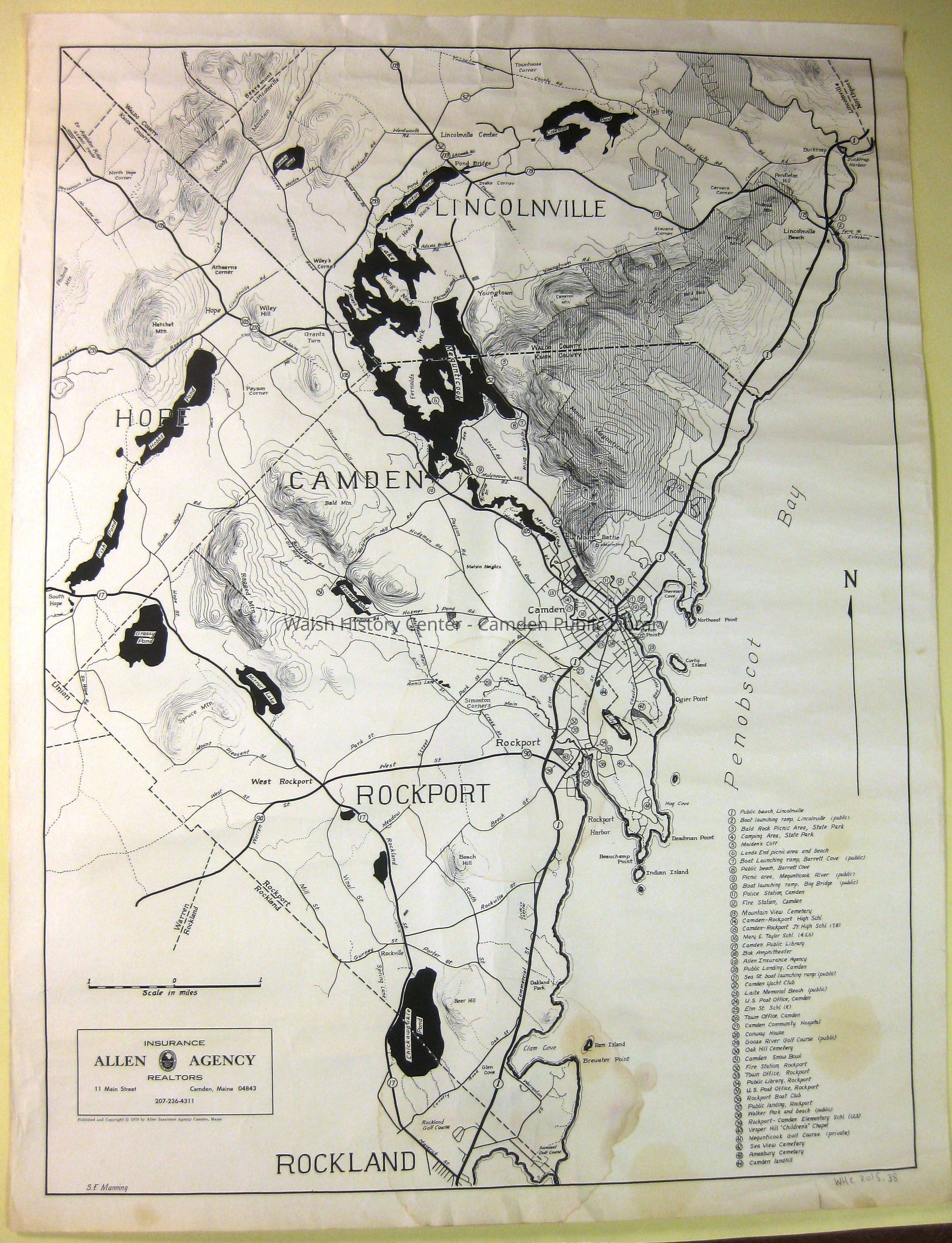
CAMDEN, ROCKPORT, AND PART OF LINCOLNVILLE, by S. F. Manning for the Allen Insurance Agency, 1970. Black and white, showing points of interest, reaching from Rockland Golf course in the south to Townhouse Corner, Lincolnville, in the north, and from Fish Pond in Hope (west) to Ducktrap Harbor (east). Light water stain in bottom centre and right side, slight tear in bottom margin.Collection
Camden Public Library Map CollectionCataloged By
Wyatt BerryAcquisition
Accession
WHC 2018.38Source or Donor
CPL Map CollectionAcquisition Method
Found in CollectionLexicon
Nomenclature 4.0
Nomenclature Secondary Object Term
MapNomenclature Primary Object Term
CartographNomenclature Sub-Class
Graphic DocumentsNomenclature Class
Documentary ObjectsNomenclature Category
Category 08: Communication ObjectsLOC Thesaurus for Graphic Materials
MapsSearch Terms
Camden, Rockport, Lincolnville, Maps, Allen Insurance AgencyArchive Details
Date(s) of Creation
1970Archive Size/Extent
24 7/8" X 32 3/4"Location
Location
Cabinet
Map CaseBuilding
Walsh History CenterCategory
PermanentDate
October 21, 2025Category
PermanentMoved By
Wyatt BerryDate
September 21, 2018Inventory
Inventoried By
Wyatt BerryInventoried Date
Sep 21, 2018Relationships
Related Person or Organization
Person or Organization
S. F. ManningGeneral Notes
Note
Status: OK
Status By: Wyatt Berry
Status Date: 2018-09-21Created By
admin@catalogit.appCreate Date
September 13, 2018Updated By
admin@catalogit.appUpdate Date
October 27, 2025