Name/Title
CAMDEN, MAINE WALKING MAP by Lawrence Zwart, 1989.Entry/Object ID
WHC 2018.42Scope and Content
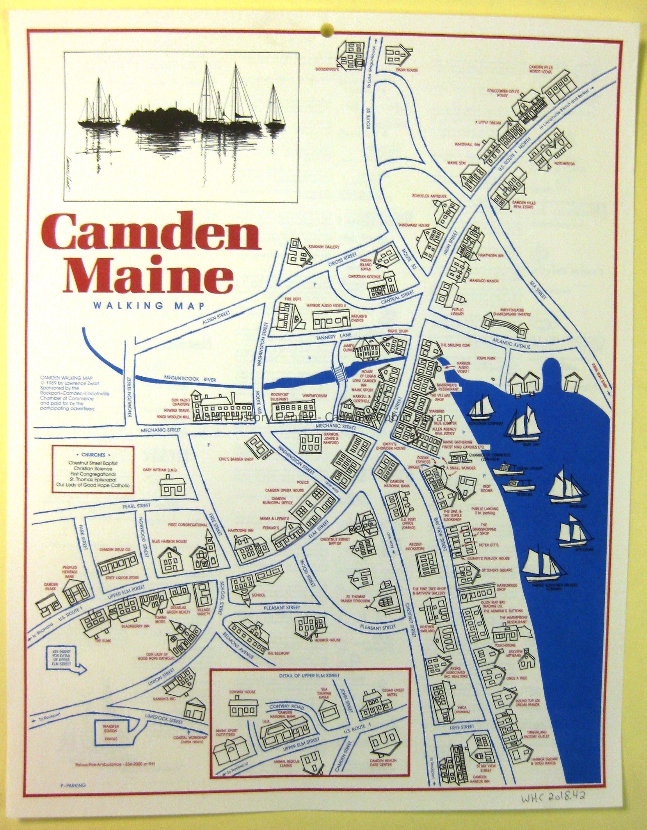
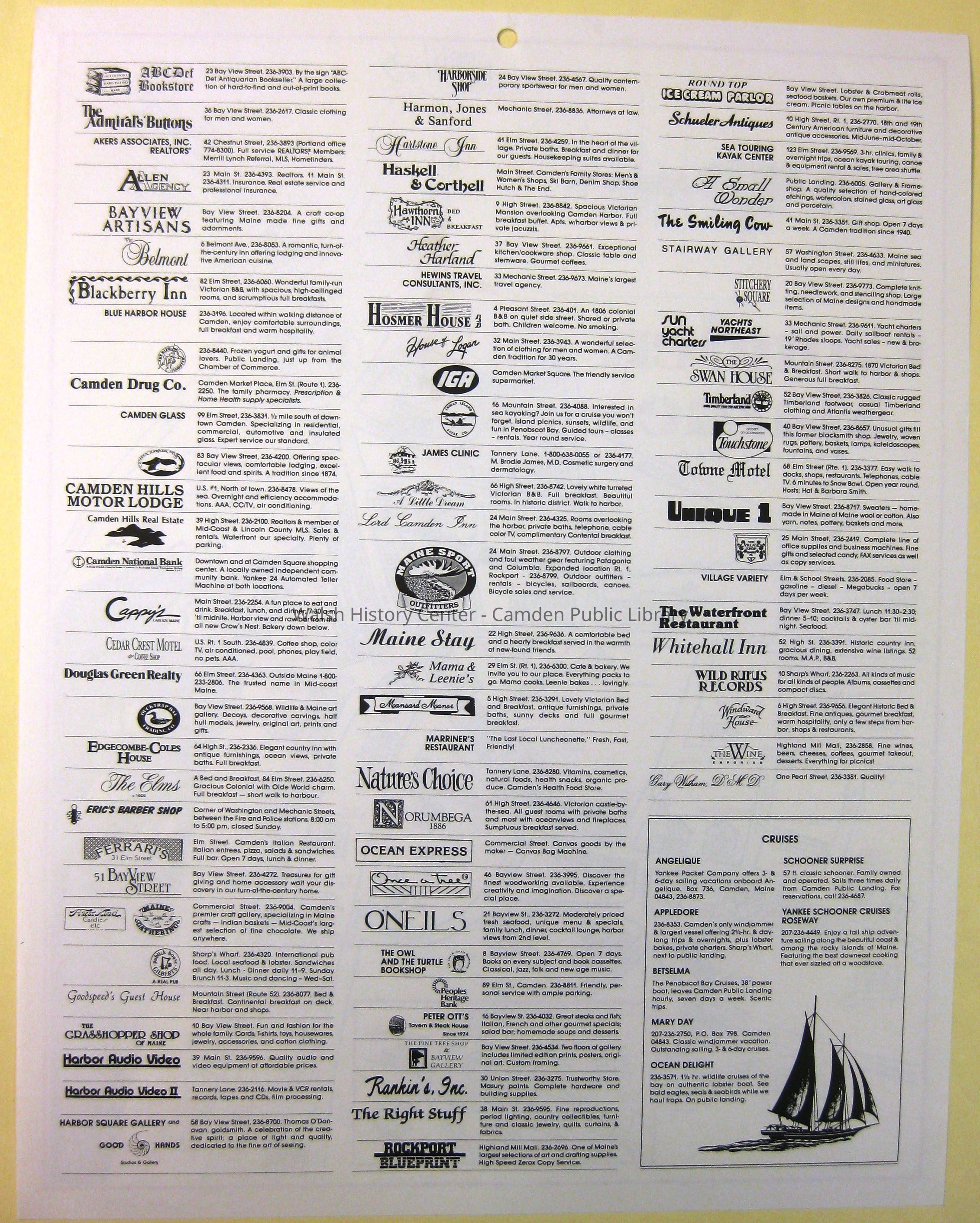
CAMDEN, MAINE WALKING MAP by Lawrence Zwart, 1989. Stylized 3-colour map of the central village area from Limerock/Union Street in the west to Sea Street in the east; and from Swan House in the north to Camden Harbour Inn in the south. Depicted by line drawings are the public structures and guest houses, hotels and businesses of 1989, labeled in red font. There is an inset at bottom centre showing a detail of upper Elm Street. Several types of vessels are shown in the harbour, and a sketch of sailing vessels appears at the upper left. Map is enclosed in a clear protective sleeve.Collection
Camden Public Library Map CollectionCataloged By
Wyatt BerryAcquisition
Accession
WHC 2018.42Source or Donor
CPL Map CollectionAcquisition Method
Found in CollectionLexicon
Nomenclature 4.0
Nomenclature Secondary Object Term
MapNomenclature Primary Object Term
CartographNomenclature Sub-Class
Graphic DocumentsNomenclature Class
Documentary ObjectsNomenclature Category
Category 08: Communication ObjectsLOC Thesaurus for Graphic Materials
MapsSearch Terms
Maps, Camden, Walking Maps, BusinessesArchive Details
Date(s) of Creation
1989Archive Size/Extent
15 3/8" X 12"Location
Location
Cabinet
Map CaseBuilding
Walsh History CenterCategory
PermanentDate
October 21, 2025Category
PermanentMoved By
Wyatt BerryDate
September 21, 2018Inventory
Inventoried By
Wyatt BerryInventoried Date
Sep 21, 2018Relationships
Related Person or Organization
Person or Organization
Lawrence ZwartGeneral Notes
Note
Status: OK
Status By: Wyatt Berry
Status Date: 2018-09-21Created By
admin@catalogit.appCreate Date
September 17, 2018Updated By
admin@catalogit.appUpdate Date
October 26, 2025