Name/Title
MATERIALS AND MAPS RELATED TO CAMDEN SETTLEMENTEntry/Object ID
WHC 2018.43Scope and Content
COLLECTION OF PHOTOCOPIES OF MATERIALS AND MAPS 50
RELATED TO SETTLEMENT OF CAMDEN AND SURROUNDING
AREA. Gift of Donovan A. R. Bowley, 21 March 2012.
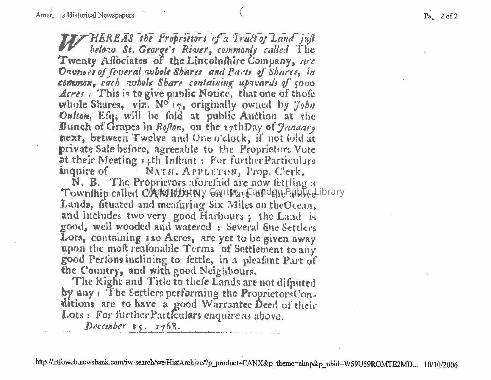
1. John Oulton's share of 20 Associates' Land (No. 17), to be sold at public
auction 17 January 1769; with announcement of 'Settlement of a Town-
ship called Cambden" 120 Ace Lots to be given away." Boston News-
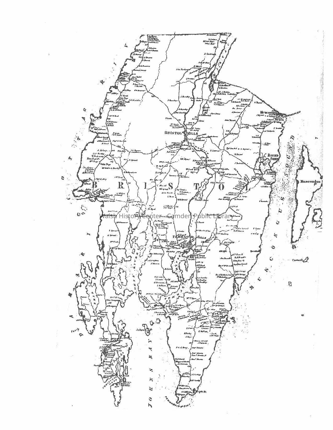
letter and New England Chronicle,29 December 1768; issue 340; page 2.
2. A Plan of the Town of Cambden in the County of Lincoln in the Common-
wealth of Massachusetts. May 1795. MA State Archives No. 1350.
[Attributed to John Harkness, Camden Surveyor, on the basis of his
handwriting.]
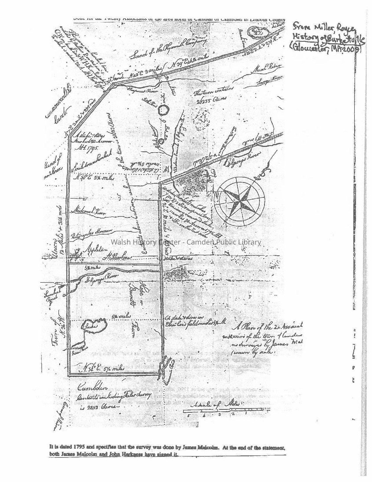
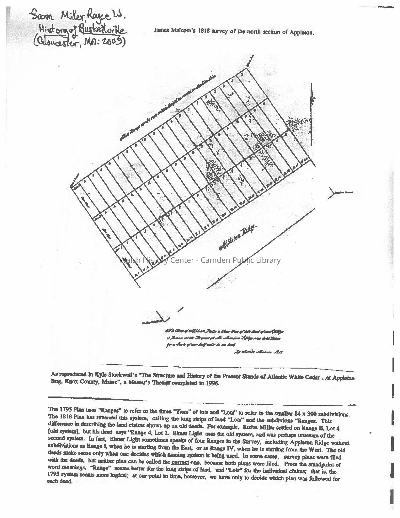
3. James Malcom's survey of the north section of Appleton, from Royce
Miller, History of Burkettville (Gloucester, MA: 2005) referencing
Kyle Stockwell's Master's Thesis, "The Structure and History of the
Present stands of White Cedar…at Appleton Bog, Knox Co, Maine,"
1996.
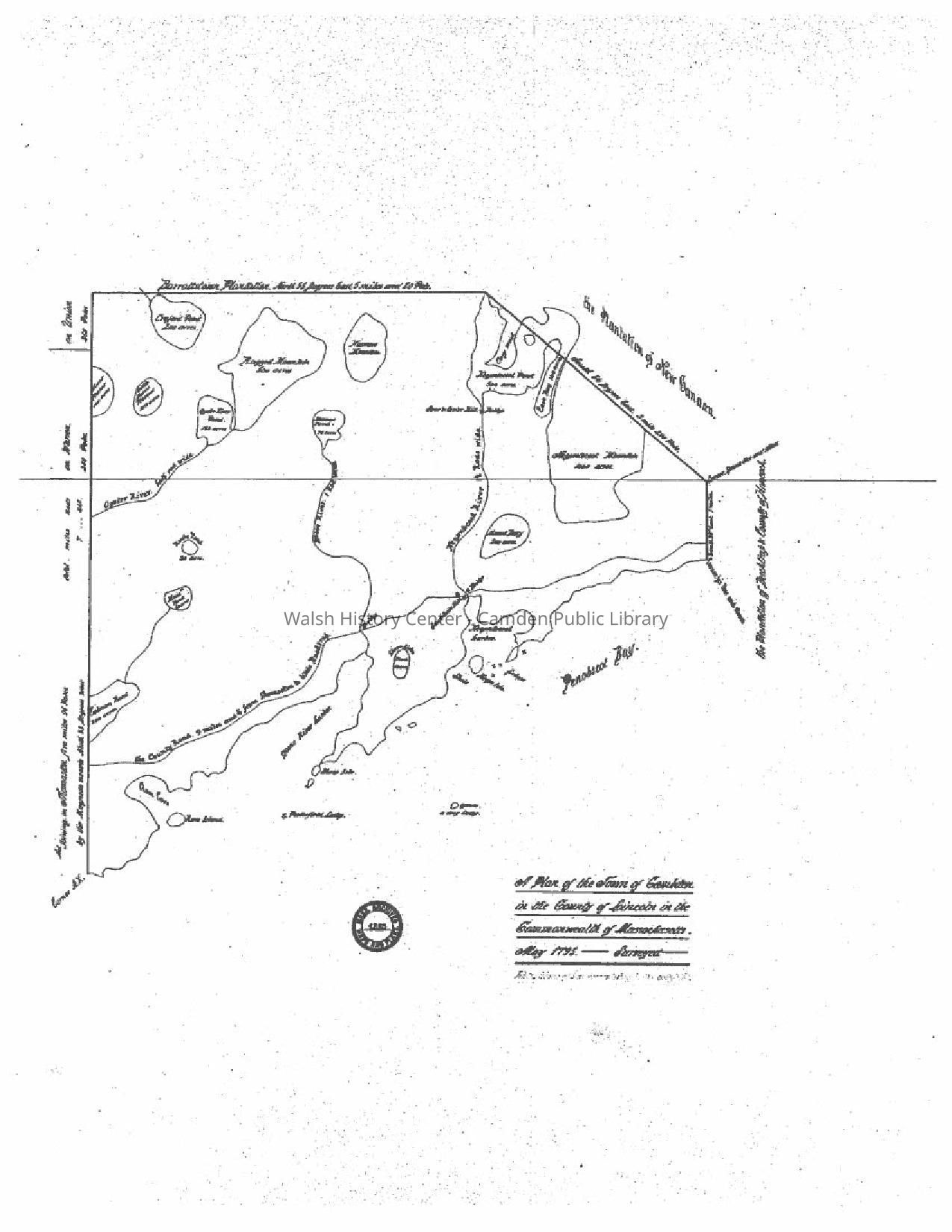
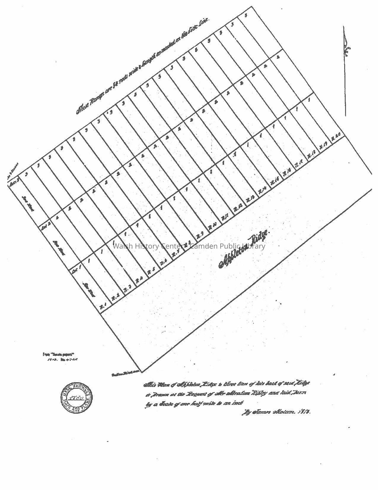
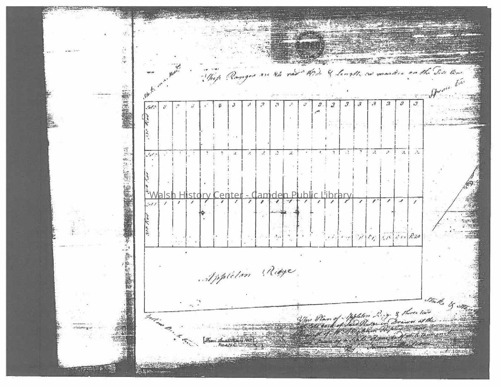
4. Appleton, Maine. "This Plan of Appleton Ridge & three tiers back of
Said Ridge is Drawn at the Request of Mr. Aaron Ripley and laid
Down by a Scale of one half mile to an inch. By James Malcom, 1818."
Massachusetts Archives No. 1760, from "Senate Papers" 1818.
There are two copies of this map: a.) Malcom's original map, from micro-
film at Massachusetts State Archives ; and b) the copy drafted for the
newly formed State of Maine by a different draftsman.
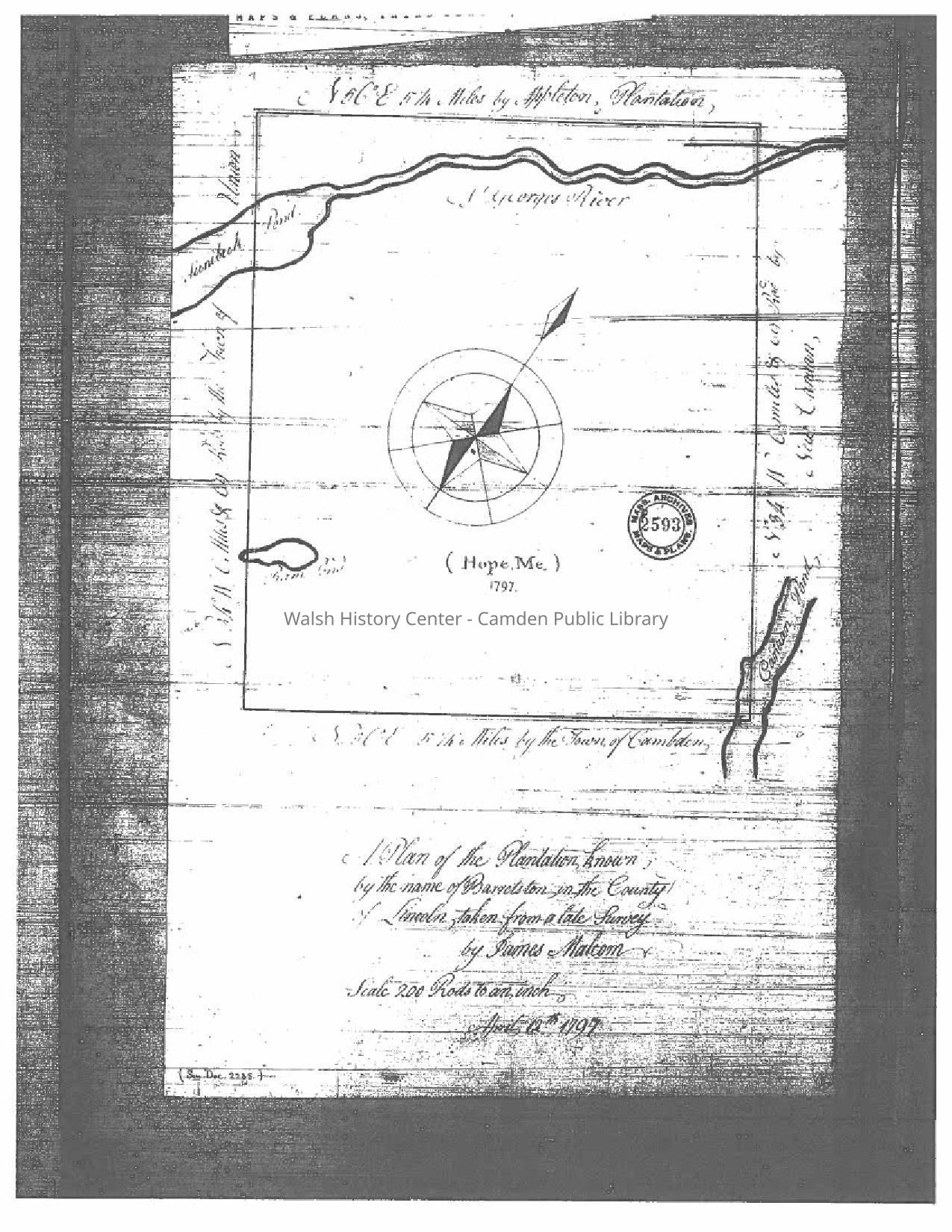
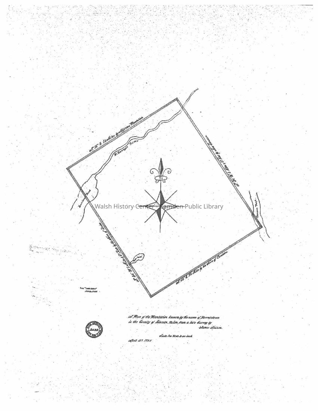
5. Hope, Maine. "A Plan of the Plantation known by the name of Barrettston
in the County of Lincoln, taken from a late Survey by James Malcom.
Scale 200 Rods to an inch. April 12th, 1797. There are two copies of this
map: a.) Massachusetts State Archives No. 2593; MA State Archives
Microfilm of Senate Document 2235 from Maps and Plans, Third Series,
vol. 40; and a copy of that map by a different draftsman for the newly-
formed State of Maine.
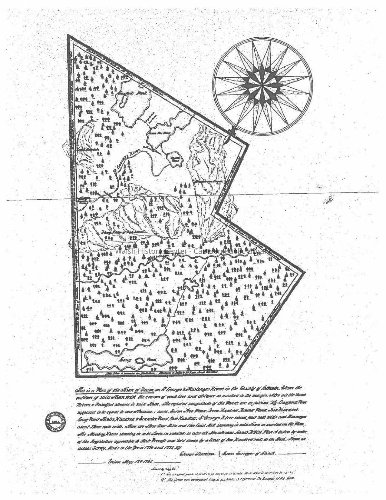
6. Union, Maine. "This is a plan of the Town of Union on St. Georges and
Muscongus Rivers in the County of Lincoln." …by Ebenezer Jennison,
Sworn Surveyor of Lands, Union, May 13th, 1795. Massachusetts State
Archives No. 1384.This is possibly the earliest known map of Union,
showing the town before the land west of the "Muscongus" (now
Medomac) River was transferred to the new town of Putnam (now
Washington) . The map is distinctive for its unusual orientation - North
is toward the bottom of the page) and the drawings of trees which cover
its surface. This a draftsman's copy of the original map made for the
newly-formed State of Maine.
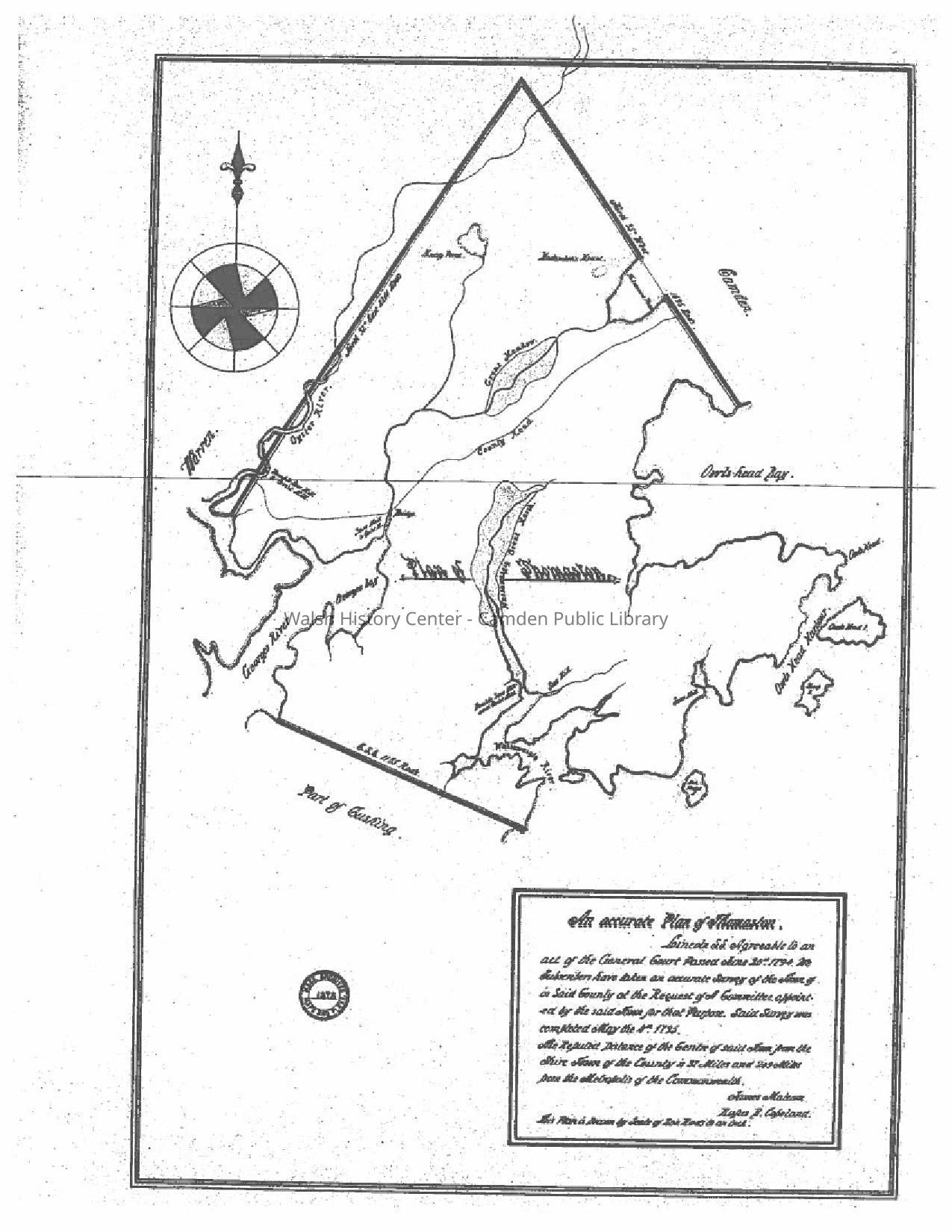
7. Thomaston, Maine. "Án Accurate Plan of Thomaston," by James Malcom.
Massachusetts State Archives No. 1376. This map shows the water
features of the town, as well as the County Road from Warren to Camden.
It includes the areas now set off for Rockland, Owls Head, and South
Thomaston. This is a copy drafted for the newly formed State of Maine.
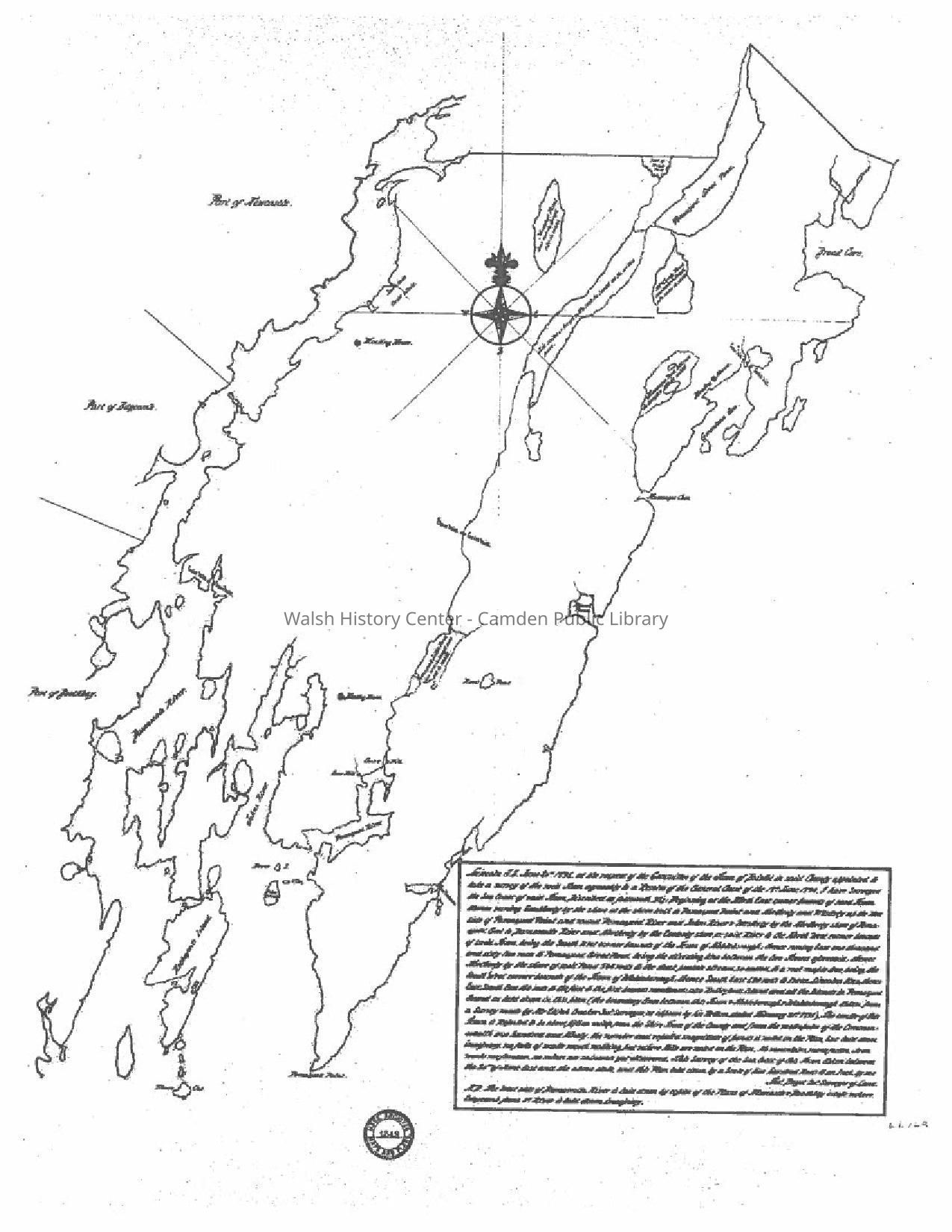
8. Bristol, Maine. Survey by Thos. Bryant, Land Surveyor. Outline map of
Bristol in 1795, before other towns were set off from it. Massachusetts State
Archives No. 1349, copied from the original draft for the newly formed State of Maine.
9. Bristol, Maine. Copy of a map taken from the 1855 map of Lincoln County,
showing water features, roads, villages, and names of inhabitants.
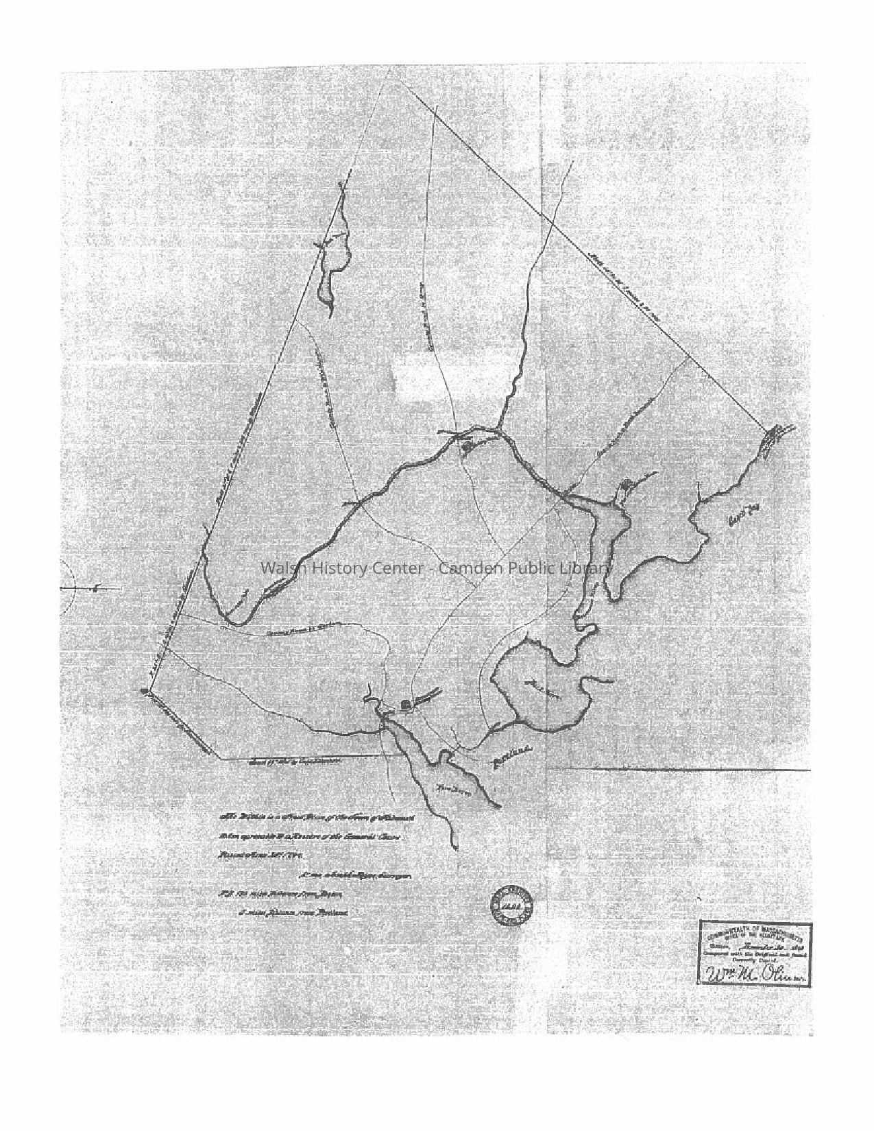
10. Falmouth, Maine. Copy of "A True Plan of the Town of Falmouth," by
Joseph Noyes, Surveyor, prepared for the newly formed State of Maine.
Certified December 30, 1893 by Wm. M. Oliver, Secretary of State.
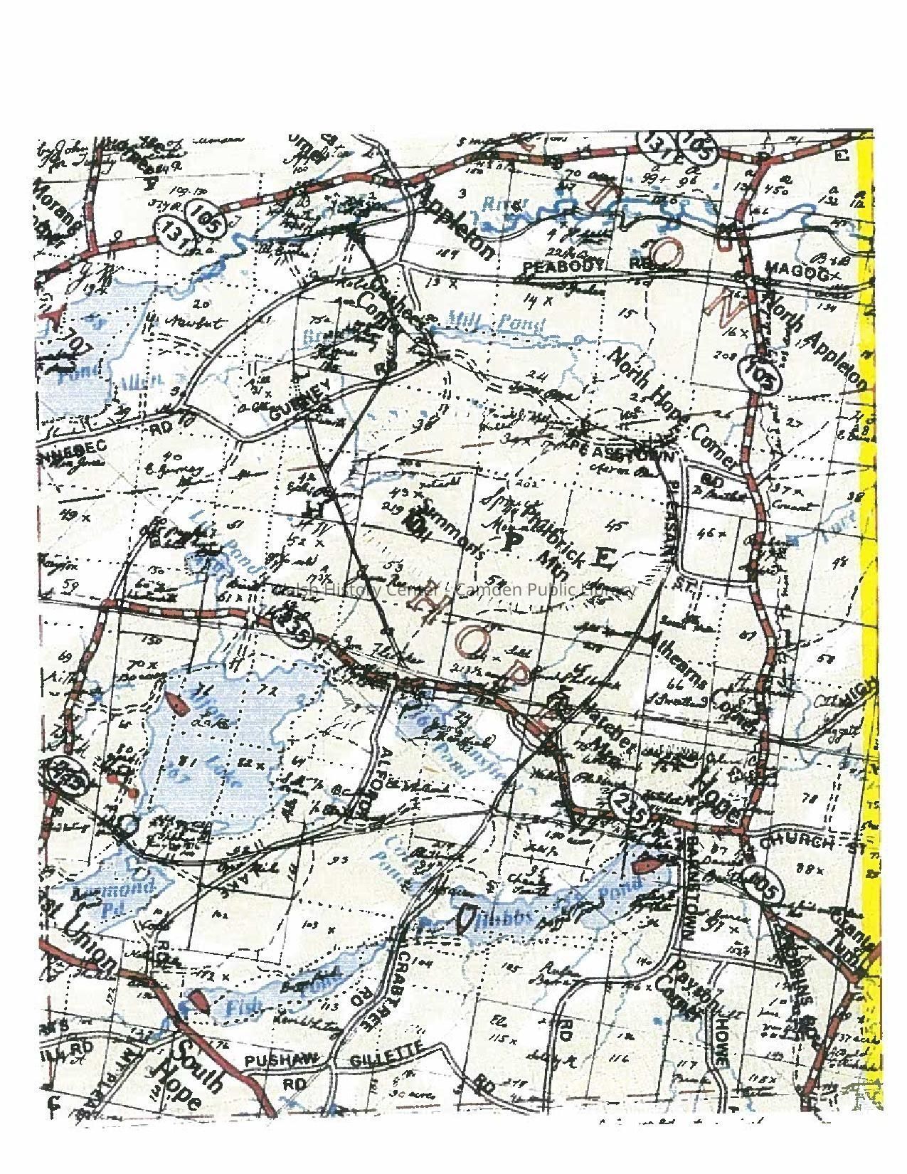
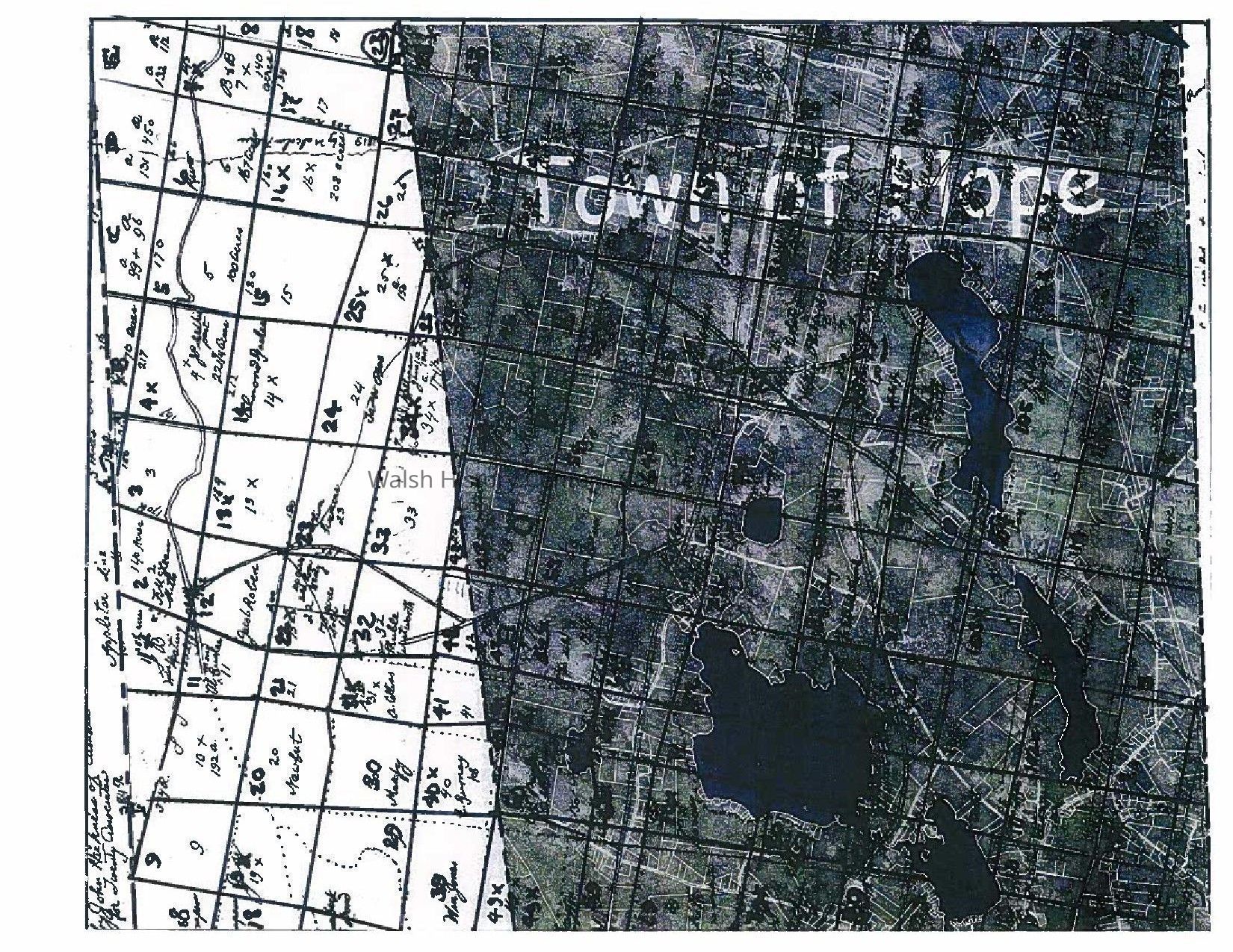
11. Hope, Maine. Photocopy composite. Orthotophoto image of Hope showing
Parcel boundaries from Tax Map (white lines) overlaid by the black and white
copy of a September 1799 parcel map of the original town of Hope. Through
this composite image, the original parcel boundaries may be compared with the current parcels.( Please note that this black and white 1799 map overlay is a
different draft than the 1799 map of Hope at the New England Historic
Genealogical Society Archives.)
12. Map of the 20 Associates land - surveyed in 1795 for General Knox and
The 20 Associates of the Lincolnshire Company by James Malcom and John Harkness. The purpose of this map was to define and mark the boundaries of
The land of the 20 Associates in relation to the land of General Knox. Bounds
of Camden were well established at that time, but the rest of the 20 Associates'
parcel were not yet as firmly known.
13. Transcription Of James Malcom Letter Regarding Twenty Associates Survey. "I James Malcom of lawful age doth testify & say, that in the fore part of the summer or in the spring of the year seventeen hundred & ninety five that I together with John Harkness agreed with Henry Knox Esq. to survey & lay out a track of land for the Twenty Associates of the Lincolnshire Company according to an agreement made between the said Henry Knox & the said Company & that we begun the said survey at the westerly corner of the Town of Cambden sometime in the summer of the same year & run the line to the westerly line of the Waldo Patent so called as run by Stone & Titcomb, but finding that the Plymouth Company's lines were not run to which lines we were obliged to conform the said Survey. We postponed the said business untill [sic] the said Plymouth lines were run, & that after the said lines were run that we went on & finished the surveying of the said Twenty Associates land according to the plans dated November the twelfth Seventeen Hundred & Nintety five which we have returned to the said parties [viz?], the said Henry Knox Esq. & the said Twenty Associates & further saith not, James Malcom. -
Commonwealth of Massachusetts,
Lincoln SS. Town of Pownalborough this third day of October in the year of our Lord 1801, personally appeared before us the subscribers two Justices of the Peace in & for the said County of Lincoln Quorum Unus the aforesaid [Deponent?] & after being carefully examined & duly cautioned to testify the whole truth & nothing but the truth made oath that the foregoing Deposition by him subscribed is true taken at the request of the Twenty Associates of the Lincolnshire Company to be preserved in perpetual remembrance of the thing, & we not knowing any persons living within twenty miles of said place of Caption interested in the Property whereto the aforesaid Deposition relates did not notify any persons to attend.
Deponents fees, [unintelligible] Orchard Cook
Justice fees, Caption - - 40 Josiah Stebbins
Writing, Caption - - 12
52
Certified by
Josiah Stebbins
Rec July 29 1806 & entered & examined
by [Warren?] Rice Reg."
14. Appleton, Maine. Composite map of Appleton, combining the 20 Associates
lot map of Appleton as originally established, together with the 1799 John
Harkness lot map of that portion of Hope which was added to Appleton by
the Maine Legislature in 1843. It includes three different surveys: Harkness
in 1799 (portion formerly of Hope); Harkness (Appleton Ridge) and James
Malcom (Appleton Ranges 1-3).
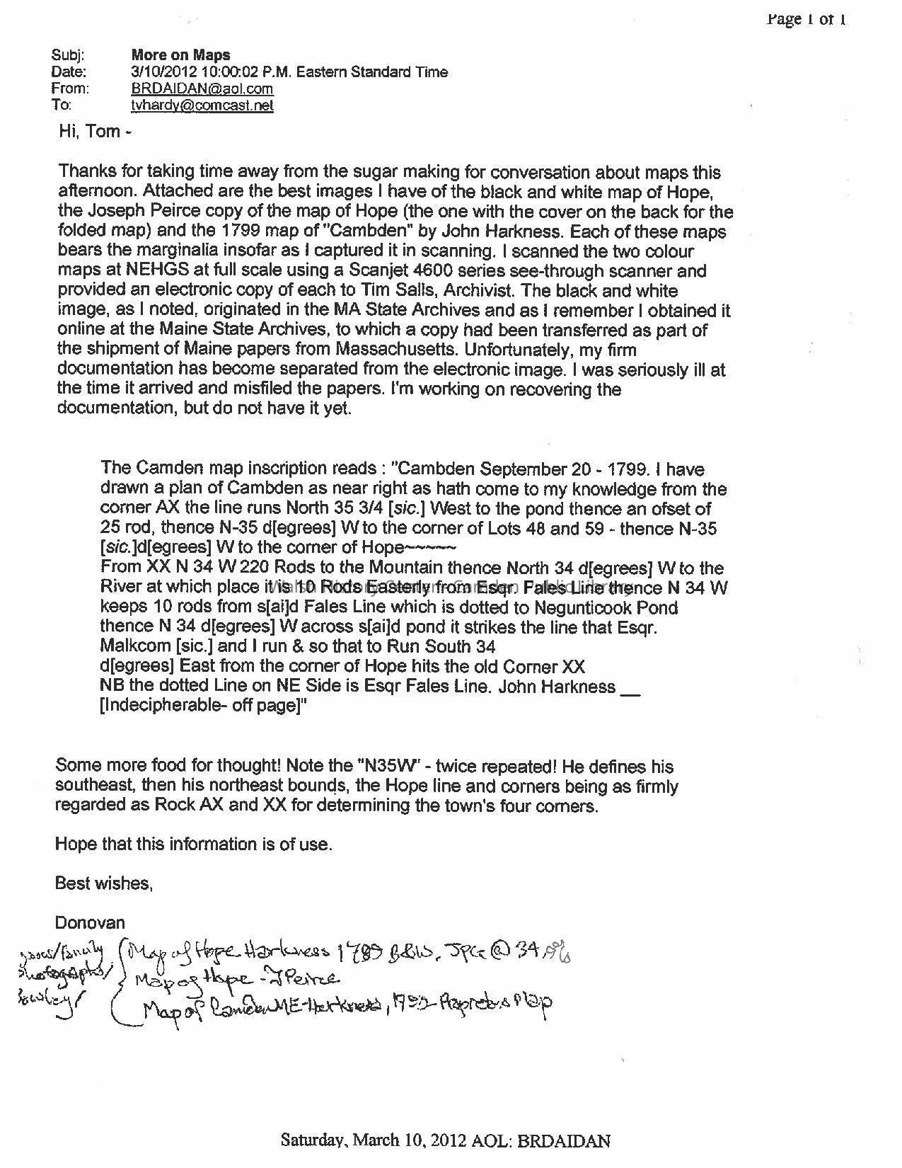
15. Correspondence of Donovan Bowley with Thomas Hardy; 10 March 2012,
re: the earliest known Lot maps of Camden and Hope.
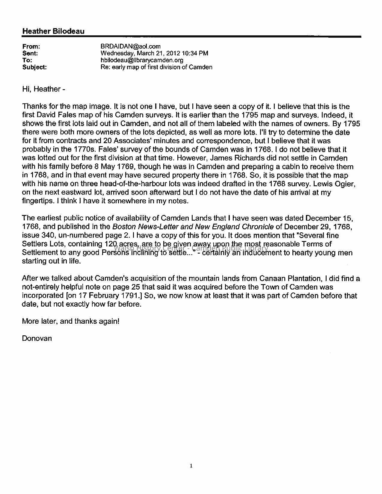
16. Correspondence of Donovan Bowley with Heather Bilodeau [Moran] re:
Fales Map, notice of availability of lands in Camden (15 December 1768),
and Camden 's mountain lands acquired from Canaan Plantation.
17.Correspondence of Donovan Bowley with Heather Bilodeau [Moran],
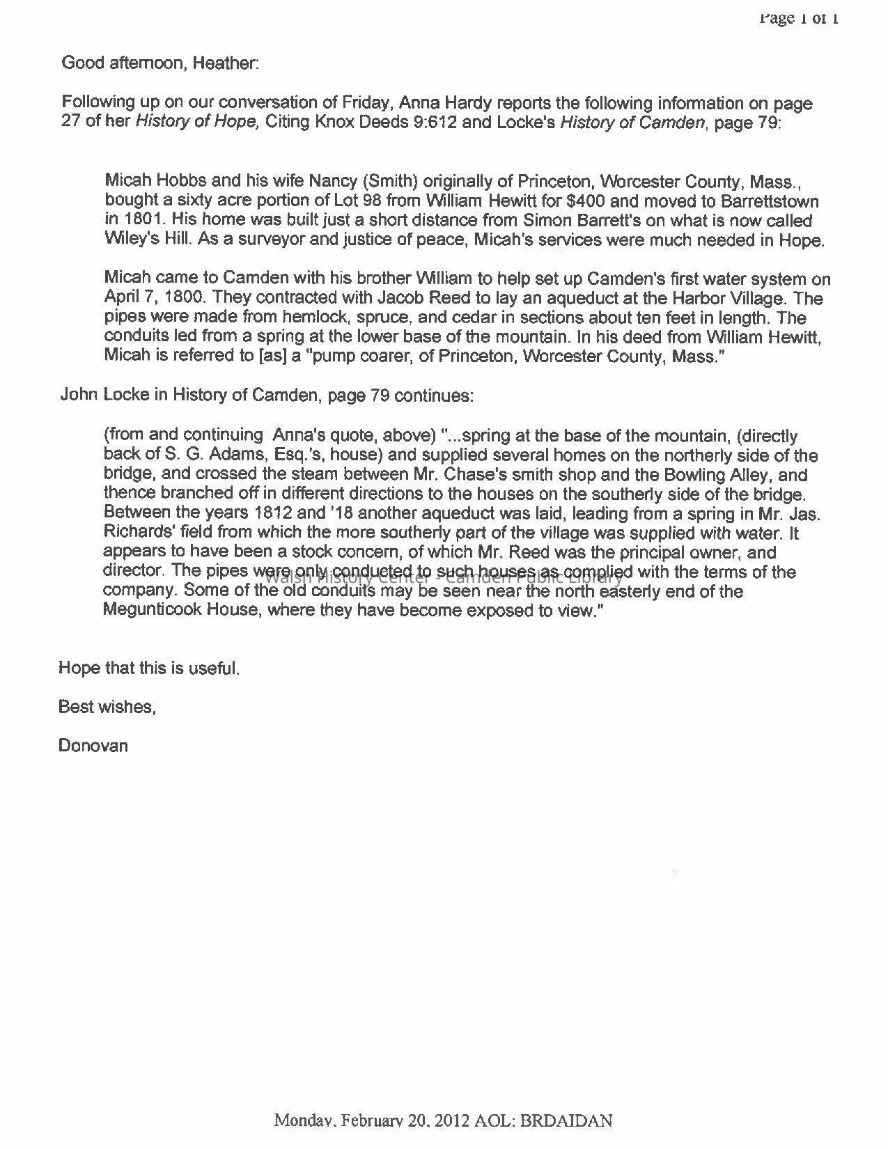
20 February 2012, re: the earliest Camden water system.
18. Hope, Maine. Composite map of Hope 2012 Road map overlaid by the black
and white 1799 John Harkness map of Barrettstown Plantation [Hope] for
purpose of comparing present roads with original roads.
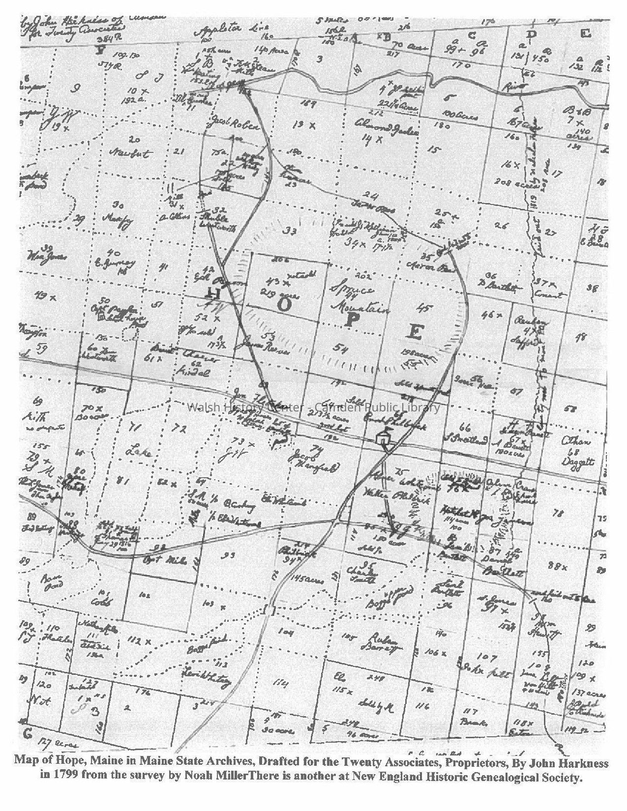
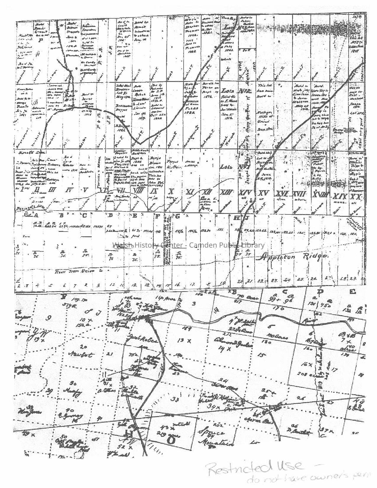
19. Hope, Maine. Black and white map of Hope by John Harkness, 1799. This map
was drafted for the Twenty Associates and is a different drafting with
some different names than the one at New England Historic
Genealogical Society.
20. Correspondence from David Fales, Surveyor, to the Committee of the
Twenty Associates of the Lincolnshire Company; Thomaston [Maine]
July 3,1798. This letter is certification by Fales of the alteration of
certain lots (No. 27-32] from the position of his first survey, to now
front on the harbour, at the direction of the 20 Associates.Collection
Camden Public Library Map CollectionCataloged By
Wyatt BerryAcquisition
Accession
WHC 2018.43Source or Donor
CPL Map CollectionAcquisition Method
Found in CollectionLexicon
Nomenclature 4.0
Nomenclature Secondary Object Term
MapNomenclature Primary Object Term
CartographNomenclature Sub-Class
Graphic DocumentsNomenclature Class
Documentary ObjectsNomenclature Category
Category 08: Communication ObjectsLOC Thesaurus for Graphic Materials
Maps, SettlementsSearch Terms
Camden, Maps, Settlement, Surveys, Hope, Early Plans, Commonwealth of MassachusettsArchive Details
Date(s) of Creation
1768 - 2012Archive Size/Extent
8 1/2" X 11" PhotocopiesLocation
Location
Cabinet
Map CaseBuilding
Walsh History CenterCategory
PermanentDate
October 21, 2025Category
PermanentMoved By
Wyatt BerryDate
September 21, 2018Inventory
Inventoried By
Wyatt BerryInventoried Date
Sep 21, 2018Relationships
Related Person or Organization
Person or Organization
John OultonPerson or Organization
John HarknessPerson or Organization
James MalcomPerson or Organization
Aaron RipleyPerson or Organization
Ebenezer JennisonPerson or Organization
Thomas BryantPerson or Organization
Joseph NoyesPerson or Organization
David FalesPerson or Organization
Donovan BowleyGeneral Notes
Note
Status: OK
Status By: Wyatt Berry
Status Date: 2018-09-21Created By
admin@catalogit.appCreate Date
September 17, 2018Updated By
admin@catalogit.appUpdate Date
October 27, 2025