Name/Title
MAP OF CAMDEN SHOWING DIVISION LINEEntry/Object ID
WHC 2018.60Scope and Content
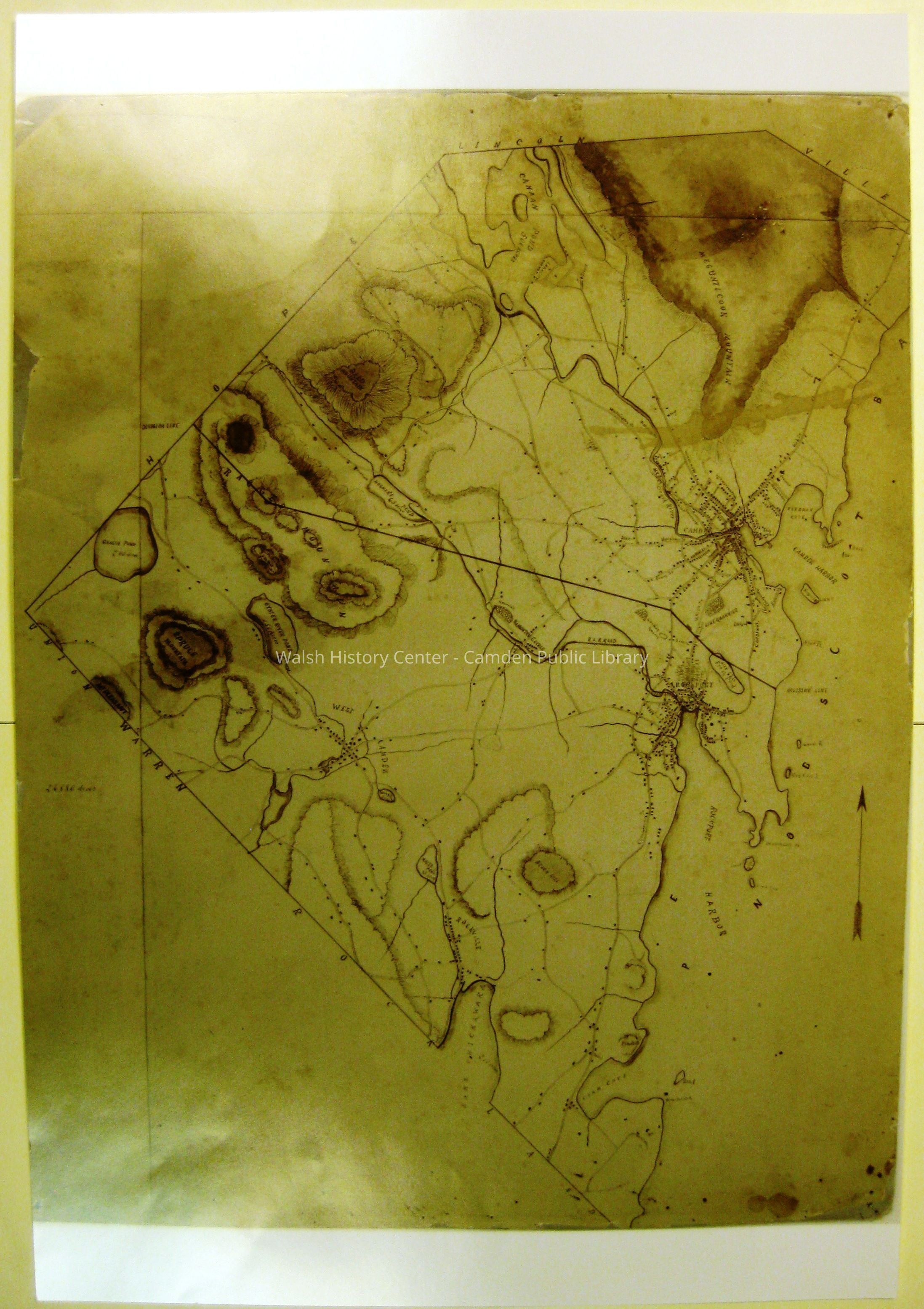
MAP OF CAMDEN SHOWING DIVISION LINE. This colour glossy print appears to be from a digital scan. It is undated but was clearly prouced about 1891. It shows a line of division between the part that stayed Camden and the part that became Rockport in that year. However, it does not show the names of the two towns, though it does show "West Rockport Village" of today as "West Camden." As well, the Chestnut Street Cemetery and the lime quarries both appear in what is today Camden rather than in Rockport. These factors suggest that this may be an early draft of the then-proposed division of the original Town of Camden.Collection
Camden Public Library Map CollectionCataloged By
Wyatt BerryAcquisition
Accession
WHC 2018.60Source or Donor
CPL Map CollectionAcquisition Method
Found in CollectionLexicon
Nomenclature 4.0
Nomenclature Secondary Object Term
MapNomenclature Primary Object Term
CartographNomenclature Sub-Class
Graphic DocumentsNomenclature Class
Documentary ObjectsNomenclature Category
Category 08: Communication ObjectsLOC Thesaurus for Graphic Materials
MapsSearch Terms
Rockport, Division, Draft, MapArchive Details
Date(s) of Creation
1891Archive Size/Extent
13" X 19"Location
Location
Cabinet
Map CaseBuilding
Walsh History CenterCategory
PermanentDate
October 21, 2025Category
PermanentMoved By
Wyatt BerryDate
September 21, 2018Inventory
Inventoried By
Wyatt BerryInventoried Date
Sep 21, 2018General Notes
Note
Status: OK
Status By: Wyatt Berry
Status Date: 2018-09-21Created By
admin@catalogit.appCreate Date
September 18, 2018Updated By
admin@catalogit.appUpdate Date
October 27, 2025