Name/Title
MIDCOAST PORTION OF MAP OF THE DISTRICT OF MAINEEntry/Object ID
WHC 2018.67Scope and Content
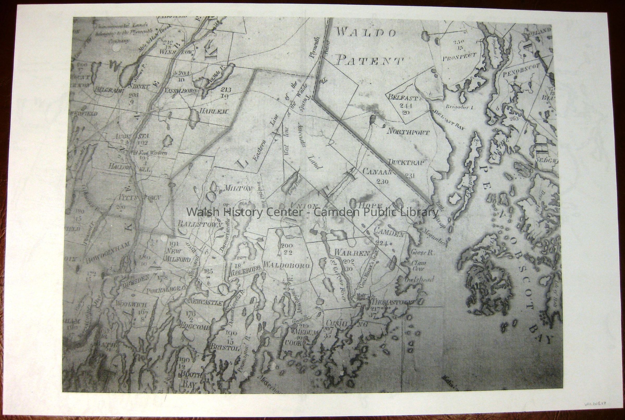
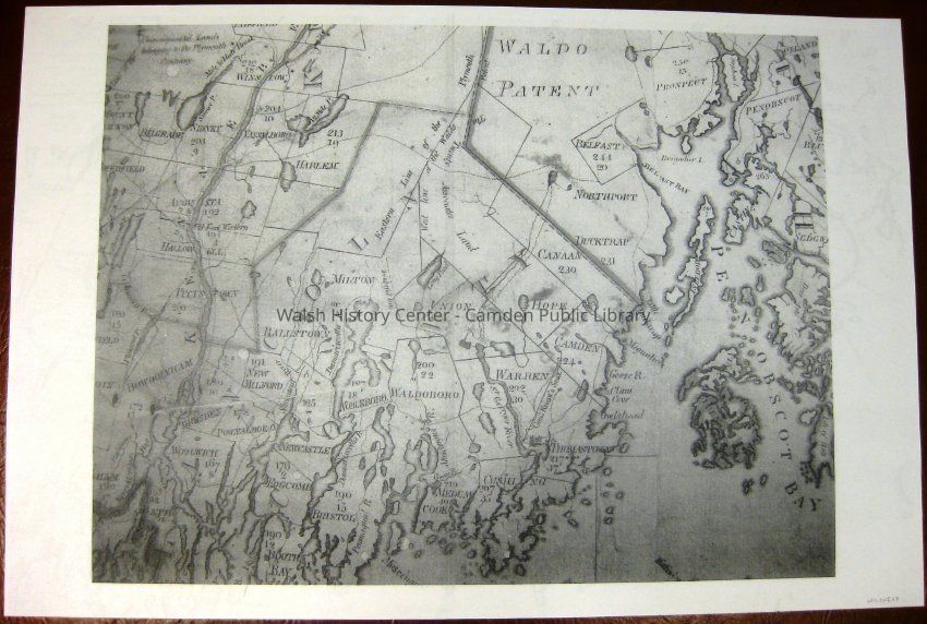
MIDCOAST PORTION OF MAP OF THE DISTRICT OF MAINE, 1802, from a digital scan of the original at Maine State Library by the Maine State Archives. Photocopy, enlarged portion, from Winslow to Boothbay and from Mount Vernon to Orland. Shown are town/plantation boundaries, miles ot the Shire Town, miles to Boston, roads, streams, meetinghouses, and mills. Gift of Donovan A.R. Bowley.Collection
Camden Public Library Map CollectionCataloged By
Wyatt BerryAcquisition
Accession
WHC 2018.67Source or Donor
CPL Map CollectionAcquisition Method
Found in CollectionLexicon
Nomenclature 4.0
Nomenclature Secondary Object Term
MapNomenclature Primary Object Term
CartographNomenclature Sub-Class
Graphic DocumentsNomenclature Class
Documentary ObjectsNomenclature Category
Category 08: Communication ObjectsLOC Thesaurus for Graphic Materials
Maps, Plantations, Boundaries, Roads, Streams, MillsSearch Terms
Map of the District of Maine, James Sullivan, History of the District of Maine, Maps, Towns, Plantations, Boundaries, Roads, Streams, Mills, MeetinghousesArchive Details
Date(s) of Creation
1802Archive Size/Extent
24" X 36"Location
Location
Cabinet
Map CaseBuilding
Walsh History CenterCategory
PermanentDate
October 21, 2025Category
PermanentMoved By
Wyatt BerryDate
September 21, 2018Inventory
Inventoried By
Wyatt BerryInventoried Date
Sep 21, 2018Relationships
Related Person or Organization
Person or Organization
James SullivanGeneral Notes
Note
Status: OK
Status By: Wyatt Berry
Status Date: 2018-09-21Created By
admin@catalogit.appCreate Date
September 18, 2018Updated By
admin@catalogit.appUpdate Date
October 27, 2025