Name/Title
PLAN OF THE TOWN OF SEARSMONTEntry/Object ID
WHC 2018.69Scope and Content
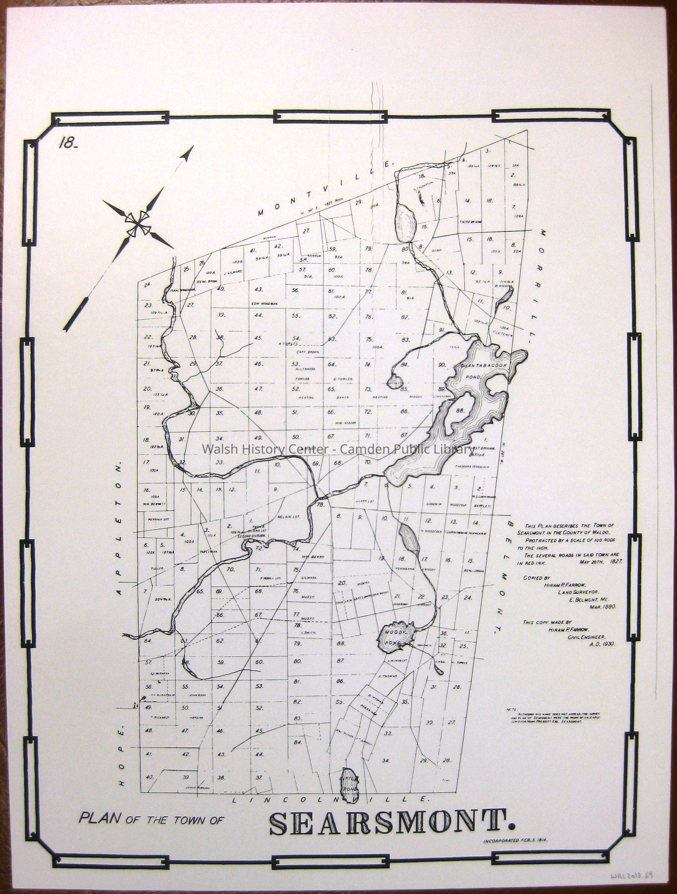
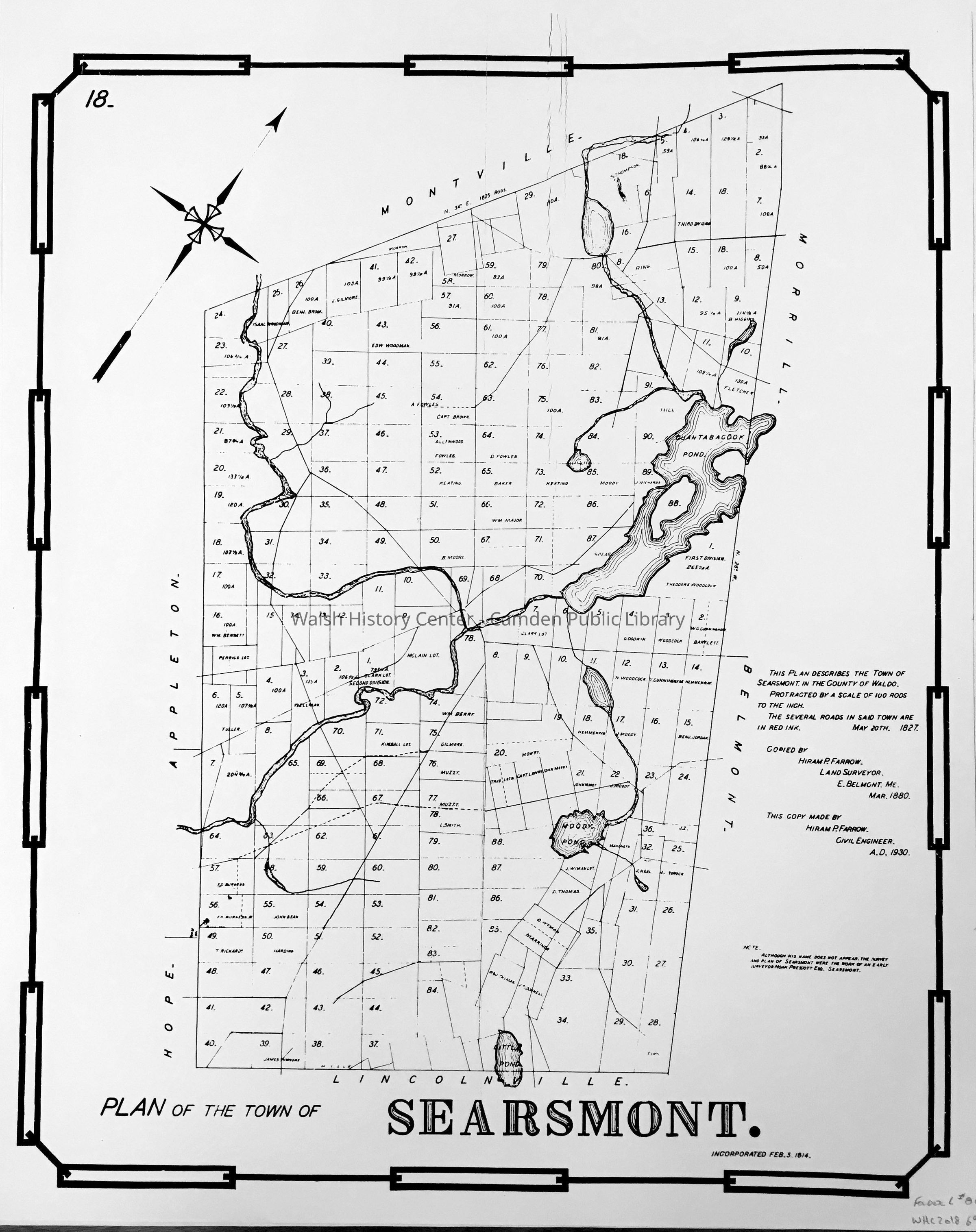
PLAN OF THE TOWN OF SEARSMONT incorporated Feb. 5, 1814. This photocopy was produced from piecemeal photocopies at Appleton Historical Society. The "original" from which this copy was made by Hiram P Farrow, Civil Engineer, in 1930 from an earlier copy drawn by him in 1880 of the actual original, which dates from 20 May 1827. The map is the earliest known lotting plan of Searsmont. This Searsmont map is number 18 in a series of such lotting plans drawn by Hiram Farrow. There are 2 copies in the WHC collection. Gift of Donovan A. R. Bowley.Collection
Camden Public Library Map CollectionCataloged By
Wyatt BerryAcquisition
Accession
WHC 2018.69Source or Donor
CPL Map CollectionAcquisition Method
Found in CollectionLexicon
Nomenclature 4.0
Nomenclature Secondary Object Term
MapNomenclature Primary Object Term
CartographNomenclature Sub-Class
Graphic DocumentsNomenclature Class
Documentary ObjectsNomenclature Category
Category 08: Communication ObjectsLOC Thesaurus for Graphic Materials
MapsSearch Terms
Hiram P. Farrow, Lotting Plan, Maps, SearsmontArchive Details
Date(s) of Creation
1930Archive Size/Extent
18" X 20"Location
Location
Cabinet
Map CaseBuilding
Walsh History CenterCategory
PermanentDate
October 21, 2025Category
PermanentMoved By
Wyatt BerryDate
September 21, 2018Inventory
Inventoried By
Wyatt BerryInventoried Date
Sep 21, 2018Relationships
Related Person or Organization
Person or Organization
Hiram P. FarrowGeneral Notes
Note
Status: OK
Status By: Wyatt Berry
Status Date: 2018-09-21Created By
admin@catalogit.appCreate Date
September 18, 2018Updated By
admin@catalogit.appUpdate Date
October 27, 2025