Name/Title
PENOBSCOT BAYEntry/Object ID
WHC 2018.72Scope and Content
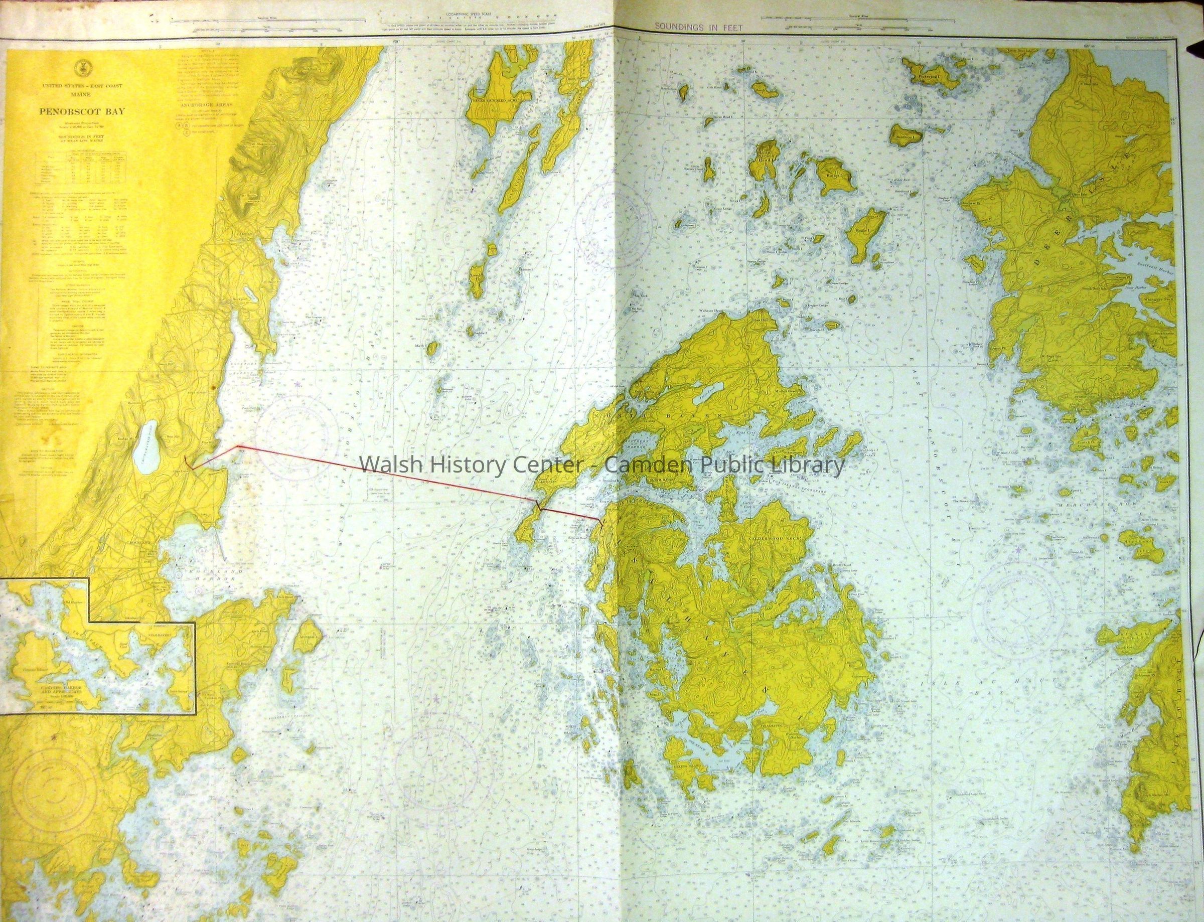
PENOBSCOT BAY - United States - East Coast - Maine. C&GS Chart No. 310. 16th ed. Feb 16, 1974. Stamped S"OUNDINGS IN FEET." Soundings in feet at mean low water. Marine Navigation Chart from Pleasant Island (South) to Seven Hundred Acre Island (North) and from Clark Island (West) to Kimball Island (East). There is a tear in the left margin, mended with tape, and an un-mended tear in the right margin. A course from Clam Cove to Brown's Head on Vinalhaven is marked in red. An inset chart shows "Carvers Harbor and Approaches." That inset is scaled in yards. (N.O. 13/27)Collection
Camden Public Library Map CollectionCataloged By
Wyatt BerryAcquisition
Accession
WHC 2018.72Source or Donor
CPL Map CollectionAcquisition Method
Found in CollectionLexicon
Nomenclature 4.0
Nomenclature Secondary Object Term
MapNomenclature Primary Object Term
CartographNomenclature Sub-Class
Graphic DocumentsNomenclature Class
Documentary ObjectsNomenclature Category
Category 08: Communication ObjectsLOC Thesaurus for Graphic Materials
Maps, HarborsSearch Terms
Coast Guard, Navigation Chart, Soundings, Maps, Surveys, Penobscot Bay, Harbors, C&GS Chart No. 310Archive Details
Date(s) of Creation
1974Archive Size/Extent
36 1/2" X 46 1/4"Location
Location
Cabinet
Map CaseBuilding
Walsh History CenterCategory
PermanentDate
October 21, 2025Category
PermanentMoved By
Wyatt BerryDate
September 21, 2018Inventory
Inventoried By
Wyatt BerryInventoried Date
Sep 21, 2018General Notes
Note
Status: OK
Status By: Wyatt Berry
Status Date: 2018-09-21Created By
admin@catalogit.appCreate Date
September 18, 2018Updated By
admin@catalogit.appUpdate Date
October 27, 2025