Name/Title
LINCOLNVILLE QUADRANGLE MAINEEntry/Object ID
WHC 2018.81Scope and Content
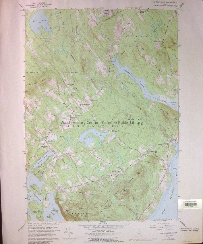
LINCOLNVILLE QUADRANGLE MAINE - 7.5 MINUTE SERIES (TOPOGRAPHIC) LINCOLNVILLE, MAINE 44069-C1-TF-024. 1960. PHOTOREVISED 1973. DMA 7172 I SERIES V811. CPL Bar Code 17229.Collection
Camden Public Library Map CollectionCataloged By
Wyatt BerryAcquisition
Accession
WHC 2018.81Source or Donor
CPL Map CollectionAcquisition Method
Found in CollectionLexicon
Nomenclature 4.0
Nomenclature Secondary Object Term
MapNomenclature Primary Object Term
CartographNomenclature Sub-Class
Graphic DocumentsNomenclature Class
Documentary ObjectsNomenclature Category
Category 08: Communication ObjectsLOC Thesaurus for Graphic Materials
MapsSearch Terms
LINCOLNVILLE QUADRANGLE MAINE, Maps, Topographic, Department of the Interior, United States Geological Survey, USGSArchive Details
Date(s) of Creation
1973Archive Size/Extent
22" X 27"Location
Location
Cabinet
Map CaseBuilding
Walsh History CenterCategory
PermanentDate
October 21, 2025Category
PermanentMoved By
Wyatt BerryDate
September 21, 2018Inventory
Inventoried By
Wyatt BerryInventoried Date
Sep 21, 2018General Notes
Note
Status: OK
Status By: Wyatt Berry
Status Date: 2018-09-21Created By
admin@catalogit.appCreate Date
September 19, 2018Updated By
admin@catalogit.appUpdate Date
October 27, 2025