Name/Title
STATE OF MAINE FRANKLIN COUNTYEntry/Object ID
WHC 2018.95Scope and Content
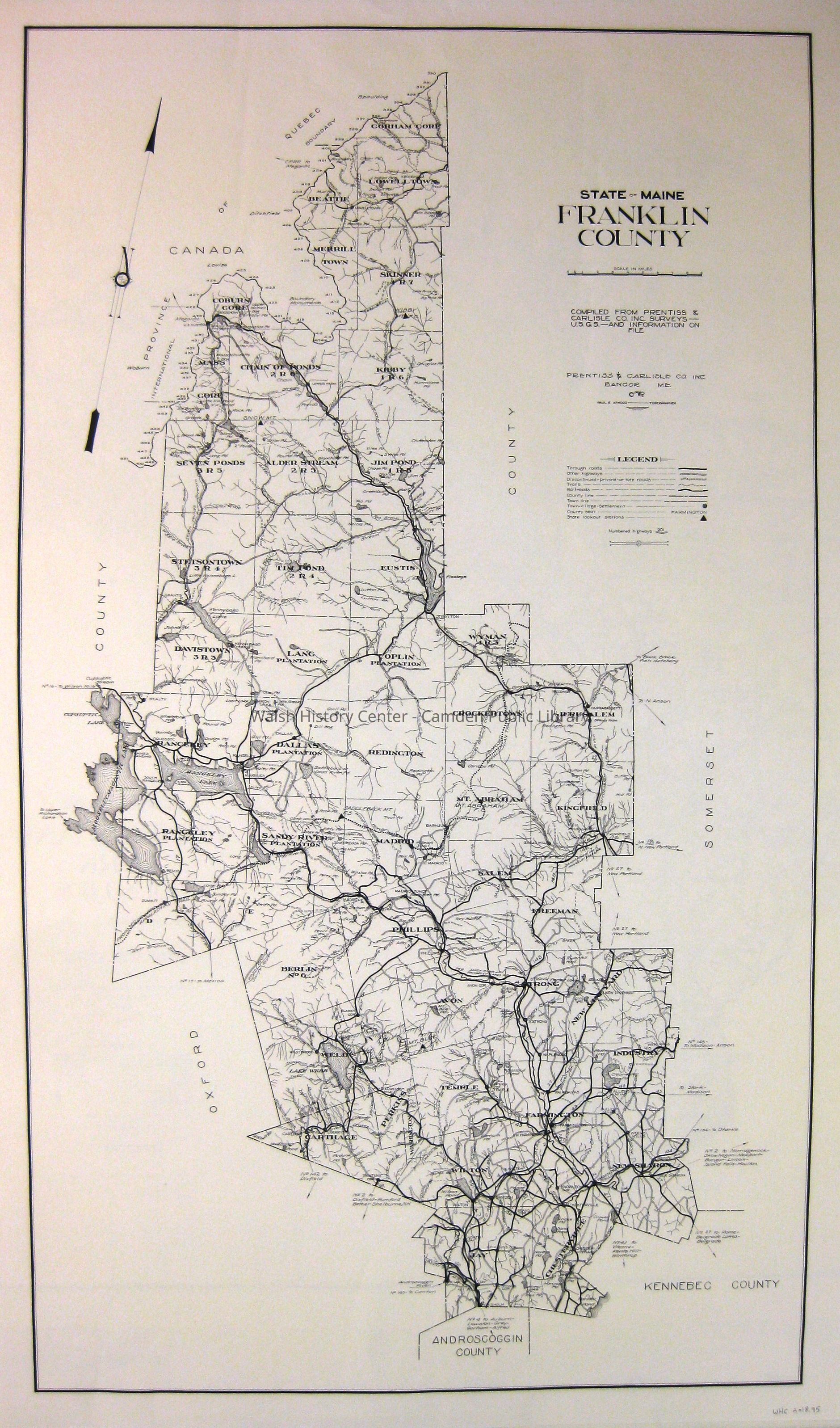
STATE OF MAINE FRANKLIN COUNTY. Compiled from Prentiss & Carlisle Co., Inc. surveys - USGS - and information on file. Prentiss & Carlisle Co., Inc. Bangor, Maine, 1966. Paul E. Atwood, Topographer. Scale: 1 inch = 3 miles.Collection
Camden Public Library Map CollectionCataloged By
Wyatt BerryAcquisition
Accession
WHC 2018.95Source or Donor
CPL Map CollectionAcquisition Method
Found in CollectionLexicon
Nomenclature 4.0
Nomenclature Secondary Object Term
MapNomenclature Primary Object Term
CartographNomenclature Sub-Class
Graphic DocumentsNomenclature Class
Documentary ObjectsNomenclature Category
Category 08: Communication ObjectsLOC Thesaurus for Graphic Materials
MapsSearch Terms
FRANKLIN COUNTY, Maps, Prentiss & Carlisle Co, USGS, Paul E. AtwoodArchive Details
Date(s) of Creation
1966Archive Size/Extent
20" X 32 7/8"Location
Location
Cabinet
Map CaseBuilding
Walsh History CenterCategory
PermanentDate
October 21, 2025Category
PermanentMoved By
Wyatt BerryDate
September 21, 2018Inventory
Inventoried By
Wyatt BerryInventoried Date
Sep 21, 2018Relationships
Related Person or Organization
Person or Organization
Paul E. AtwoodPerson or Organization
Prentiss & Carlisle CoGeneral Notes
Note
Status: OK
Status By: Wyatt Berry
Status Date: 2018-09-21Created By
admin@catalogit.appCreate Date
September 19, 2018Updated By
admin@catalogit.appUpdate Date
October 27, 2025