Name/Title
SANBORN INSURANCE MAP CAMDEN/ROCKPORT 1894Entry/Object ID
WHC 2018.102Scope and Content
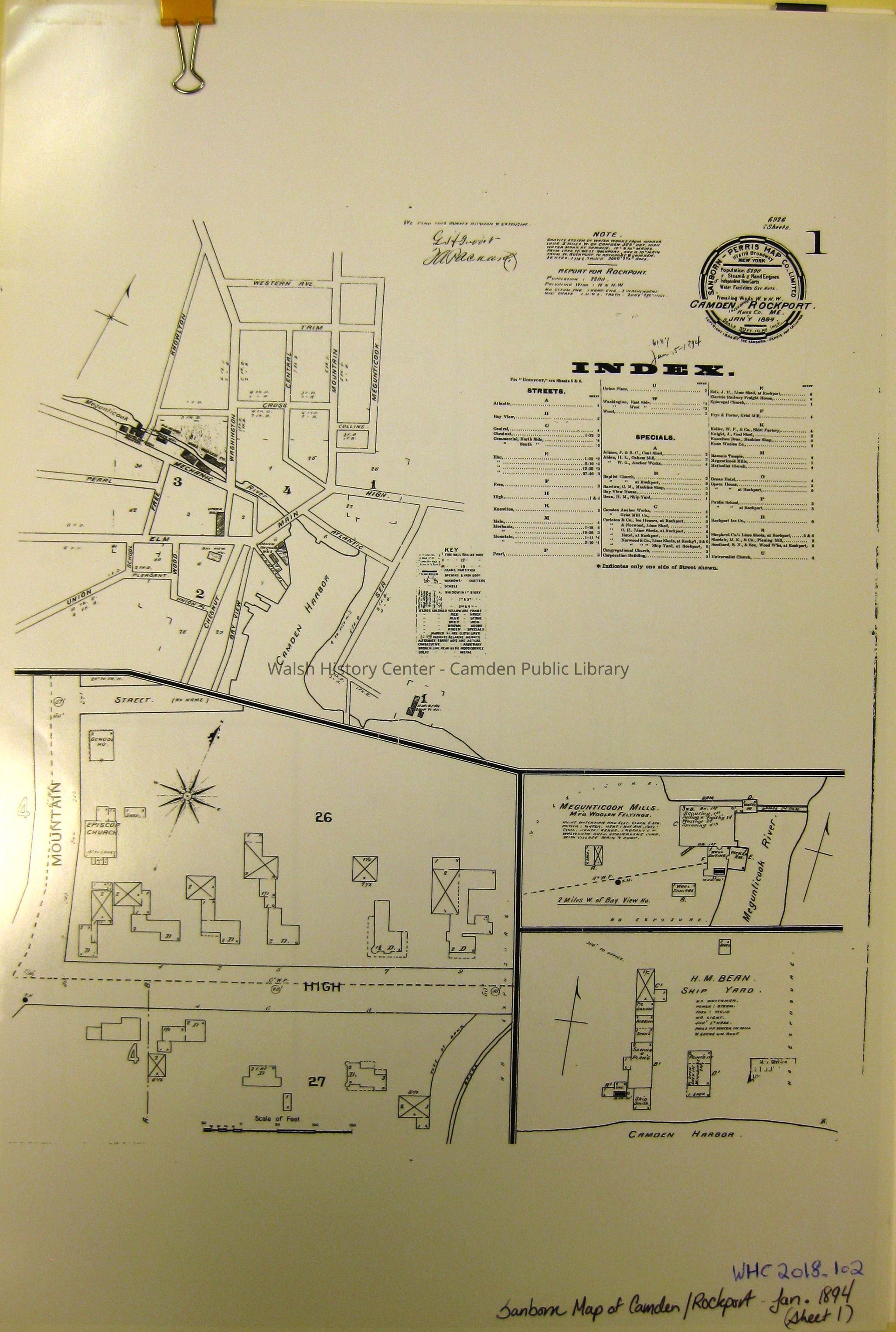
SANBORN INSURANCE MAP - CAMDEN AND ROCKPORT January 1894. (6 sheets). Black and white Photostats. [Shows rebuilding after the downtown Camden fire.]Collection
Camden Public Library Map CollectionCataloged By
Wyatt BerryAcquisition
Accession
WHC 2018.102Source or Donor
CPL Map CollectionAcquisition Method
Found in CollectionLexicon
Nomenclature 4.0
Nomenclature Secondary Object Term
MapNomenclature Primary Object Term
CartographNomenclature Sub-Class
Graphic DocumentsNomenclature Class
Documentary ObjectsNomenclature Category
Category 08: Communication ObjectsLOC Thesaurus for Graphic Materials
Maps, VillagesSearch Terms
SANBORN INSURANCE MAP, Maps, CAMDEN, ROCKPORT, VillageArchive Details
Date(s) of Creation
1894Archive Size/Extent
13" X 19"Location
Location
Cabinet
Map CaseBuilding
Walsh History CenterCategory
PermanentDate
October 21, 2025Category
PermanentMoved By
Wyatt BerryDate
September 21, 2018Inventory
Inventoried By
Wyatt BerryInventoried Date
Sep 21, 2018General Notes
Note
Status: OK
Status By: Wyatt Berry
Status Date: 2018-09-21Created By
admin@catalogit.appCreate Date
September 21, 2018Updated By
admin@catalogit.appUpdate Date
October 27, 2025