Name/Title
PLAN OF HOPE 1799.Entry/Object ID
WHC 2018.106Scope and Content
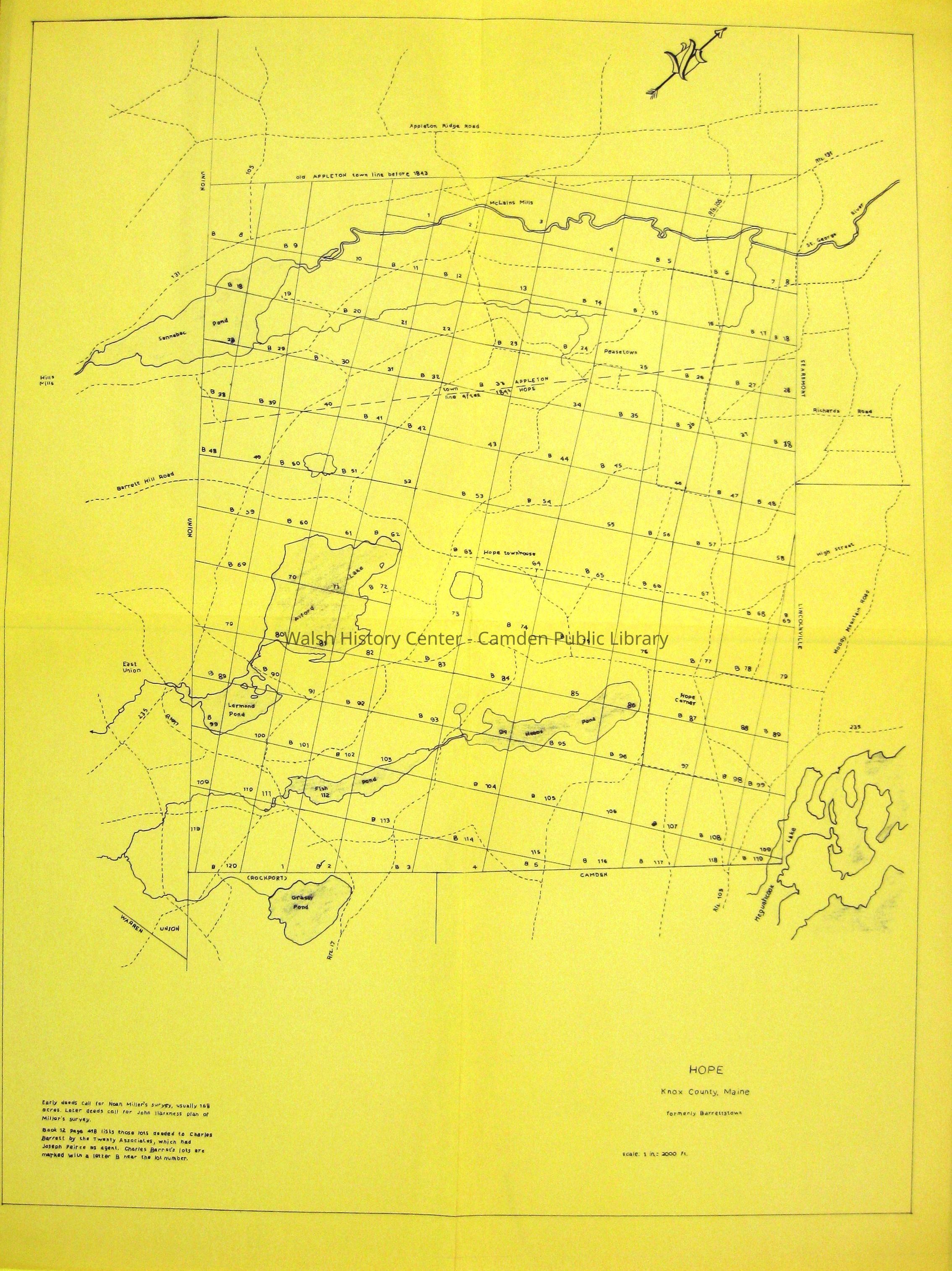
HOPE. Plan of Hope as originally laid out by Noah Miller and redrafted in 1799 by John Harkness. The portion later set off to Appleton is included. Modern roads are shown and named. Some roads now abandoned are depicted - e.g., the road from Route 105 at the present "Penny Lane" straight over the Pearse farm, "Rocky Top," onward to present-day Robbins Road and back to Route 105. Blueprint, scale of 1"=2000'.Collection
Camden Public Library Map CollectionCataloged By
Wyatt BerryAcquisition
Accession
WHC 2018.106Source or Donor
CPL Map CollectionAcquisition Method
Found in CollectionLexicon
Nomenclature 4.0
Nomenclature Secondary Object Term
MapNomenclature Primary Object Term
CartographNomenclature Sub-Class
Graphic DocumentsNomenclature Class
Documentary ObjectsNomenclature Category
Category 08: Communication ObjectsLOC Thesaurus for Graphic Materials
Maps, RoadsSearch Terms
Plan of Hope, Maps, Noah Miller, John Harkness, Appleton, RoadsArchive Details
Date(s) of Creation
1799Archive Size/Extent
24 1/4" X 32 1/8"Location
Location
Cabinet
Map CaseBuilding
Walsh History CenterCategory
PermanentDate
October 21, 2025Category
PermanentMoved By
Wyatt BerryDate
September 21, 2018Inventory
Inventoried By
Wyatt BerryInventoried Date
Sep 21, 2018Relationships
Related Person or Organization
Person or Organization
Noah MillerPerson or Organization
John HarknessGeneral Notes
Note
Status: OK
Status By: Wyatt Berry
Status Date: 2018-09-21Created By
admin@catalogit.appCreate Date
September 21, 2018Updated By
admin@catalogit.appUpdate Date
October 27, 2025