Name/Title
AN ACCURATE PLAN OF THOMASTON, LINCOLN SSEntry/Object ID
WHC 2018.108Scope and Content
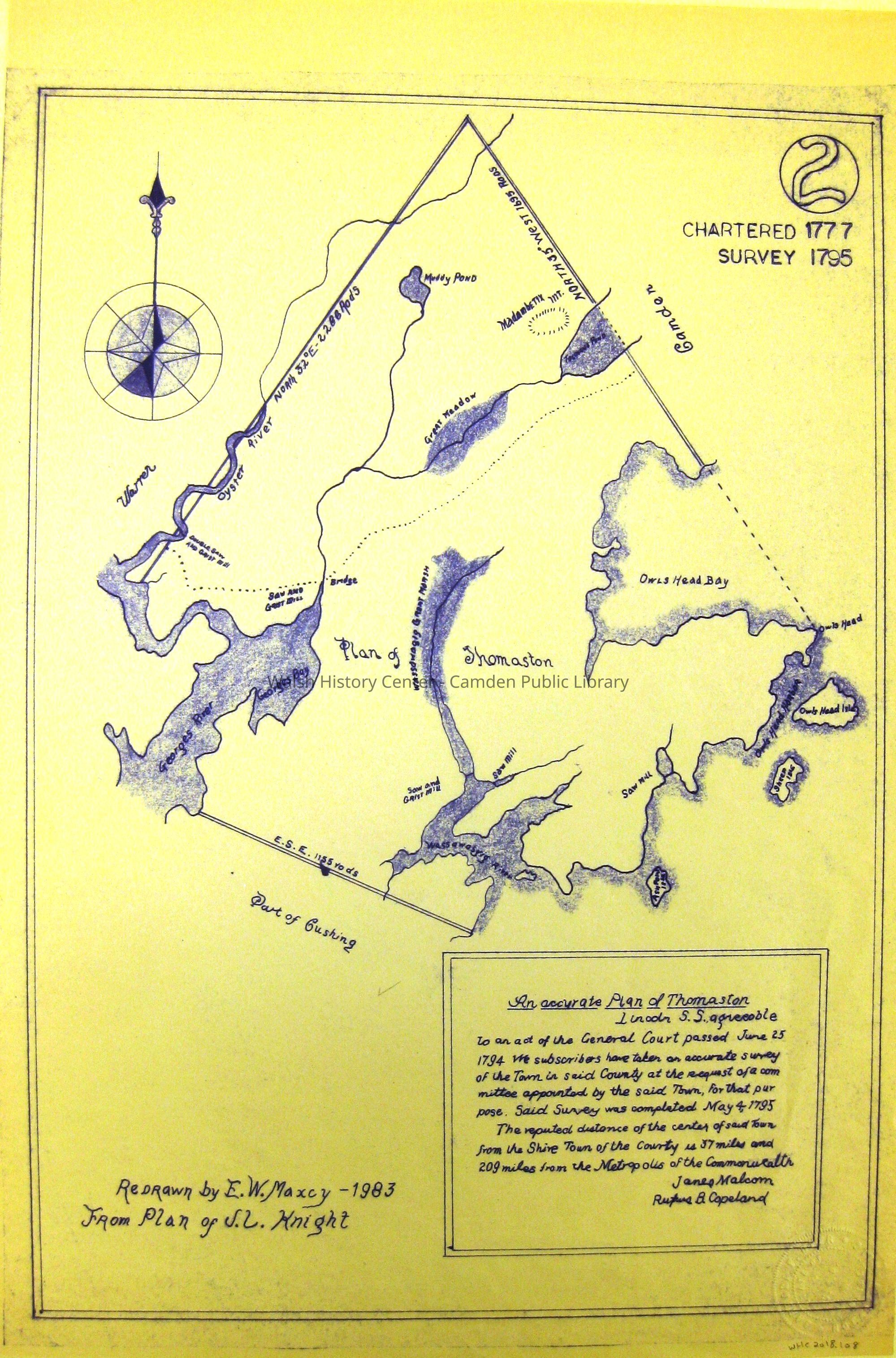
AN ACCURATE PLAN OF THOMASTON, LINCOLN SS, Agreeable to an Act of the General Court passed June 25, 1794. We subscribers have taken an accurate Survey of the Town in Said County at th request of a Committee appointed by said Town, for that purpose. Said Survey was completed May 4, 1795. The reputed distance of the center of said Town from the Shire Town of the County is 37 miles and 209 miles from the Metropolis of the Commonwealth. James Malcom, Rufus B. Copeland. Redrawn by E. W. Maxcy - 1983 from plan of J. L. KnightCollection
Camden Public Library Map CollectionCataloged By
Wyatt BerryAcquisition
Accession
WHC 2018.108Source or Donor
CPL Map CollectionAcquisition Method
Found in CollectionLexicon
Nomenclature 4.0
Nomenclature Secondary Object Term
MapNomenclature Primary Object Term
CartographNomenclature Sub-Class
Graphic DocumentsNomenclature Class
Documentary ObjectsNomenclature Category
Category 08: Communication ObjectsLOC Thesaurus for Graphic Materials
MapsSearch Terms
PLAN OF THOMASTON, Surveys, Maps, James Malcom, Rufus B. Copeland, E. W. Maxcy, J. L. KnightArchive Details
Date(s) of Creation
1795Archive Size/Extent
12 1/4" X 18"Location
Location
Cabinet
Map CaseBuilding
Walsh History CenterCategory
PermanentDate
October 21, 2025Category
PermanentMoved By
Wyatt BerryDate
September 21, 2018Inventory
Inventoried By
Wyatt BerryInventoried Date
Sep 21, 2018Relationships
Related Person or Organization
Person or Organization
James MalcomPerson or Organization
Rufus B. CopelandPerson or Organization
E. W. MaxcyPerson or Organization
J. L. KnightGeneral Notes
Note
Status: OK
Status By: Wyatt Berry
Status Date: 2018-09-21Created By
admin@catalogit.appCreate Date
September 21, 2018Updated By
admin@catalogit.appUpdate Date
October 27, 2025