Name/Title
MapEntry/Object ID
WHC 2021.5Scope and Content
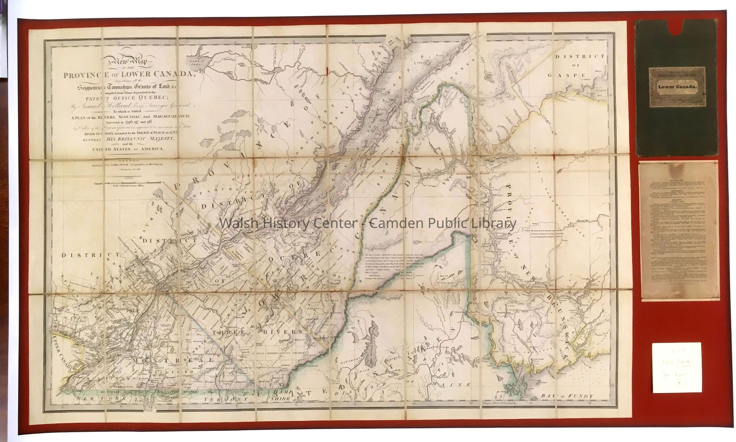
A New Map of the Province of Lower Canada, Describing All the Seigneuries, Townships, Grants of Land, &c. Compiled from Plans Deposited in the Patent Office Quebec; by Samuel Holland Esqr. Surveyor General
To Which is Added a Plan of the Rivers, Scoudiac and Magaguadavic surveyed in 1796, 97, and 98, by Order of the Commissioners Appointed to Ascertain the True River St. Croix Intended by the Treaty of Peace in 1783 Between His Britannic Majesty and the United States of America. London. Published by James Wyld Geographer to His Majesty. 5 Charing Cross Jan'y 4, 1838.
Color print. Scale bar in British Statute Miles. This map, in great detail shows the area from Gaspe to upper Maine to upper New York and Quebec. The Maine border was not yet firmly established at the drafting of this map.
Gift of Hank Lunn.Collection
Camden Public Library Map CollectionCataloged By
Donovan BowleyAcquisition
Accession
WHC 2021.5Source or Donor
Donated by Hank LunnAcquisition Method
GiftLexicon
Nomenclature 4.0
Nomenclature Secondary Object Term
MapNomenclature Primary Object Term
CartographNomenclature Sub-Class
Graphic DocumentsNomenclature Class
Documentary ObjectsNomenclature Category
Category 08: Communication ObjectsSearch Terms
Map, Canada, 1783, Treaty of Peace, MaineArchive Details
Date(s) of Creation
Dec 17, 2021Location
Category
PermanentDate
October 21, 2025Condition
Overall Condition
GoodDate Examined
Dec 17, 2021Examined By
Ken GrossGeneral Notes
Note
Status: OK
Status By: Ken Gross
Status Date: 2021-12-17Created By
admin@catalogit.appCreate Date
December 17, 2021Updated By
admin@catalogit.appUpdate Date
October 26, 2025