Name/Title
Tourist Map 1981Entry/Object ID
WHC 2021.7Scope and Content
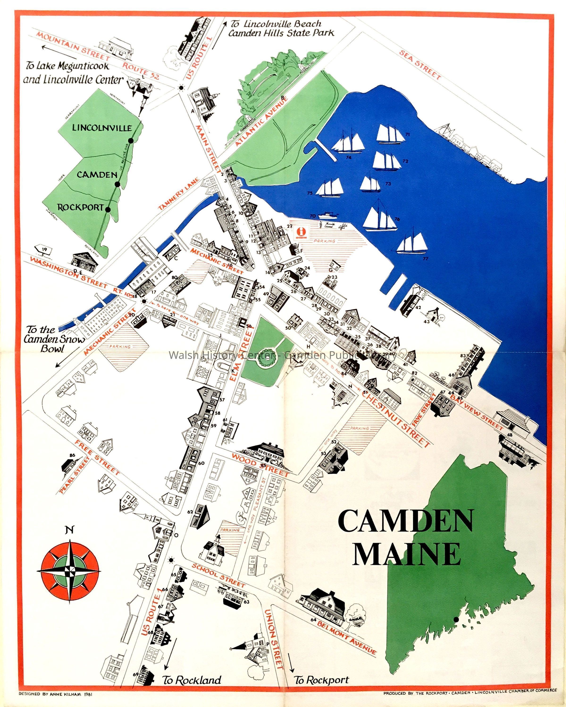
CAMDEN, MAINE Tourist map 1981 of Camden Harbor and village area from Mechanic Street and Free Street and Sea Street and Atlantic Avenue. Sketches of houses and other structures; inset map in green of Maine and another of Rockport, Camden, and Lincolnville. Harbor is blue. Other features and border in red, green, and black. Features in black are numbered, and keyed on reverse side to identify labels and advertisers.
Designed by Anne Kilham, 1981. Produced by the Rockport-Camden-Lincolnville Chamber of Commerce. Gift of Donovan A.R. Bowley 6/8/2021.Collection
Camden Public Library Map CollectionCataloged By
Ken GrossAcquisition
Accession
WHC 2021.7Source or Donor
Donovan BowleyAcquisition Method
GiftLexicon
Nomenclature 4.0
Nomenclature Secondary Object Term
MapNomenclature Primary Object Term
CartographNomenclature Sub-Class
Graphic DocumentsNomenclature Class
Documentary ObjectsNomenclature Category
Category 08: Communication ObjectsArchive Details
Date(s) of Creation
Dec 20, 2021Dimensions
Dimension Notes
Size: 19" x 24"Location
Location
Building
Map File Folder KCategory
PermanentDate
October 21, 2025Condition
Overall Condition
FairDate Examined
Dec 20, 2021Examined By
Ken GrossRelationships
Related Person or Organization
Person or Organization
Kilham, AnneGeneral Notes
Note
Status: OK
Status By: Ken Gross
Status Date: 2021-12-20Created By
admin@catalogit.appCreate Date
December 20, 2021Updated By
admin@catalogit.appUpdate Date
October 27, 2025