Name/Title
1795 Map of Camden by John HarknessEntry/Object ID
WHC 2021.10Scope and Content
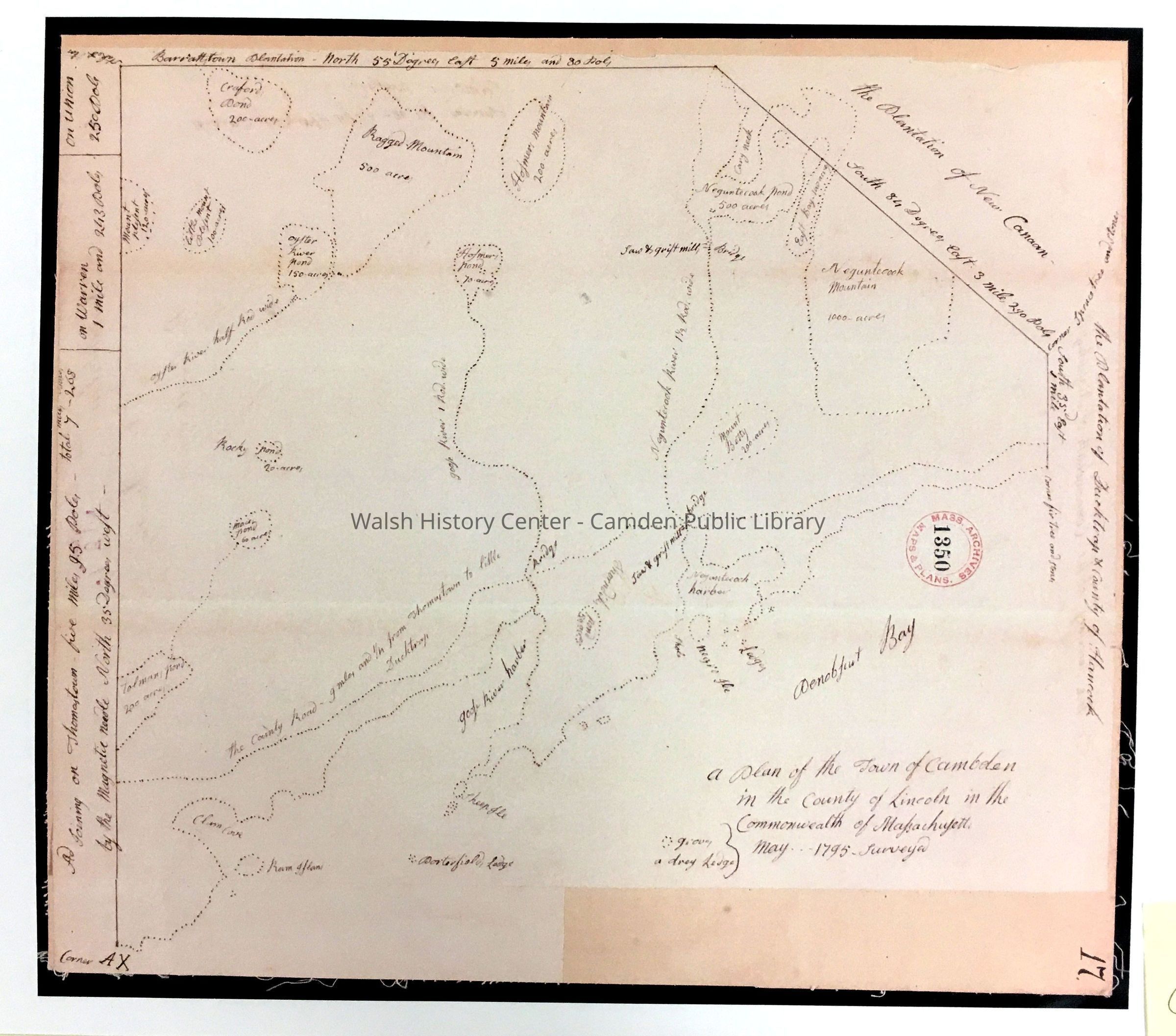
A Plan of the Town of Cambden In the County of Lincoln in the Commonwealth of Massachusetts. Surveyed May 1795. Hand-drafted (attributed to John Harkness). Numbered 17.
Stamp of Mass-Archives & Plans 1350. This appears to be a copy of the original requested by the Massachusetts General Court in 1795 for the Osgood Carleton 1802 Map of the District of Maine and is in the map book of that period at Massachusetts Archives.Collection
Camden Public Library Map CollectionCataloged By
Donovan BowleyAcquisition
Accession
WHC 2021.10Acquisition Method
GiftLexicon
Nomenclature 4.0
Nomenclature Secondary Object Term
MapNomenclature Primary Object Term
CartographNomenclature Sub-Class
Graphic DocumentsNomenclature Class
Documentary ObjectsNomenclature Category
Category 08: Communication ObjectsSearch Terms
1795, Osgood-Carleton, 1802Archive Details
Date(s) of Creation
Dec 21, 2021Dimensions
Dimension Notes
Size: 9 7/8" x 11" on 11.5x17"Location
Location
Building
Map File Folder ACategory
PermanentDate
October 21, 2025Condition
Overall Condition
GoodDate Examined
Dec 21, 2021Examined By
Ken GrossRelationships
Related Person or Organization
Person or Organization
Harkness, JohnGeneral Notes
Note
Status: OK
Status By: Ken Gross
Status Date: 2021-12-21Created By
admin@catalogit.appCreate Date
December 21, 2021Updated By
admin@catalogit.appUpdate Date
October 26, 2025