Name/Title
Map of the Waldo Patent c 1795 -- The Knox MapEntry/Object ID
WHC 2021.11Scope and Content
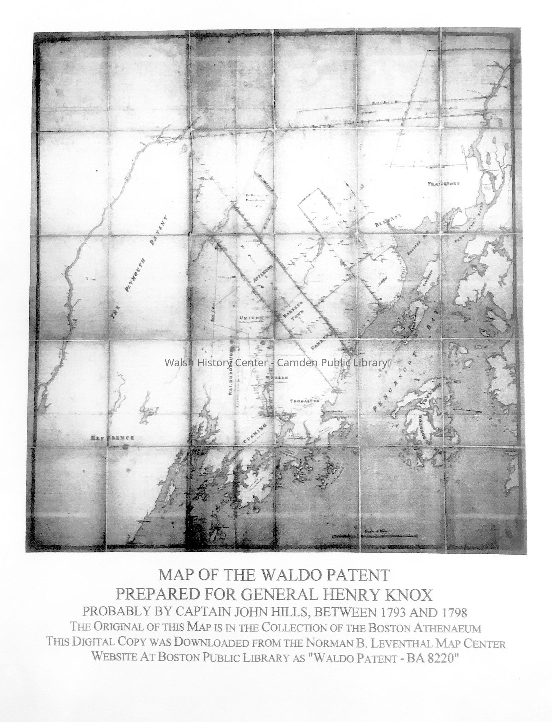
Map of the Waldo Patent [and adjacent areas] Prepared for General Henry Knox, probably by Captain John Hills, between 1792 and 1798. B&W photocopy of an online image on Boston Public Library's Leventhal Map Center website, as "Waldo Patent -BA8220". The original much larger map is at the Boston Athenaeum. This copy gift of Donovan A.R. Bowley.Collection
Camden Public Library Map CollectionCataloged By
Donovan BowleyAcquisition
Accession
WHC 2021.11Source or Donor
Donovan A. R. BowleyAcquisition Method
GiftLexicon
Nomenclature 4.0
Nomenclature Secondary Object Term
MapNomenclature Primary Object Term
CartographNomenclature Sub-Class
Graphic DocumentsNomenclature Class
Documentary ObjectsNomenclature Category
Category 08: Communication ObjectsSearch Terms
Waldo Patent, Twenty Associates, Knox MapArchive Details
Date(s) of Creation
Dec 21, 2021Dimensions
Dimension Notes
Size: 18" x 24"Location
Location
Building
Map FIle Folder BCategory
PermanentDate
October 21, 2025Condition
Overall Condition
GoodDate Examined
Dec 21, 2021Examined By
Ken GrossRelationships
Related Person or Organization
Person or Organization
Hills, JohnPerson or Organization
Knox, HenryGeneral Notes
Note
Status: OK
Status By: Ken Gross
Status Date: 2021-12-21Created By
admin@catalogit.appCreate Date
December 21, 2021Updated By
admin@catalogit.appUpdate Date
October 26, 2025