Name/Title
Trail Map Camden Snow Bowl / Camden OutdoorsEntry/Object ID
WHC 2021.12Scope and Content
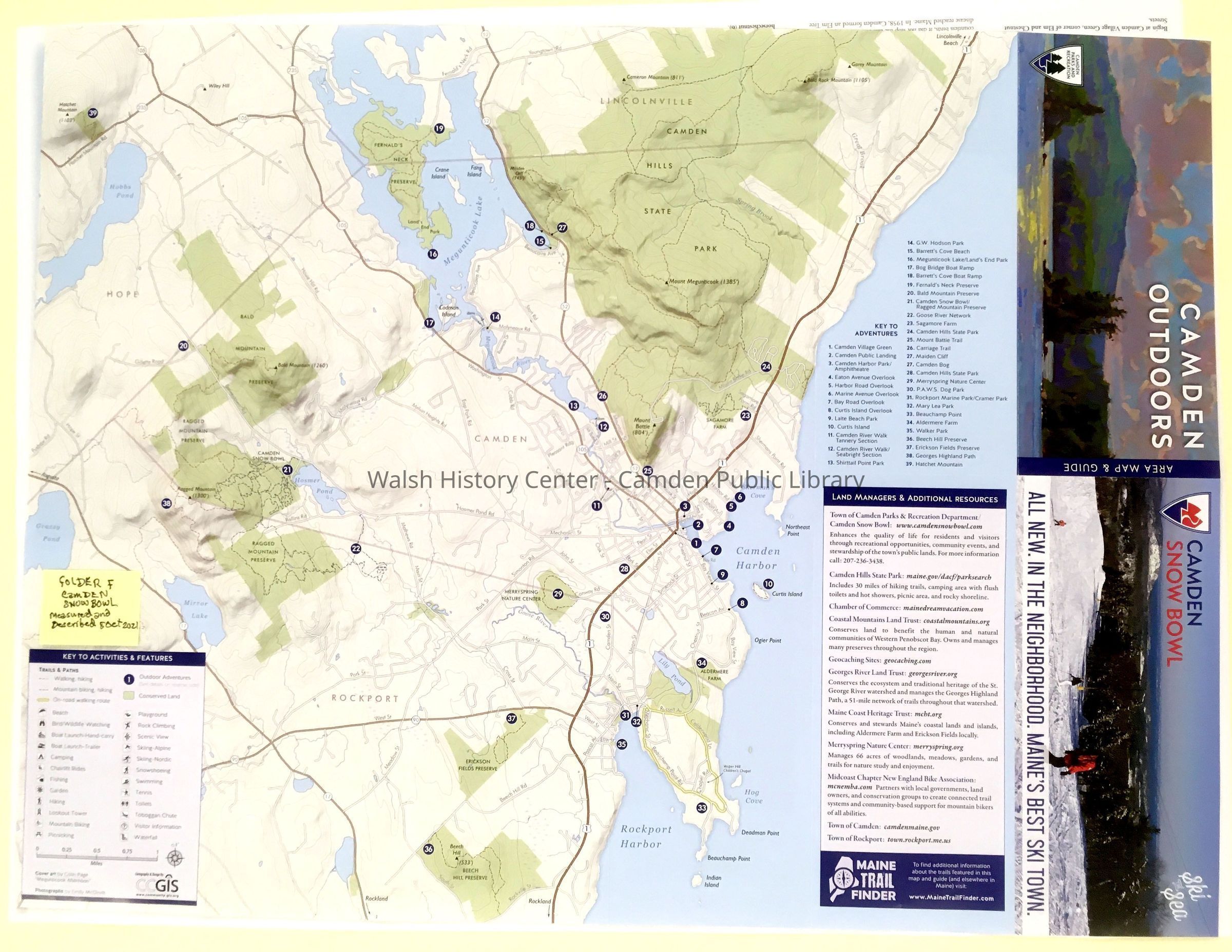
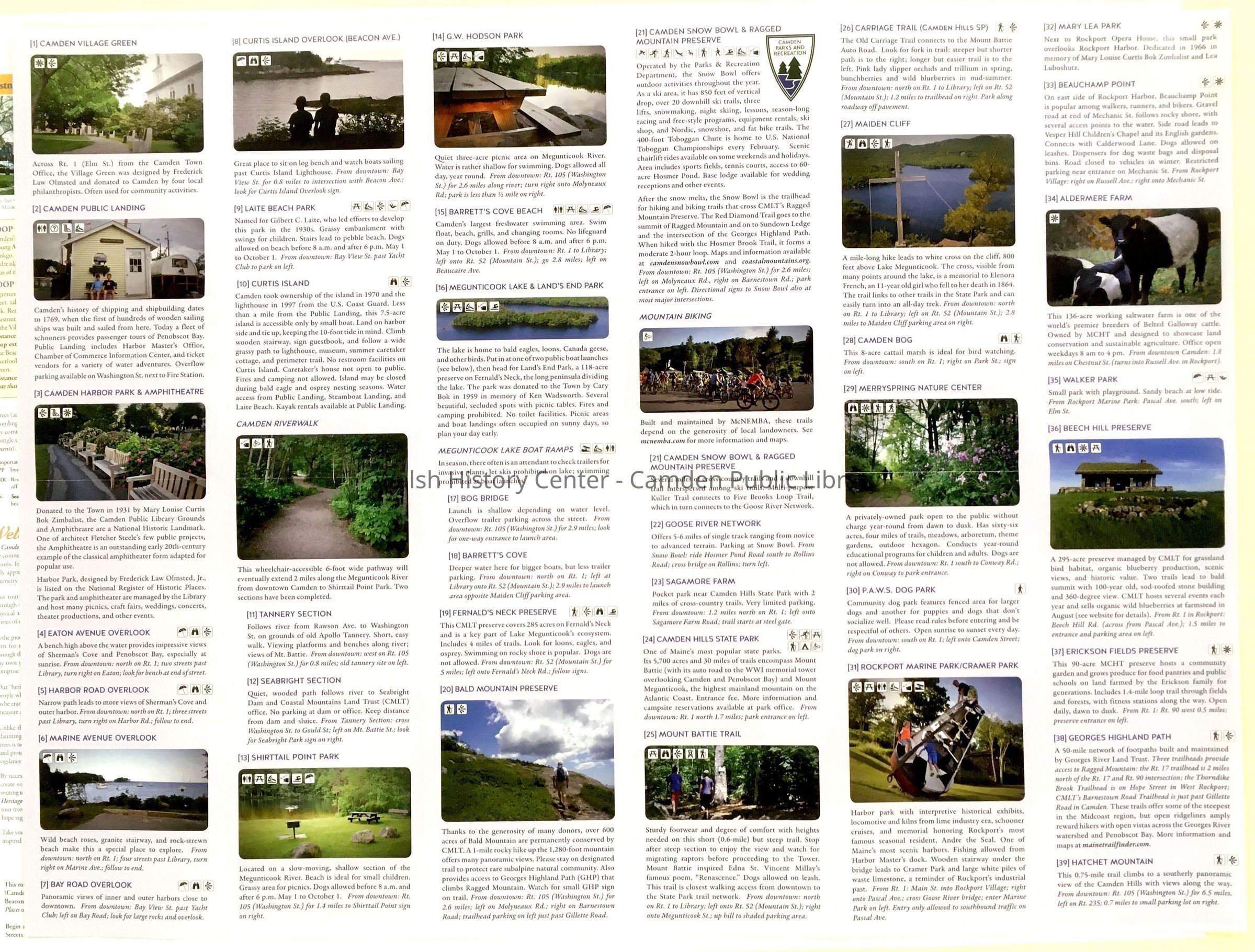
Camden Snow Bowl / Camden Outdoors. Camden Parks & Recreation color map of Camden & adjacent areas on a topographic base showing roads, political boundaries, and hydrography. Depicts 39 numbered points of interest, which are described on the reverse of the map; 17 are depicted in color photographs. Reference to www.MaineTrailsfinder.com for detailed information on trails, as well as links to 11 other useful references for hikers and mountain bikers. Undated.Collection
Camden Public Library Map CollectionCataloged By
Ken GrossAcquisition
Accession
WHC 2021.12Acquisition Method
GiftLexicon
Nomenclature 4.0
Nomenclature Secondary Object Term
MapNomenclature Primary Object Term
CartographNomenclature Sub-Class
Graphic DocumentsNomenclature Class
Documentary ObjectsNomenclature Category
Category 08: Communication ObjectsSearch Terms
Snow Bowl, Trail maps, Coastal Mountain Land Trust, Camden Hills State ParkArchive Details
Date(s) of Creation
Dec 21, 2021Dimensions
Dimension Notes
Size: 24" x 15"Location
Location
Building
Map File Folder FCategory
PermanentDate
October 21, 2025General Notes
Note
Status: OK
Status By: Ken Gross
Status Date: 2021-12-21Created By
admin@catalogit.appCreate Date
December 21, 2021Updated By
admin@catalogit.appUpdate Date
October 27, 2025