Name/Title
Megunticook Lake and Norton's PondEntry/Object ID
WHC 2021.14Scope and Content
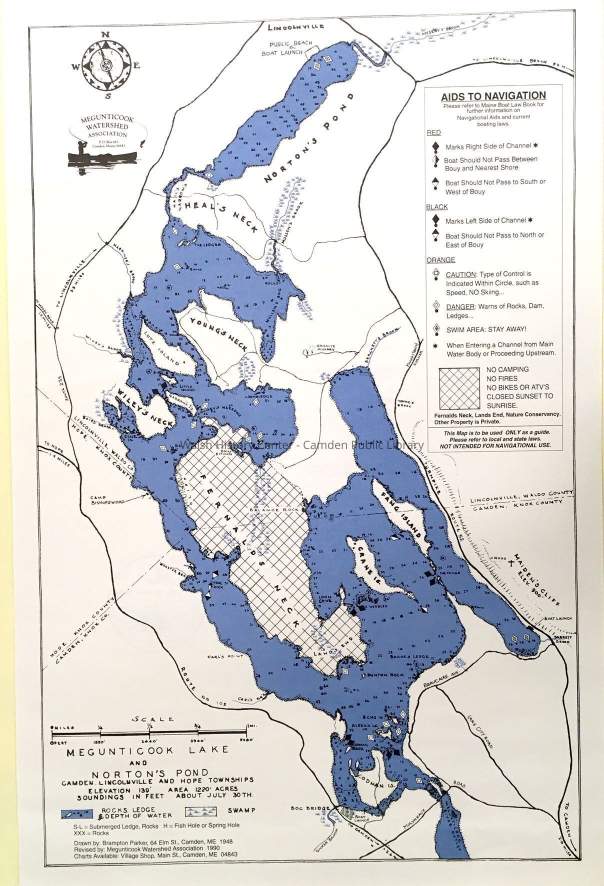
Megunticook Lake and Norton's Pond, by Brampton Parker, 1948; revised by Megunticook Watershed Association, 1990. Scale of miles, shows water features, roads, political boundaries; with a key to features. Depth of water is shown in feet as of the usual end of July. Two-color map (blue and black)Collection
Camden Public Library Map CollectionCataloged By
Ken GrossAcquisition
Accession
WHC 2021.14Acquisition Method
GiftLexicon
Nomenclature 4.0
Nomenclature Secondary Object Term
MapNomenclature Primary Object Term
CartographNomenclature Sub-Class
Graphic DocumentsNomenclature Class
Documentary ObjectsNomenclature Category
Category 08: Communication ObjectsSearch Terms
Megunticook Lake, Norton's Pond, Megunticook Watershed Association, Village ShopArchive Details
Date(s) of Creation
Dec 21, 2021Dimensions
Dimension Notes
Size: 15" x 24"Location
Location
Building
Map File Folder ICategory
PermanentDate
October 21, 2025Relationships
Related Person or Organization
Person or Organization
Parker, BramptonGeneral Notes
Note
Status: OK
Status By: Ken Gross
Status Date: 2021-12-21Created By
admin@catalogit.appCreate Date
December 21, 2021Updated By
admin@catalogit.appUpdate Date
October 26, 2025