Name/Title
Map of North Haven and Vinalhaven, 1859Entry/Object ID
WHC 2021.19Scope and Content
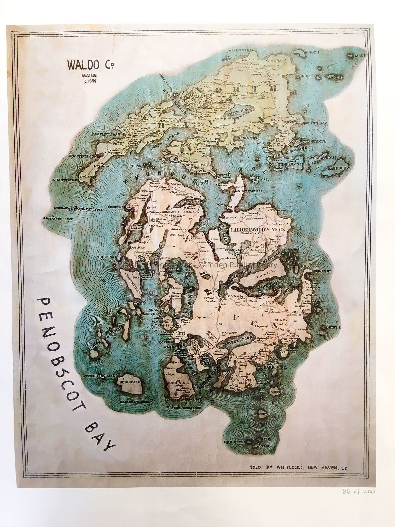
Map of North Haven and Vinalhaven, 1859 (then in Waldo County). Colored map of the two principal islands and adjacent smaller ones. Appears to be a lithographic print on fine watercolor stock. Titled "Waldo Co. / Maine / c. 1859" [the year of the Waldo County Map printing]. "Sold by Whitlock's, New Haven, Ct." Numbered in pencil in the lower r.h. border "86 of 200." The map depicts roads and hydrography on both islands, as well as names of residents and of some geographic features.
This original print is enclosed in a protective plastic sleeve.Collection
Camden Public Library Map CollectionCataloged By
Donovan BowleyAcquisition
Accession
WHC 2021.19Acquisition Method
GiftLexicon
Nomenclature 4.0
Nomenclature Secondary Object Term
MapNomenclature Primary Object Term
CartographNomenclature Sub-Class
Graphic DocumentsNomenclature Class
Documentary ObjectsNomenclature Category
Category 08: Communication ObjectsSearch Terms
Vinalhaven, North HavenArchive Details
Date(s) of Creation
Dec 22, 2021Location
Location
Building
Map File Folder LCategory
PermanentDate
October 21, 2025Condition
Overall Condition
GoodDate Examined
Dec 22, 2021Examined By
Ken GrossGeneral Notes
Note
Status: OK
Status By: Ken Gross
Status Date: 2021-12-22Created By
admin@catalogit.appCreate Date
December 22, 2021Updated By
admin@catalogit.appUpdate Date
October 26, 2025