Name/Title
CAMDEN, ROCKPORT, AND LINCOLNVILLE MAP, 2003-2004Entry/Object ID
WHC 2022.3Scope and Content
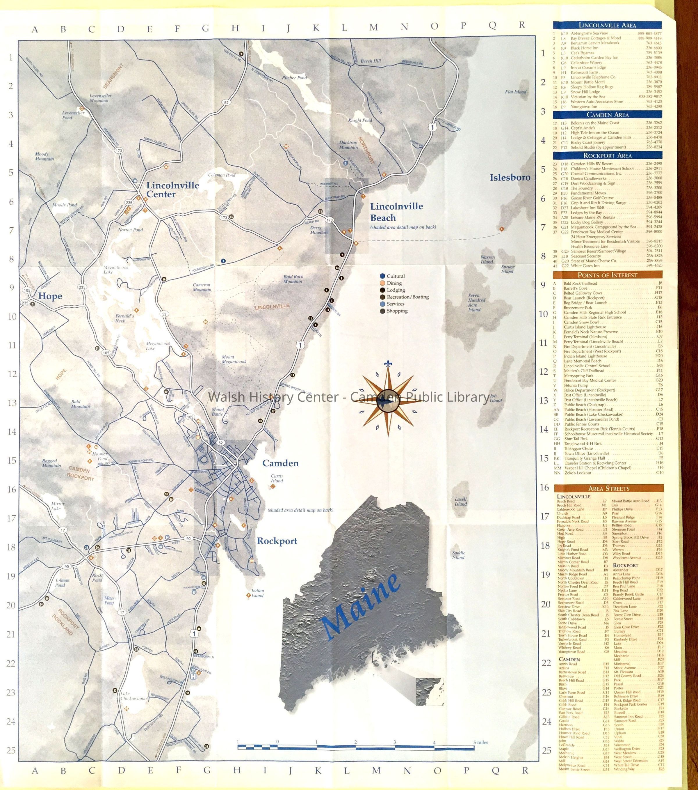
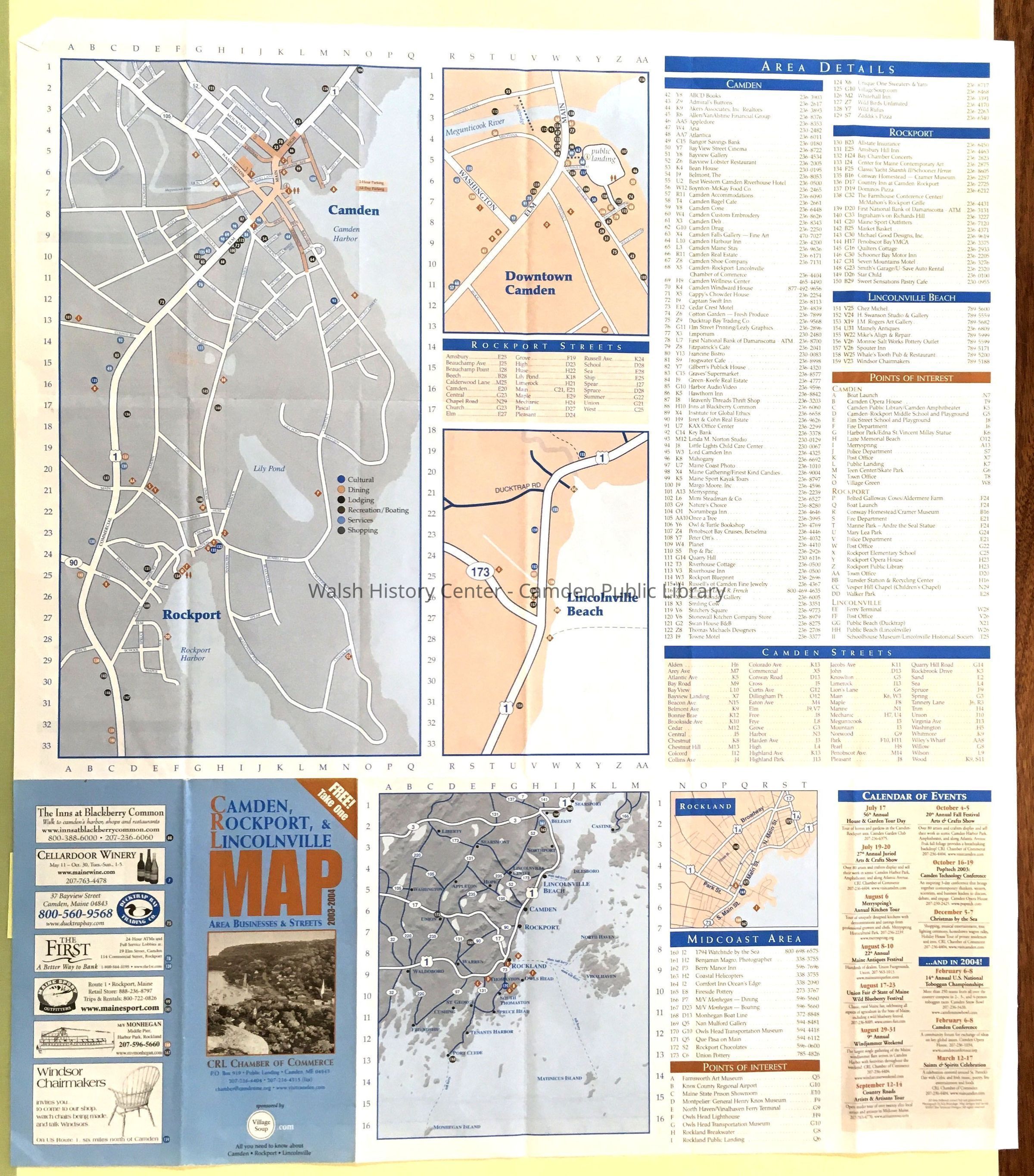
CAMDEN, ROCKPORT, AND LINCOLNVILLE MAP, 2003-2004. Published by CRL Chamber of Commerce. This depicts the Camden area, from Hope [Hope Corner] (west) to Flat Island (east) and from Van Cycle Road (north) to Samoset Road (South). Roads and town boundaries and bodies of water are shown. Inset maps include topographic relief maps of Maine and the map area on the primary side, and detail maps of parts of Camden and Rockport, downtown Camden, Lincolnville Beach, and Rockland, with an area map showing state highways and Route 1. On each side there are street directions appropriate to that map. Blue and brown ink on white paper. Folded in 24 sections. On the title block side, there are 5 maps, each numbered with number/letter locational aids; as well as lists of details and points of interest keyed to the maps.Collection
Camden Public Library Map CollectionCataloged By
Donovan BowleyAcquisition
Accession
WHC 2022.3Acquisition Method
GiftLexicon
Nomenclature 4.0
Nomenclature Secondary Object Term
MapNomenclature Primary Object Term
CartographNomenclature Sub-Class
Graphic DocumentsNomenclature Class
Documentary ObjectsNomenclature Category
Category 08: Communication ObjectsDimensions
Dimension Notes
Size: 27" x 24"Location
Location
Container
Map CaseDrawer
Folder KCategory
PermanentDate
October 21, 2025Condition
Overall Condition
GoodDate Examined
Apr 13, 2022Examined By
Ken GrossGeneral Notes
Note
Status: OK
Status By: Ken Gross
Status Date: 2022-04-13Created By
admin@catalogit.appCreate Date
April 13, 2022Updated By
admin@catalogit.appUpdate Date
October 27, 2025