Name/Title
1762 PLAN of the interior parts of the Countrey from Penobscot to Quebec,Entry/Object ID
WHC 2022.4.1Scope and Content
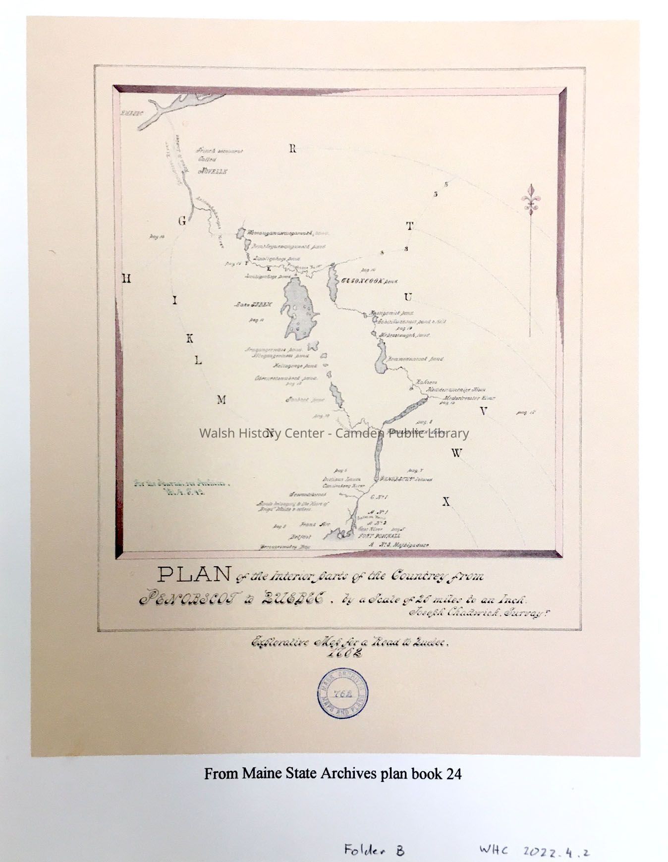
PLAN of the interior parts of the Countrey from Penobscot to Quebec, by a scale of 25 miles to an inch. Joseph Chadwick, Surveyor.
Explorative Map for a Road to Quebec, 1762.
Two copies.
Note: "Add a copy of the transcript of the surveyor's journal."
From Maine State Archives plan book 24
See also WHC 2018.1.1 in Folder B:
"A Draught of a Rout from Fort Pownall on Penobscot River by way of Piscataquess River, Lake Sabim, Wolf River, and the River Chaudiere, to Quebec and back again to Fort Pownall, by Penobscot River. Taken by order of His Excellent Francis Bernard, Esq; Governor &c of His Majesty's Province of the Massachusetts Bay in New England 1764."
Gift of Donovan BowleyCollection
Camden Public Library Map CollectionCataloged By
Donovan BowleyAcquisition
Accession
WHC 2022.4Acquisition Method
GiftLexicon
Nomenclature 4.0
Nomenclature Secondary Object Term
MapNomenclature Primary Object Term
CartographNomenclature Sub-Class
Graphic DocumentsNomenclature Class
Documentary ObjectsNomenclature Category
Category 08: Communication ObjectsSearch Terms
Fort Pownall, QuebecArchive Details
Date(s) of Creation
Apr 20, 2022Location
Location
Building
Map Case Folder BCategory
PermanentDate
October 21, 2025Condition
Overall Condition
GoodDate Examined
Apr 20, 2022Examined By
Ken GrossRelationships
Related Person or Organization
Person or Organization
Joseph ChadwickGeneral Notes
Note
Notes: 19x24"
Status: OK
Status By: Ken Gross
Status Date: 2022-04-20Created By
admin@catalogit.appCreate Date
April 20, 2022Updated By
admin@catalogit.appUpdate Date
October 26, 2025