Name/Title
Copy of 1875 Map of CamdenEntry/Object ID
WHC 2022.6Scope and Content
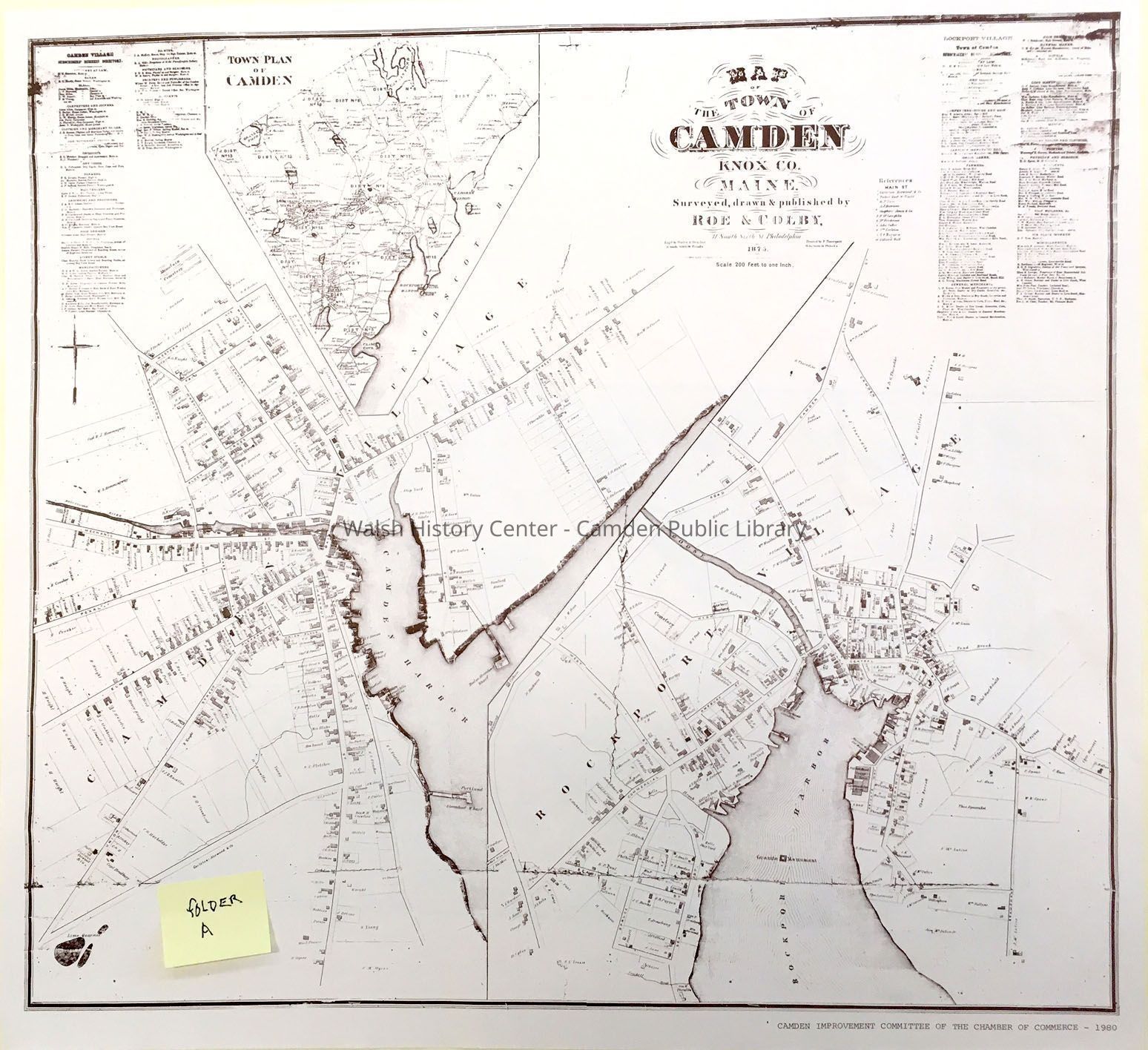
MAP OF THE TOWN OF CAMDEN, KNOX CO. MAINE. Surveyed, drawn, and published by ROE & COLBY, 31 South Sixth Street Philadelphia. Scale: 200 feet to one inch [on the original map]. This reduced copy of the 1875 original was reprinted by the Improvement Committee of the Chamber of Commerce in 1980.
The map, reprinted in brown ink on cream paper, depicts the whole town of Camden in reduced scale at the top and an enlarged view of Camden in the center, and Rockport Village at the bottom
There are business Directories of Camden subscribers at the top left and of Rockport subscribers at top right.
Streets, lot lines, and structures are shown on the detailed sections. Note that this map was created 16 years before the original town was divided between these two principal villages.
There is a framed copy of the original of this map in the collection, from which better detail can be observed, and and on which fine-printed detail can be read. The original measures 41" x 45".Collection
1875Camden Public Library Map CollectionCataloged By
Donovan BowleyAcquisition
Accession
WHC 2022.6Source or Donor
Unknown Accession Donor (ae487771-ae8a-11f0-a0b9-c7ce86d2caba)Acquisition Method
GiftLexicon
Nomenclature 4.0
Nomenclature Secondary Object Term
MapNomenclature Primary Object Term
CartographNomenclature Sub-Class
Graphic DocumentsNomenclature Class
Documentary ObjectsNomenclature Category
Category 08: Communication ObjectsSearch Terms
Camden, Rockport, 1875Archive Details
Date(s) of Creation
Apr 20, 2022Location
Location
Building
Map case Folder ACategory
PermanentDate
October 21, 2025Condition
Overall Condition
GoodDate Examined
Apr 20, 2022Examined By
Ken GrossGeneral Notes
Note
Notes: 21.25" x 19.75"
Status: OK
Status By: Ken Gross
Status Date: 2022-04-20Created By
admin@catalogit.appCreate Date
April 20, 2022Updated By
admin@catalogit.appUpdate Date
October 27, 2025