Name/Title
Maine New Hampshire Vermont road mapEntry/Object ID
WHC 2022.8Scope and Content
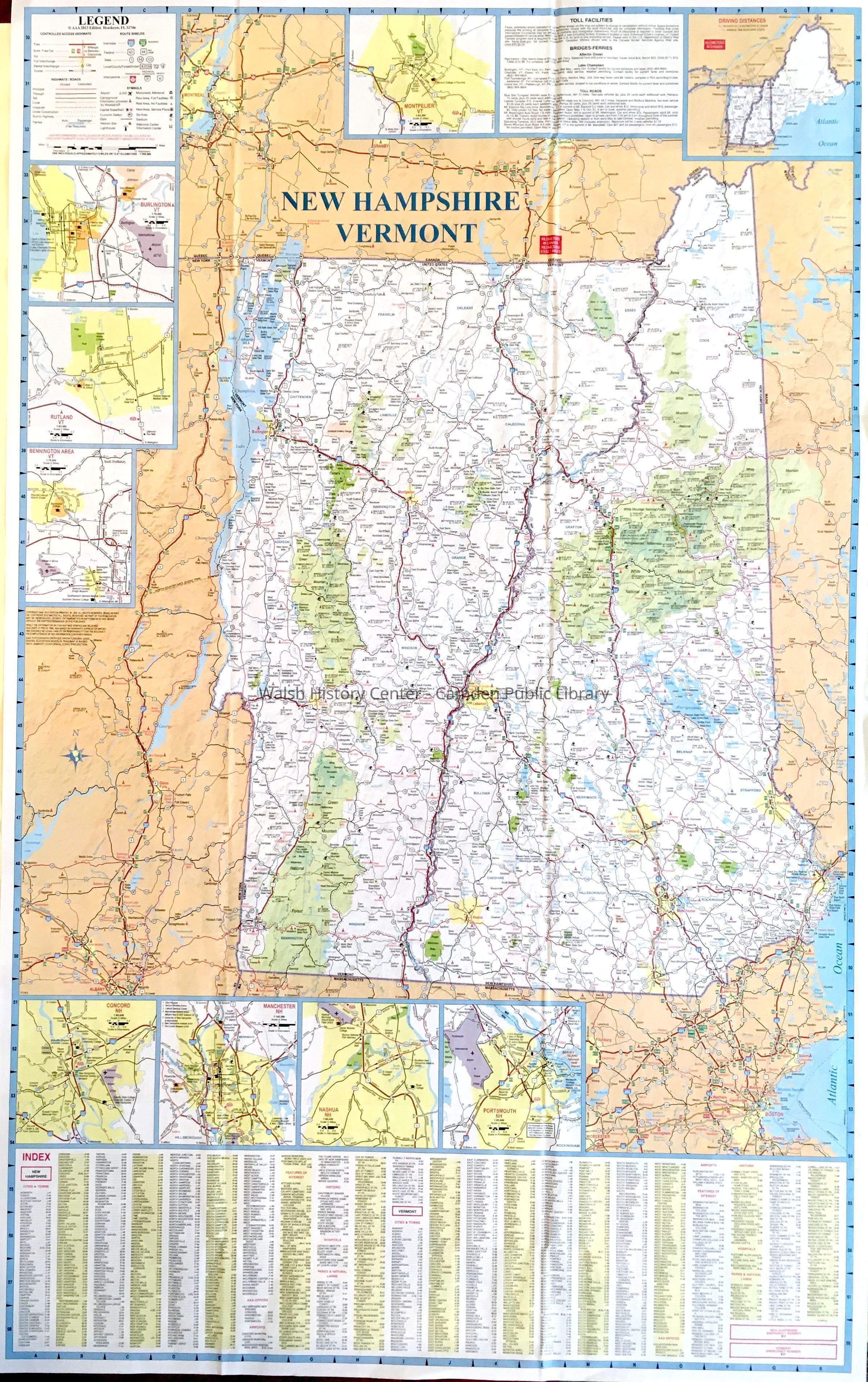
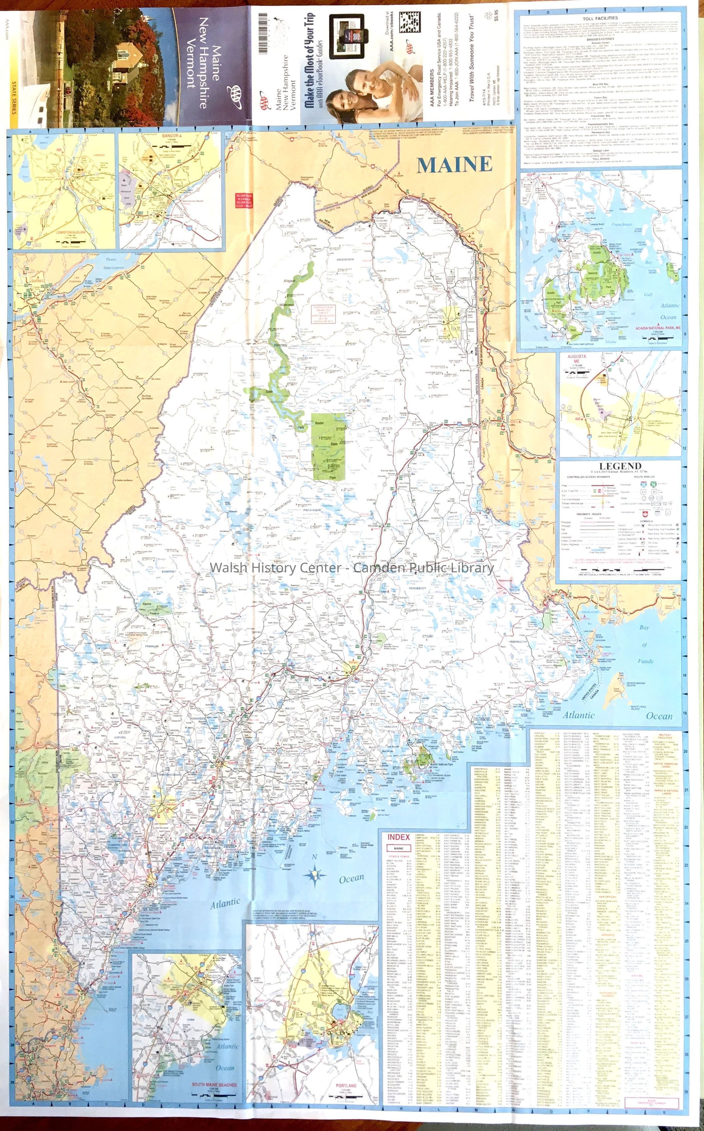
MAINE-NEW HAMPSHIRE - VERMONT American Automobile Association (AAA) State Series map. Note the cover of this map, when folded, shows the Camden Public Library. Maine is shown on one side at approx. one inch = eleven miles, New Hampshire and Vermont are shown on the other side at a scale of approx.. 8 miles.
Both sides show roads, political bounds, state and national parks, urban areas, camping and ski areas, beaches, etc. For each side of the map sheet, there are tables of cities and towns matched to number coordinate grids. In addition to legend blocks, there are inset maps of cities and towns: Lewiston/Auburn, Bangor, Acadia National Park area, Augusta, Portland, and South Maine Beaches on the Maine side. On the Vermont and New Hampshire side, inset maps show Bennington area, Rutland, Burlington, Montpelier, Concord, Manchester, Nashua, and Portsmouth.
Each side of this map also has an inset block showing toll facilities (bridges, roads, and ferries).Collection
Camden Public Library Map CollectionCataloged By
Donovan BowleyAcquisition
Accession
WHC 2022.8Source or Donor
Unknown Accession Donor (ae489e81-ae8a-11f0-a0b9-c7ce86d2caba)Acquisition Method
GiftLexicon
Nomenclature 4.0
Nomenclature Secondary Object Term
MapNomenclature Primary Object Term
CartographNomenclature Sub-Class
Graphic DocumentsNomenclature Class
Documentary ObjectsNomenclature Category
Category 08: Communication ObjectsSearch Terms
Maine, New Hampshire, VermontArchive Details
Date(s) of Creation
Apr 22, 2022Location
Location
Building
Map case Folder PCategory
PermanentDate
October 21, 2025Condition
Overall Condition
GoodDate Examined
Apr 22, 2022Examined By
Ken GrossGeneral Notes
Note
Status: OK
Status By: Ken Gross
Status Date: 2022-04-22Created By
admin@catalogit.appCreate Date
April 22, 2022Updated By
admin@catalogit.appUpdate Date
October 27, 2025