Name/Title
Monhegan IslandEntry/Object ID
WHC 2022.11Scope and Content
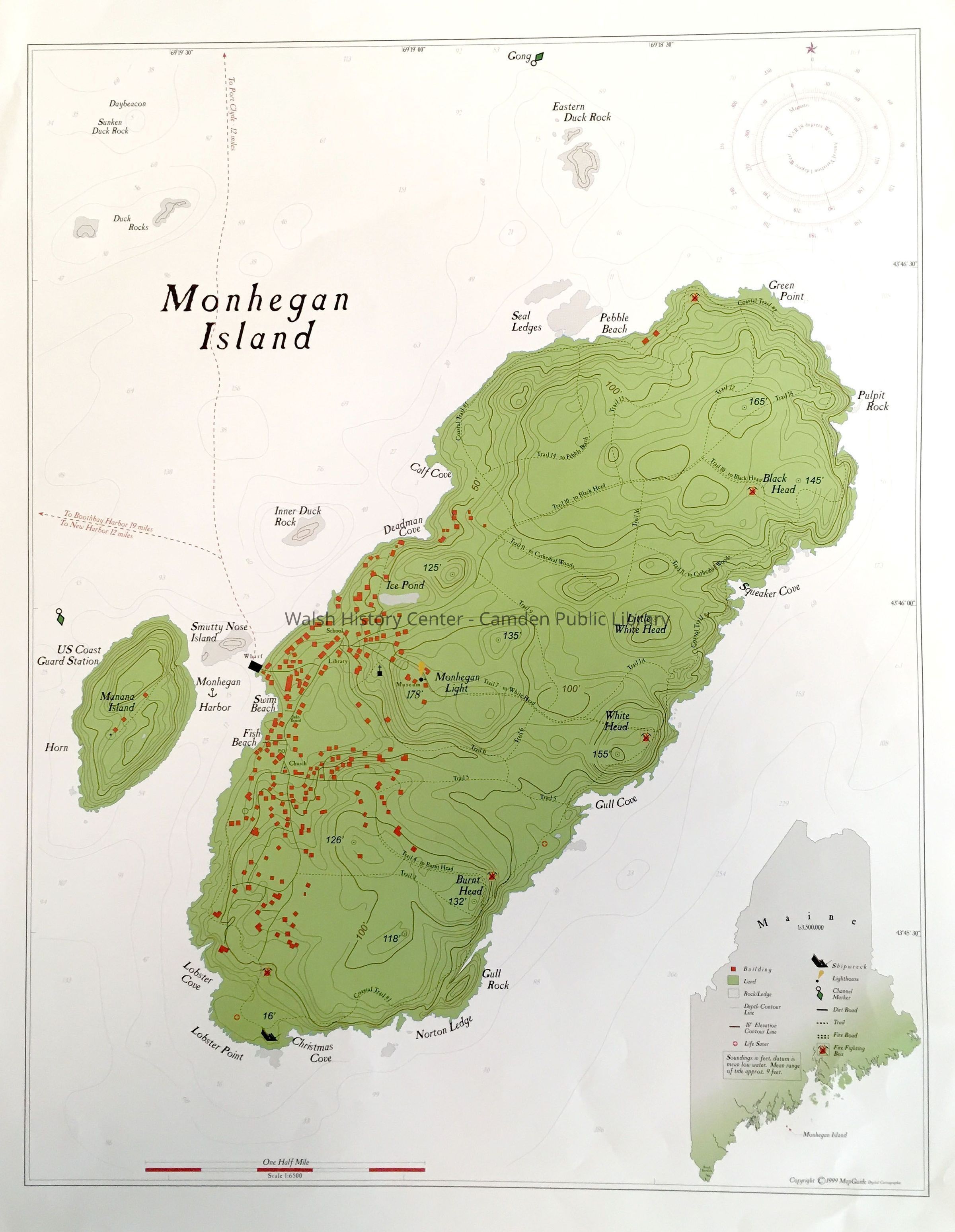
MONHEGAN ISLAND. Four-color map of Monhegan and Manana Islands. This map shows the two islands in green, with both land topology and marine depth contours, as well as symbols marking buildings, rocks, and ledges, life saver locations, shipwrecks, lighthouses, channer markers, dirt roads, trails, fire roads, and fire fighting boxes. There is a scale bar. The map was printed by MapGuide Digital Cartographic copyrighted 1999.Collection
Camden Public Library Map CollectionCataloged By
Donovan BowleyAcquisition
Accession
WHC 2022.11Source or Donor
Unknown Accession Donor (ae48c590-ae8a-11f0-a0b9-c7ce86d2caba)Acquisition Method
GiftLexicon
Nomenclature 4.0
Nomenclature Secondary Object Term
MapNomenclature Primary Object Term
CartographNomenclature Sub-Class
Graphic DocumentsNomenclature Class
Documentary ObjectsNomenclature Category
Category 08: Communication ObjectsSearch Terms
Monhegan, Island, MananaArchive Details
Date(s) of Creation
Apr 22, 2022Location
Location
Building
Map Case Folder LCategory
PermanentDate
October 21, 2025Condition
Overall Condition
GoodDate Examined
Apr 22, 2022Examined By
Ken GrossGeneral Notes
Note
Notes: 17x22"
Status: OK
Status By: Ken Gross
Status Date: 2022-04-22Created By
admin@catalogit.appCreate Date
April 22, 2022Updated By
admin@catalogit.appUpdate Date
October 27, 2025