Name/Title
Survey of TURNPIKE OVER MEGUNTICOOK MOUNTAIN 1801Entry/Object ID
WHC 2022.16Scope and Content
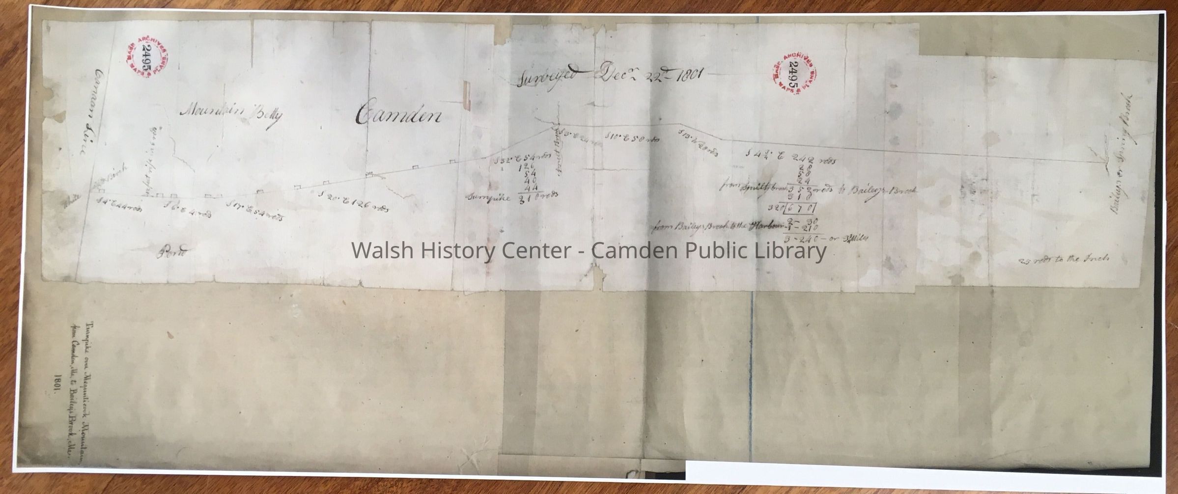
TURNPIKE OVER MEGUNTICOOK MOUNTAIN from Camden, Me., to Bailey's Brook, Me. Color photocopy, full size of original, which is in Mass. Archives, Maps & Plans No. 2495. This map is a survey taken 22 December 1801, with "Bailey Brook or Spring Brook" at one end and "Canaan Line" at the other. Landmarks along the way are "Pond", "Mountain Betty", and "Smelt Brook". There is no north arrow, but the landmarks show that the title (which is on the backing paper and not on the original paper) is INACCURATE. It is written by another hand than that of the survey and appears upside down at the north end of the map. It is clear that the title was added by someone unfamiliar with the area. The route surveyed does not go over Megunticook Mountain and instead appears to align with Route 52. It may be part of a survey of the Turnpike built by Daniel Barrett starting in 1802. Gift of Sanford R. Delano, 5 October 2019.Collection
Camden Public Library Map CollectionCataloged By
Donovan BowleyAcquisition
Accession
WHC 2022.16Source or Donor
Unknown Accession Donor (ae4913b0-ae8a-11f0-a0b9-c7ce86d2caba)Acquisition Method
GiftLexicon
Nomenclature 4.0
Nomenclature Secondary Object Term
MapNomenclature Primary Object Term
CartographNomenclature Sub-Class
Graphic DocumentsNomenclature Class
Documentary ObjectsNomenclature Category
Category 08: Communication ObjectsSearch Terms
Turnpike, Bailey Brook, SMelt Brook, Mount BettyArchive Details
Date(s) of Creation
Apr 28, 2022Location
Location
Building
Map case Folder ACategory
PermanentDate
October 21, 2025Condition
Overall Condition
GoodDate Examined
Apr 28, 2022Examined By
Ken GrossRelationships
Related Person or Organization
Person or Organization
Daniel BarrettGeneral Notes
Note
Status: OK
Status By: Ken Gross
Status Date: 2022-04-28Created By
admin@catalogit.appCreate Date
April 28, 2022Updated By
admin@catalogit.appUpdate Date
October 26, 2025