Name/Title
1759 Pownall ExpeditionEntry/Object ID
WHC 2024.7Scope and Content
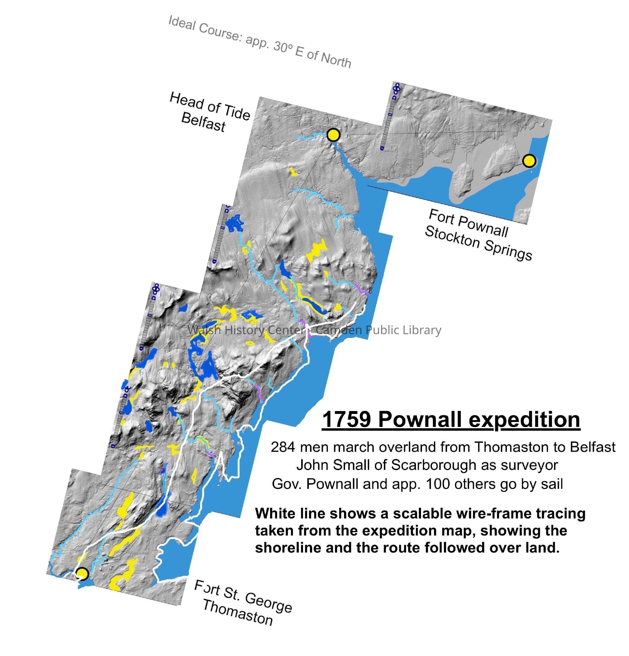
1759 Pownall Expedition - color map developed by Kerry Hardy from the expedition map of John Small, surveyor (of Scarborough), current maps, and Maine GIS Lidar imagery. It overlays the 1759 Expedition Map shoreline and road between Thomaston and Northport (road went from Fort St. George in Thomaston to Fort Pownall in Stockton Springs, at the mouth of the Penobscot River). [Note: the Library also has a copy of the Expedition Map and of Governor Pownall's journal.] Notes on the map: "284 men marched overland from Thomaston to Belfast. John Small of Scarborough as surveyor. Gov. Pownall and app. 100 others go by sail. White line shows a scalable wire-frame tracing taken from the expedition map, showing the shoreline and the route followed over the land."Collection
Walsh History Center Map CollectionCataloged By
Ken GrossAcquisition
Accession
WHC 2024.7Source or Donor
Kerry HardyAcquisition Method
Collected by StaffLexicon
Nomenclature 4.0
Nomenclature Secondary Object Term
MapNomenclature Primary Object Term
CartographNomenclature Sub-Class
Graphic DocumentsNomenclature Class
Documentary ObjectsNomenclature Category
Category 08: Communication ObjectsArchive Details
Creator
Kerry HardyDate(s) of Creation
Feb 14, 2024Condition
Overall Condition
GoodDate Examined
Feb 14, 2024Examined By
Ken GrossGeneral Notes
Note
Notes: Digital file
"Kerry Hardy Bernard-Pownall Map 1759"
11x17" color print
Status: OK
Status By: Ken Gross
Status Date: 2024-02-14Created By
admin@catalogit.appCreate Date
February 14, 2024Updated By
admin@catalogit.appUpdate Date
October 27, 2025