Name/Title
Trails and Preserves - Geroges River Land TrustEntry/Object ID
WHC 2024.15Scope and Content
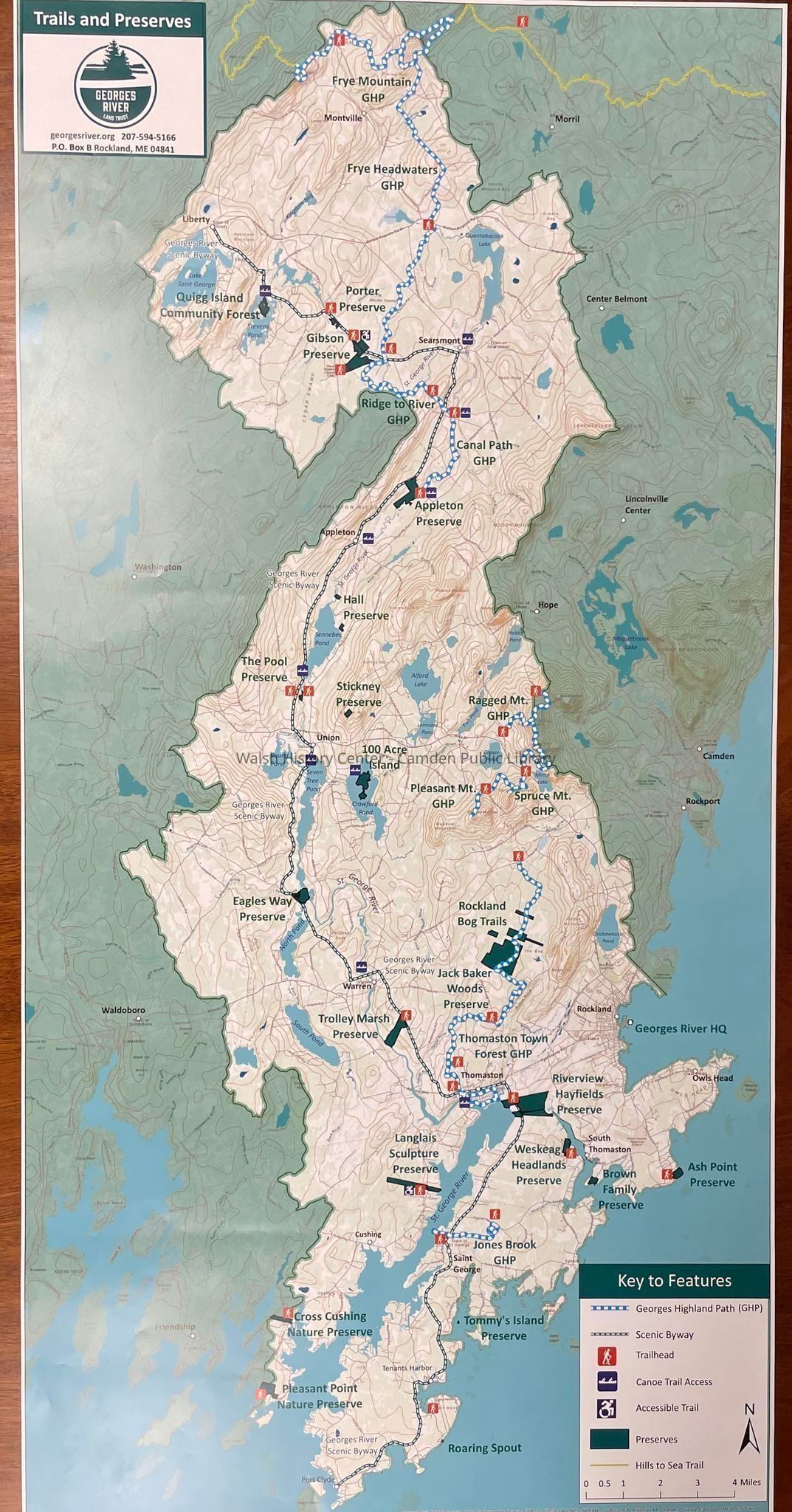
This map includes the Georges River watershed from it's northernmost area in Montville to its southern terminus in the golf of maine at Port Clyde. Features include: Georges Highland Path, scenic byways, trail heads; canoe trail access; handicap accessible trail at the Langlais Sculpture Preserve; Preserve areas and the Hills-to-sea trail north of Frye Mountain in Montville; Topography, aquatic features, as well as roads and town centers are shown. The map in color is surrounded by an 1/8 inch border of white.
Gift of Georges River Land TrustCollection
Walsh History Center Map CollectionCataloged By
Wyatt PorterAcquisition
Accession
WHC 2024.15.1Acquisition Method
Collected by StaffLexicon
Nomenclature 4.0
Nomenclature Secondary Object Term
MapNomenclature Primary Object Term
CartographNomenclature Sub-Class
Graphic DocumentsNomenclature Class
Documentary ObjectsNomenclature Category
Category 08: Communication ObjectsLOC Thesaurus for Graphic Materials
Canoes, HikingSearch Terms
Georges River Land Trust, St. George River, Canoe, Hiking, TrailsArchive Details
Creator
Georges River Land TrustDate(s) of Creation
2024 - 2024Archive Notes
Date(s): 06/06/2024Location
Location
Building
Walsh History CenterCategory
PermanentDate
October 21, 2025Condition
Overall Condition
GoodDate Examined
Jun 6, 2024Examined By
Wyatt PorterGeneral Notes
Note
Notes: 18" x 36"
Status: OK
Status By: Wyatt Porter
Status Date: 2024-06-06Created By
admin@catalogit.appCreate Date
June 6, 2024Updated By
admin@catalogit.appUpdate Date
October 27, 2025