Name/Title
Map of Governor Thomas Pownall's Penobscot Expedition of 1759Entry/Object ID
WHC 2024.16.1Scope and Content
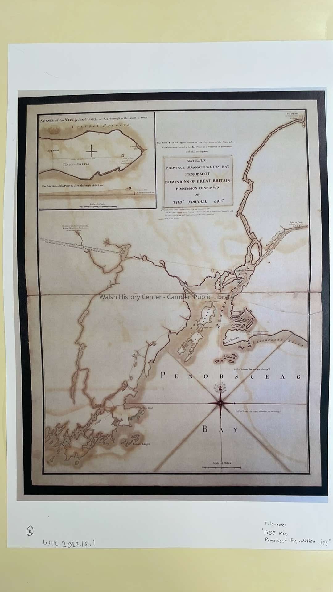
A set of three maps of Governor Thomas Pownall's Penobscot Expedition of 1759.
This expidition was conducted to fortify the mouth of the Penobscot River during the French and Indian War, and to mark the Northeasternmost corner of British possessions in New England.
A copy of the journal of the Exedition may be found in the History Center's "verticle file".
A. this colour map shows the area of Penobscot Bay from the estuary of the Georges River and Port Saint George to the location in Brewer where a lead plate marking the Northeasternmost corner of the Englos River plseas round in New England. It shows a trail from the Passagassawakeag River to the Kennebec River, and on an inset map depicts the location of the new fort "Fort Pownall". There is a scale bar of miles. There is also a copy of the lead point buried at the Northeast corner of the map.
This print is from the online map from the Leventhal map collection of the Boston Public Library.Collection
Camden Public Library Map CollectionCataloged By
Wyatt PorterAcquisition
Accession
WHC 2024.16.1Acquisition Method
Collected by StaffLexicon
Nomenclature 4.0
Nomenclature Secondary Object Term
MapNomenclature Primary Object Term
CartographNomenclature Sub-Class
Graphic DocumentsNomenclature Class
Documentary ObjectsNomenclature Category
Category 08: Communication ObjectsLOC Thesaurus for Graphic Materials
MapsSearch Terms
Maps, Pownall Expedition, Map, 17th century, 18th century, 1802Archive Details
Date(s) of Creation
1759 - 1802Archive Notes
Date(s): 07/19/2024Location
Location
Building
Walsh History CenterCategory
PermanentDate
October 21, 2025Relationships
Related Person or Organization
Person or Organization
Pownall, ThomasPerson or Organization
LeventhalGeneral Notes
Note
Status: OK
Status By: Wyatt Porter
Status Date: 2024-07-19Created By
admin@catalogit.appCreate Date
July 18, 2024Updated By
admin@catalogit.appUpdate Date
October 27, 2025