Name/Title
Plan of Camden by S. F. Manning, 1988Entry/Object ID
WHC 2024.17Scope and Content
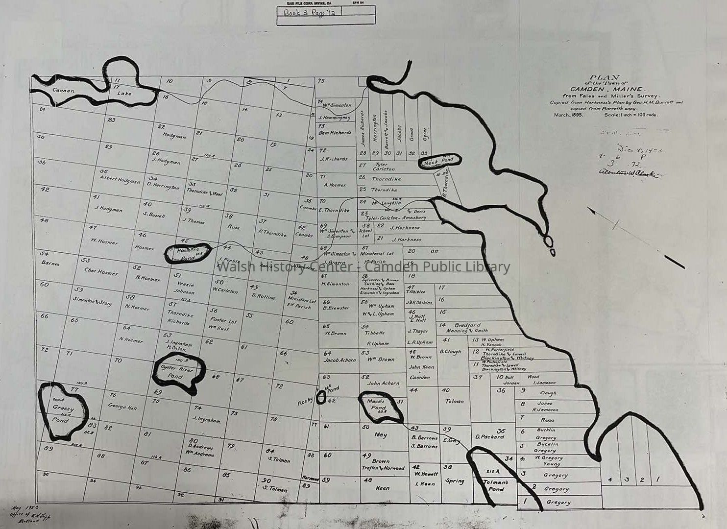
Plan of Camden by S. F. Manning, 1988. Blackline print. This map shows the "1768" Twenty Associates town plan and the Camden Extension plan of 1791. It incorporates information from the surveys of Dr. David Fales (and of Noah Miller of Ducktrap) As depicted in the 1983 map by E. W. Maxey, which incorporates John Harkness' 1799 map for the 20 associates, as well as the Camden Extension plan of 1791 as traced buy E. W. Maxey.Collection
Camden Public Library Map CollectionCataloged By
Wyatt PorterAcquisition
Accession
WHC 2024.17Acquisition Method
Collected by StaffLexicon
Nomenclature 4.0
Nomenclature Secondary Object Term
MapNomenclature Primary Object Term
CartographNomenclature Sub-Class
Graphic DocumentsNomenclature Class
Documentary ObjectsNomenclature Category
Category 08: Communication ObjectsSearch Terms
Maps, Manning, S. F., Maxey, E. W., Harkness, JohnArchive Details
Creator
Manning, S. F.Date(s) of Creation
1791 - 1988Date(s) Material Assembled
2022Archive Notes
Date(s) Created: 1988
Date(s): 07/23/2024Location
Location
Building
Walsh History CenterCategory
PermanentDate
October 21, 2025Condition
Overall Condition
GoodDate Examined
Jul 23, 2024Examined By
Wyatt PorterRelationships
Related Person or Organization
Person or Organization
Manning, S. F.Person or Organization
Maxey, E. W.Person or Organization
Harkness, JohnGeneral Notes
Note
Status: OK
Status By: Wyatt Porter
Status Date: 2024-07-23Created By
admin@catalogit.appCreate Date
July 23, 2024Updated By
admin@catalogit.appUpdate Date
October 27, 2025