Name/Title
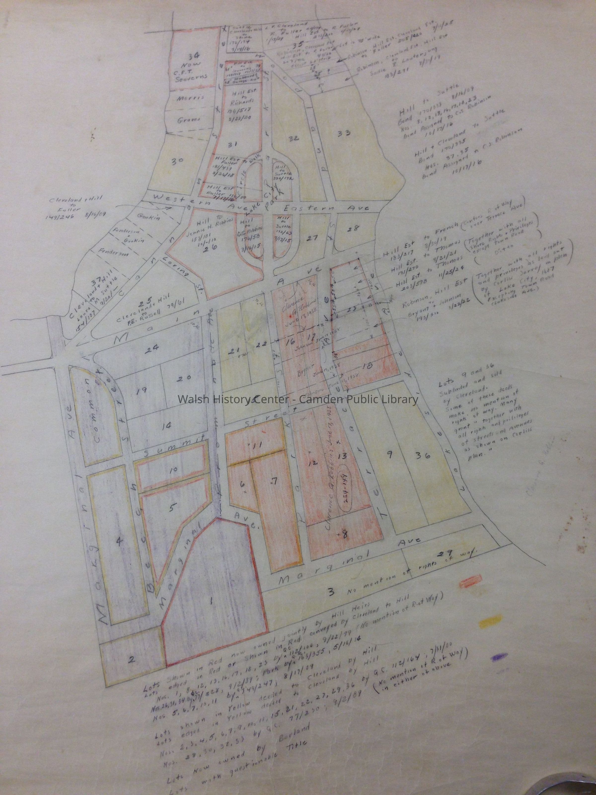
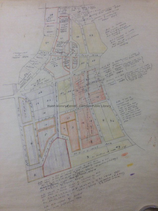
[Map of Lake City lots 1887-1938]Entry/Object ID
WHC 2014.30.1Description
Hand-drawn map of Lake City lots bounded on two sides by Lakeside Avenue and Marginal Avenue. Map is undated and creator is unknown. No scale noted. Colored shadings on map indicate lots owned by Cleveland, Hill, and Borland heirs.Collection
Camden Public Library Map CollectionCataloged By
Heather MoranAcquisition
Accession
WHC 2014.30Source or Donor
Boynton, Mrs. HaroldAcquisition Method
GiftLexicon
Nomenclature 4.0
Nomenclature Secondary Object Term
MapNomenclature Primary Object Term
CartographNomenclature Sub-Class
Graphic DocumentsNomenclature Class
Documentary ObjectsNomenclature Category
Category 08: Communication ObjectsLOC Thesaurus for Graphic Materials
Land, Land subdivision, SettlementsSearch Terms
Lake City, Megunticook LakeMap Details
Maker or Creator
unknownArea or Region
Location
Megunticook Lake/CamdenPublisher
unknownDate Published
1887 - 1938Medium
PaperPublication Language
EnglishDimensions
Dimension Notes
59 x 72 cmLocation
Location
Container
Lake City maps folderCabinet
Map CaseBuilding
Walsh History CenterCategory
PermanentDate
October 21, 2025Condition
Overall Condition
FairDate Examined
Jul 5, 2014Examined By
Heather MoranGeneral Notes
Note
Status: OK
Status By: Heather Moran
Status Date: 2014-07-05Created By
admin@catalogit.appCreate Date
July 5, 2014Updated By
admin@catalogit.appUpdate Date
October 27, 2025