Name/Title
MapEntry/Object ID
WHC 2018.33Description
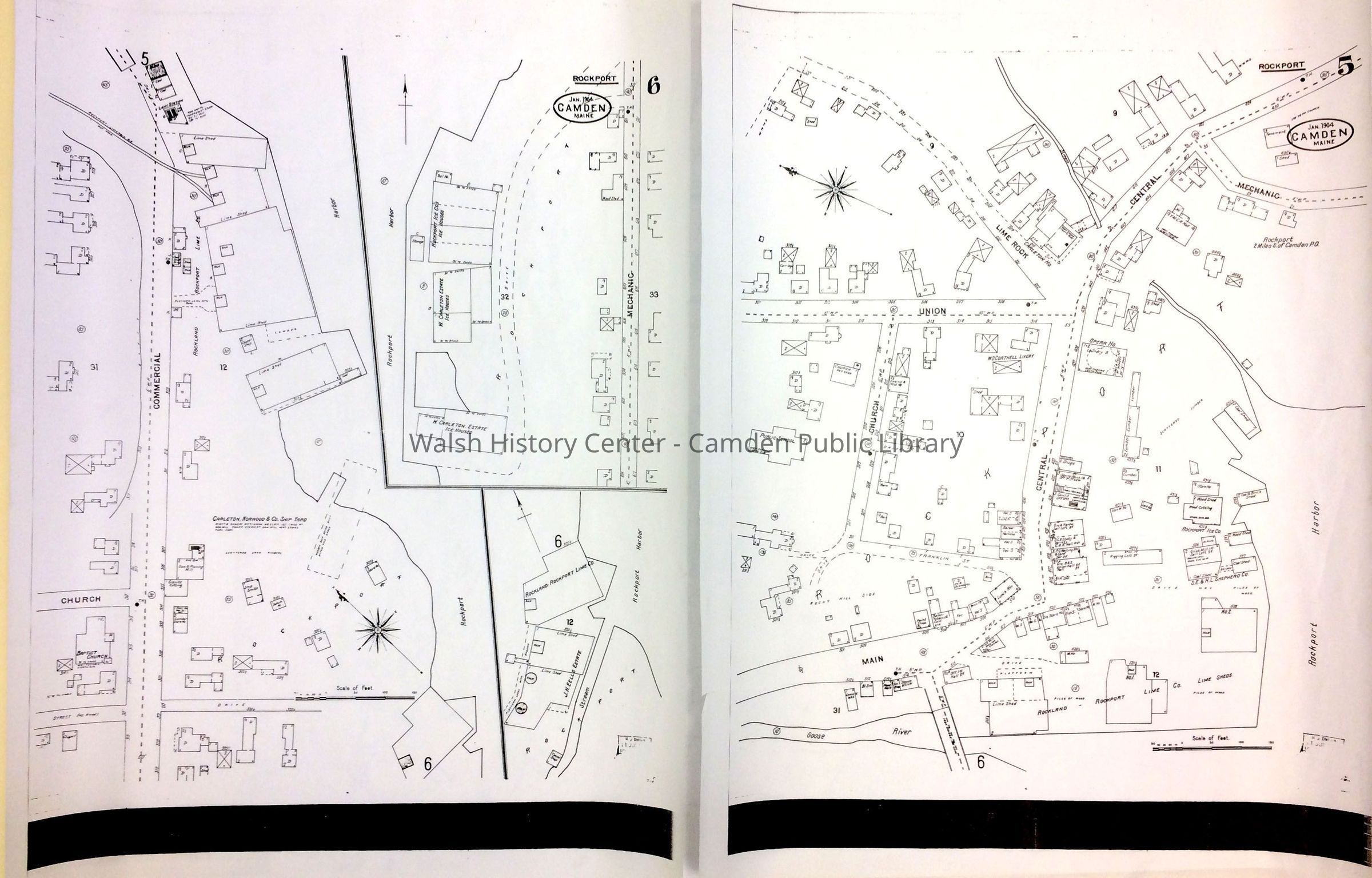
ROCKPORT. Sanborn Insurance Map, 1904. Section 6. Shows the area from Commercial Street [Pascal Avenue] on the left to Rockport Harbor on the right, and from [no name] Street on the left to Rockland-Rockport Lime Railway, at the top. This is the area once covered by Rockland-Rockport Lime company kilns and the Carleton-Norwood Shipyard. Insets show the Rockport Ice Houses between Rockport Harbor and Mechanic Street, and additional Lime Company houses where a stream enters Rockport Harbor.
Photocopy on vellum.Collection
Camden Public Library Map CollectionCataloged By
Wyatt BerryAcquisition
Accession
WHC 2018.33Source or Donor
CPL Map CollectionAcquisition Method
Found in CollectionLexicon
Nomenclature 4.0
Nomenclature Secondary Object Term
MapNomenclature Primary Object Term
CartographNomenclature Sub-Class
Graphic DocumentsNomenclature Class
Documentary ObjectsNomenclature Category
Category 08: Communication ObjectsLOC Thesaurus for Graphic Materials
Ice housesSearch Terms
Rockport, Sanborn Insurance Map, Pascal Avenue, Ice Houses, Rockland-Rockport Lime Company, Carleton-Norwood ShipyardMap Details
Map Notes
Early Create Date: 1904Location
Location
Cabinet
Map CaseBuilding
Walsh History CenterCategory
PermanentDate
October 21, 2025Category
PermanentMoved By
Wyatt BerryDate
September 21, 2018Inventory
Inventoried By
Wyatt BerryInventoried Date
Sep 21, 2018General Notes
Note
Status: OK
Status By: Wyatt Berry
Status Date: 2018-09-21Created By
admin@catalogit.appCreate Date
September 7, 2018Updated By
admin@catalogit.appUpdate Date
October 26, 2025