Name/Title
"Historic Landmark Map"Entry/Object ID
WHC 2018.34Description
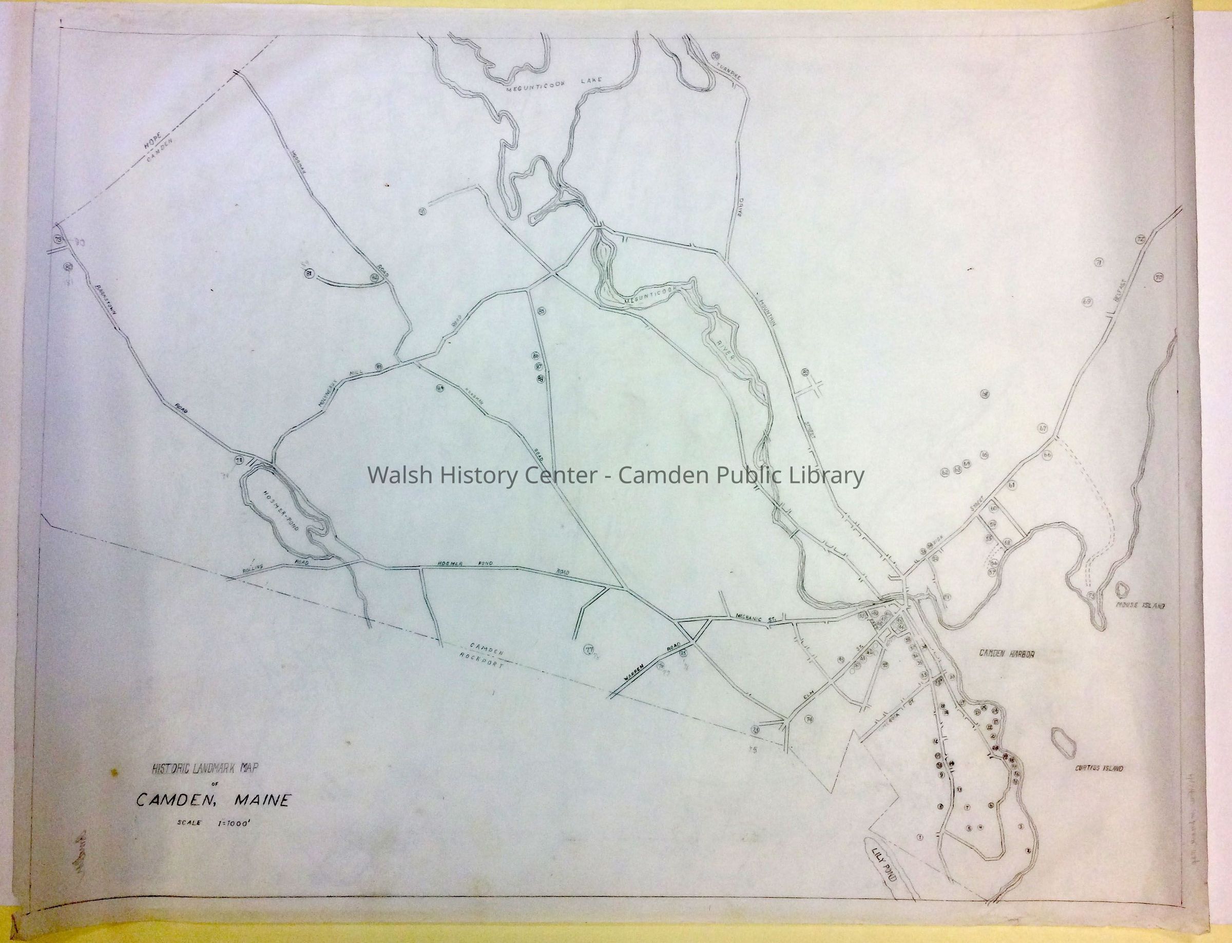
CAMDEN. "Camden, Maine - Historic Landmark Map." Historic landmarks are indicated by numbered circles. Road names of principal roads are shown. Some names are changed: e.g., Hodgman Road is now Howe Hill Road; Molyneaux Mill Road is now simply Molyneaux Road; Warren Road is now Simonton Road. This is evidently a "work in progress;" some of the numbered locations appear to be in the process of being revised. The key to the numbered locations is not indicated on the map, and a search of the Vertical File did not reveal a key to this map.
Pencil on vellum.Collection
Camden Public Library Map CollectionCataloged By
Wyatt BerryAcquisition
Accession
WHC 2018.34Source or Donor
CPL Map CollectionAcquisition Method
Found in CollectionLexicon
Nomenclature 4.0
Nomenclature Secondary Object Term
MapNomenclature Primary Object Term
CartographNomenclature Sub-Class
Graphic DocumentsNomenclature Class
Documentary ObjectsNomenclature Category
Category 08: Communication ObjectsLocation
Location
Cabinet
Map CaseBuilding
Walsh History CenterCategory
PermanentDate
October 21, 2025Category
PermanentMoved By
Wyatt BerryDate
September 21, 2018Inventory
Inventoried By
Wyatt BerryInventoried Date
Sep 21, 2018General Notes
Note
Status: OK
Status By: Wyatt Berry
Status Date: 2018-09-21Created By
admin@catalogit.appCreate Date
September 7, 2018Updated By
admin@catalogit.appUpdate Date
October 26, 2025