Name/Title
TRACES OF FEDERAL MAINE, With Reproduction of the 1795 Map From Sullivan's History of the DistrictEntry/Object ID
WHC 2018.56Description
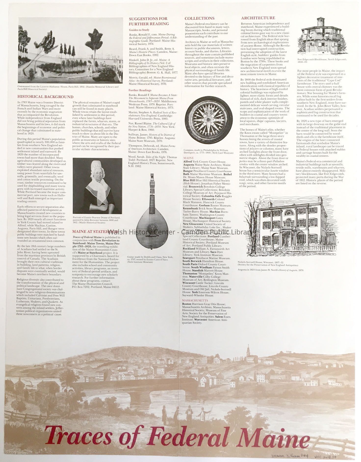
FLYER: TRACES OF FEDERAL MAINE, with reproduction of the map from Sullivan's History of the District of Maine, 1795; also a List of Maine's Federal Period Towns and Buildings.
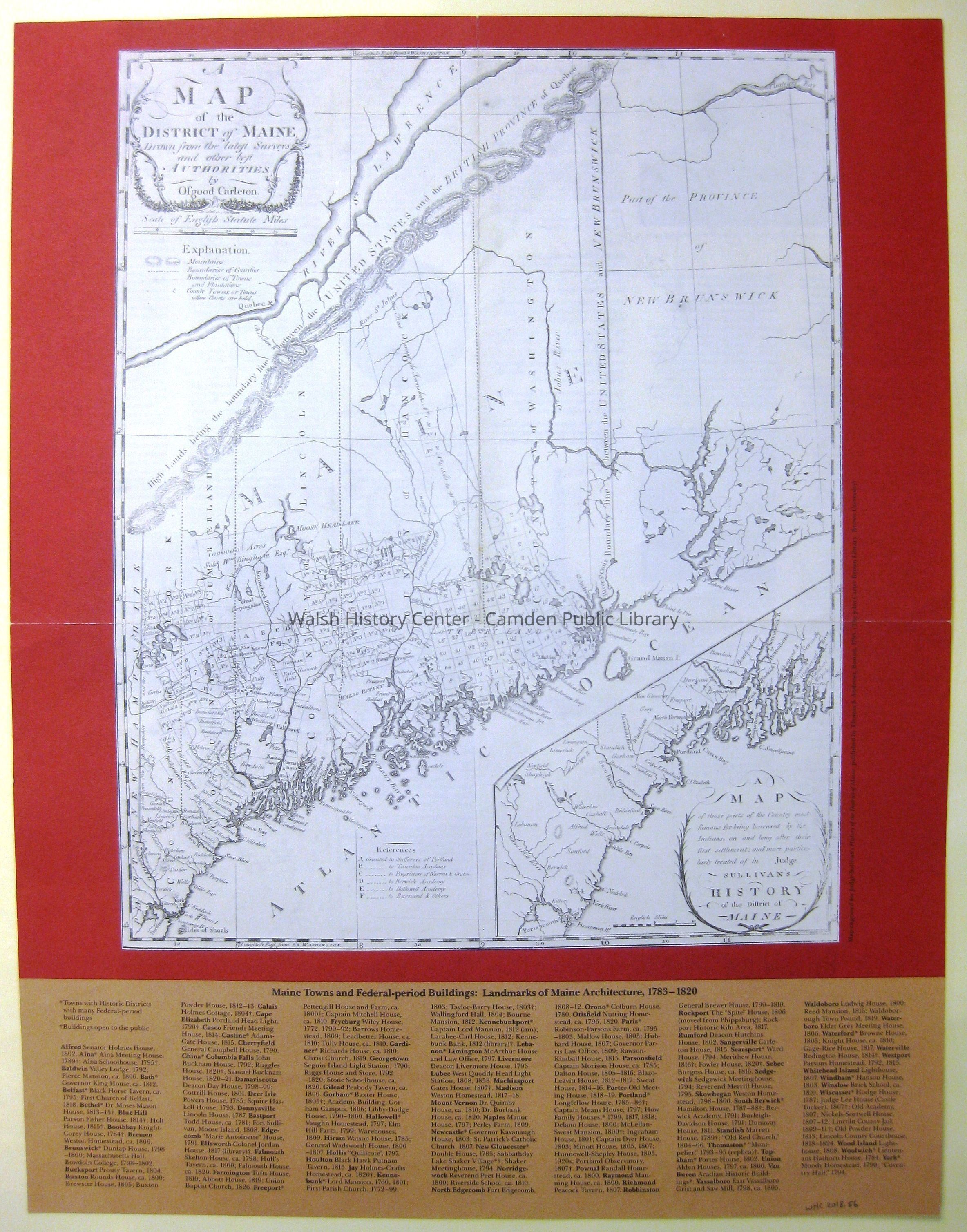
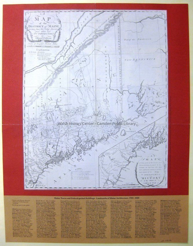
A MAP of the DISTRICT OF MAINE Drawn from the latest surveys and other best authorities by Osgood Carleton, 1795. Shown here as part of a large flyer on Federal Maine. The original of this map appeared as an insert in Judge James Sullivan's History of the District of Maine, Massachusetts, and was prepared by Osgood Carleton for that publication.
Color reproduction
See also WHC 2018.65Collection
Camden Public Library Map CollectionCataloged By
Wyatt BerryAcquisition
Accession
WHC 2018.56Source or Donor
CPL Map CollectionAcquisition Method
Found in CollectionLexicon
Nomenclature 4.0
Nomenclature Secondary Object Term
MapNomenclature Primary Object Term
CartographNomenclature Sub-Class
Graphic DocumentsNomenclature Class
Documentary ObjectsNomenclature Category
Category 08: Communication ObjectsLOC Thesaurus for Graphic Materials
MapsSearch Terms
District of Maine, Massachusetts, James Sullivan, Osgood Carleton, MapsLocation
Location
Cabinet
Map Case Folder PBuilding
Walsh History CenterCategory
PermanentDate
October 21, 2025Category
PermanentMoved By
Wyatt BerryDate
September 21, 2018Inventory
Inventoried By
Ken GrossInventoried Date
Apr 25, 2022Relationships
Related Person or Organization
Person or Organization
James SullivanPerson or Organization
Osgood CarletonGeneral Notes
Note
Status: OK
Status By: Wyatt Berry
Status Date: 2018-09-21Created By
admin@catalogit.appCreate Date
September 18, 2018Updated By
admin@catalogit.appUpdate Date
October 27, 2025