Name/Title
Map and pronunciation guide to traditional Penobscot landsEntry/Object ID
WHC 2022.15.1Description
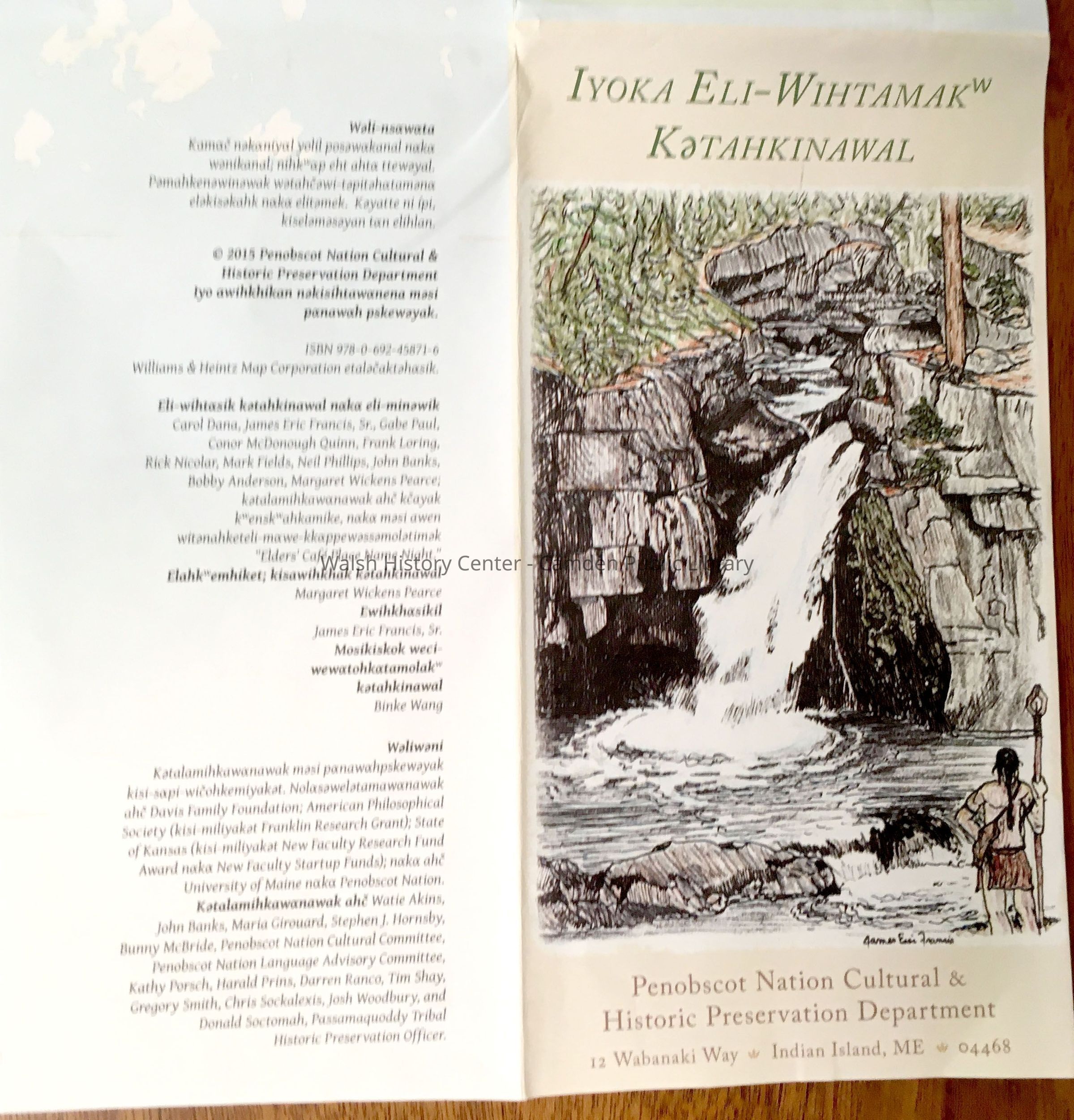
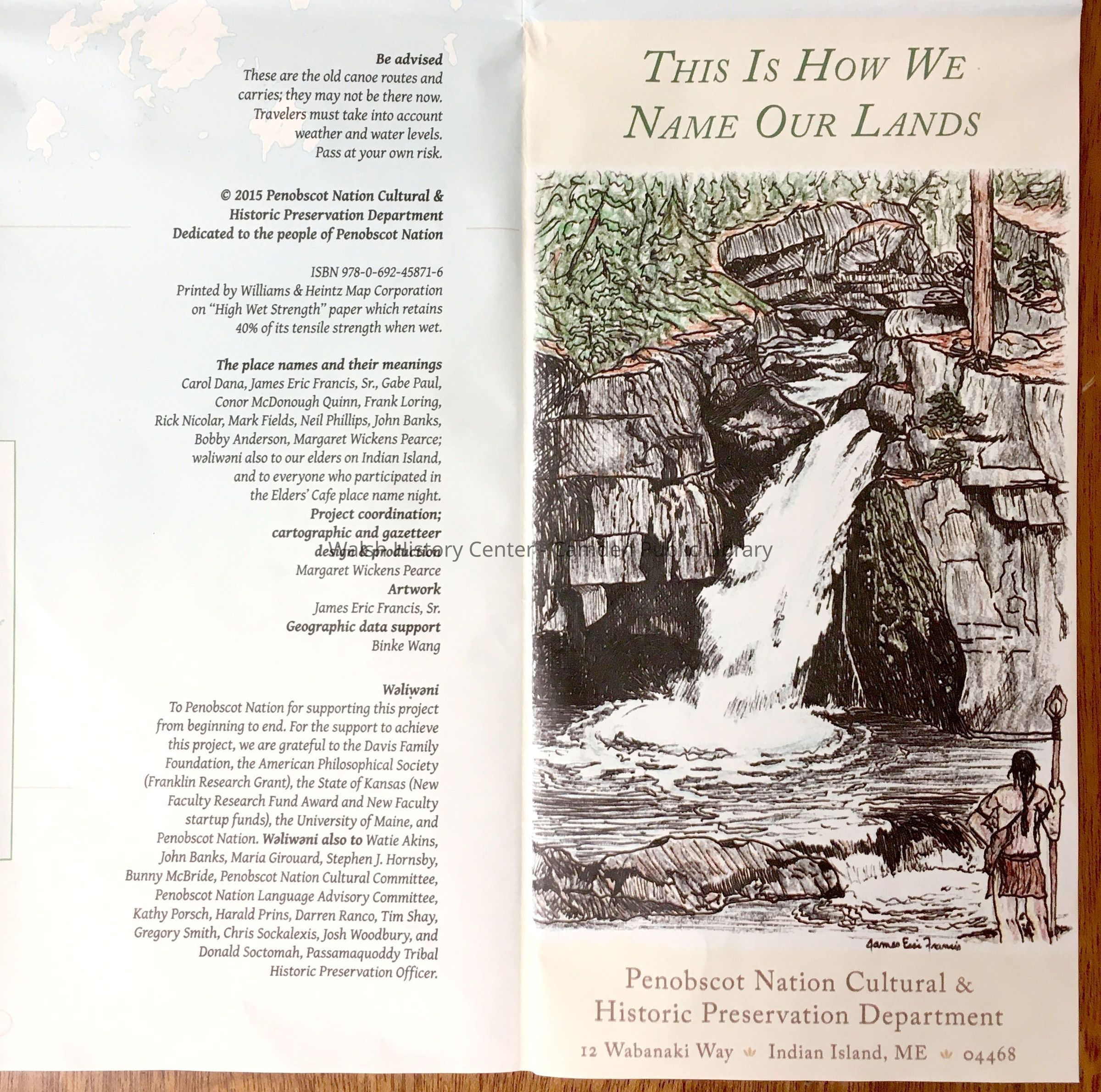
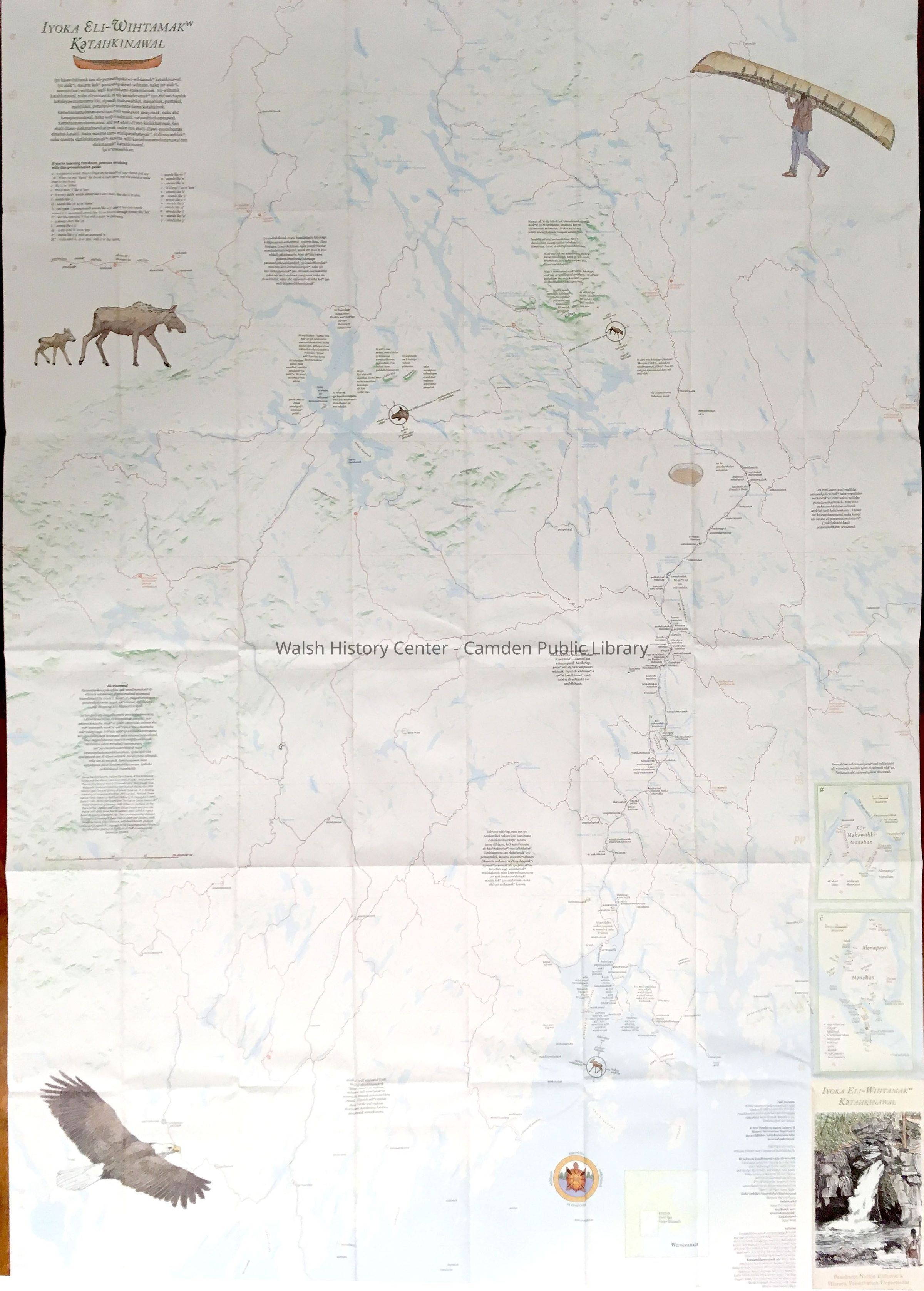
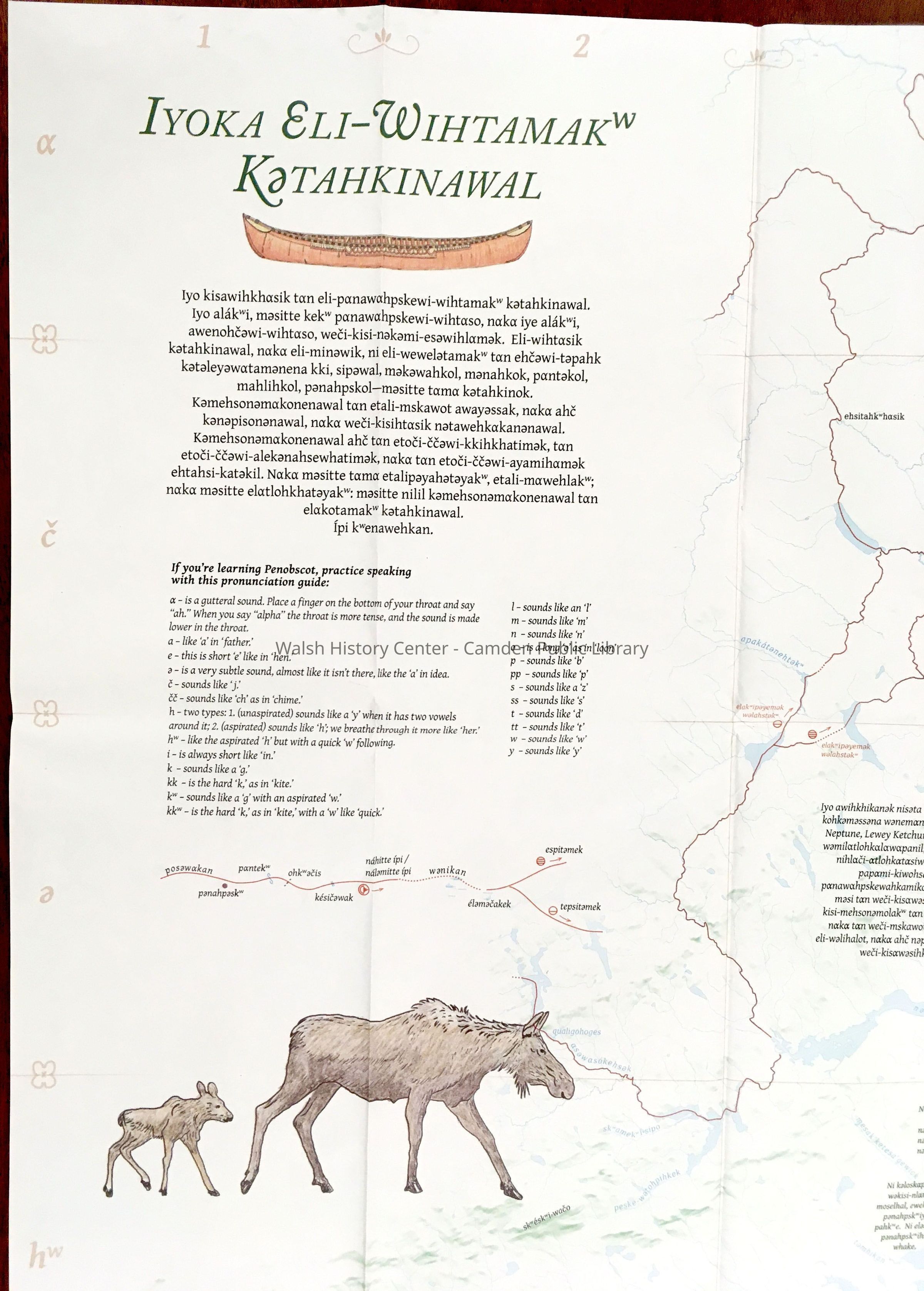
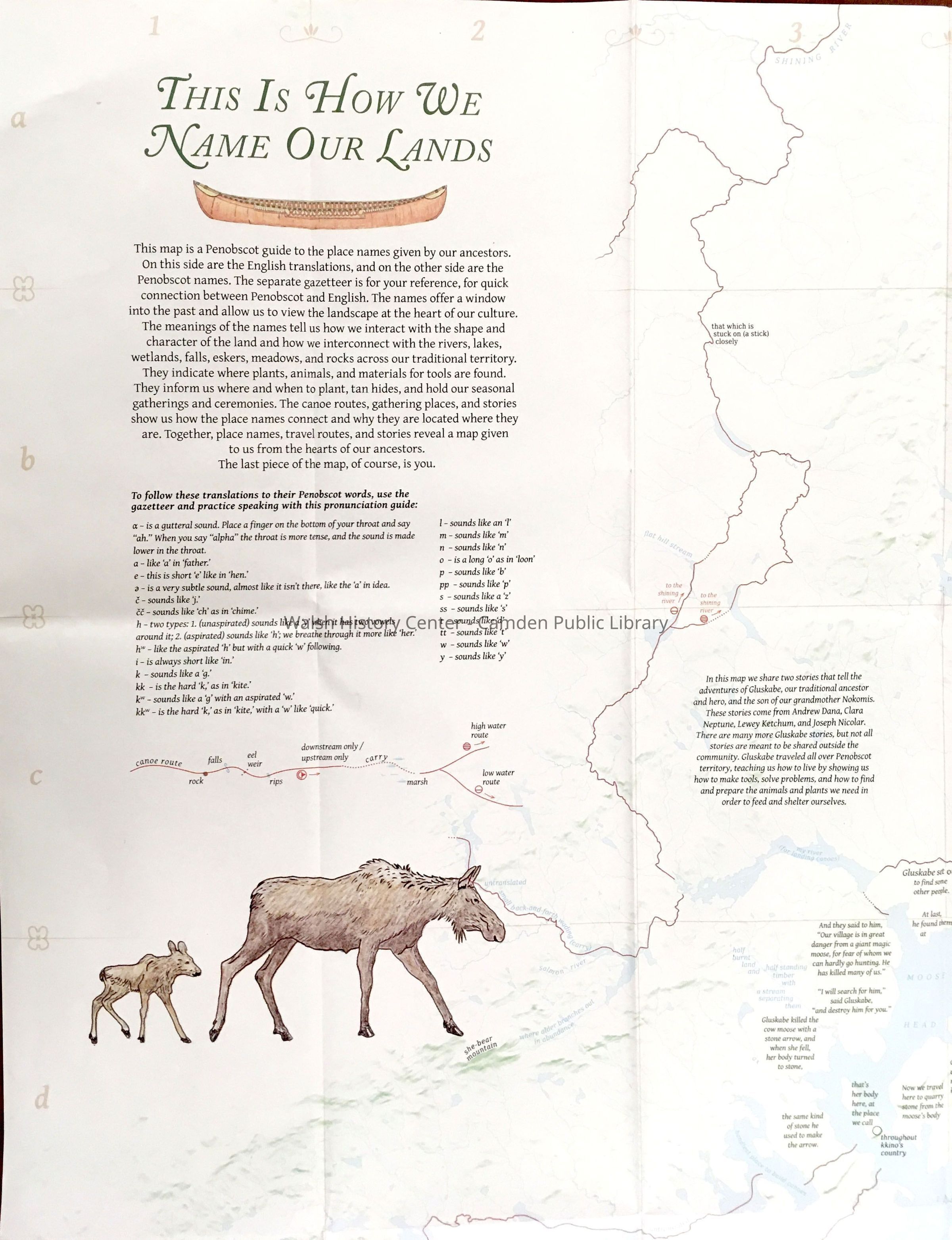
"This is How We Name Our Lands" / Iyoka-Wihtamakw Katahkinawal. Bilingual Penobscot / English map of traditional Penobscot lands - "Wahoabahjkik" or "Dawnland." It shows lands and waters and traditional canoe routes and carries. Many explanatory notes and a pronunciation guide and a table of sources for Penobscot and for English names.
Inset shows "The People's Island" (Indian Island) and adjacent Bog Island.
Copyright 2015 Penobscot Nation Cultural & Historic Preservation Department. ISBN 978-0-692-45871-6
The Penobscot Nation Cultural and Historic Preservation Department is at 12 Wabanaki Way, Indian Island, ME 04468.
WHC 2022.15.2 5" x 7" English to Penobscot / Penobscot to English Gazetteer. Copyright 2015, The Penobscot Nation Cultural and Historic Preservation Department. 44 pages. "The map and gazetteer are set in DejaVu Serif, Sans, and Gentium, all open-source Unicode typefaces. They let us write Penobscot and English words together, as equals." "A bilingual product in Penobscot and English.Collection
Camden Public Library Map CollectionCataloged By
Donovan BowleyAcquisition
Accession
WHC 2022.15Source or Donor
Unknown Accession Donor (ae48eca1-ae8a-11f0-a0b9-c7ce86d2caba)Acquisition Method
GiftLexicon
Nomenclature 4.0
Nomenclature Secondary Object Term
MapNomenclature Primary Object Term
CartographNomenclature Sub-Class
Graphic DocumentsNomenclature Class
Documentary ObjectsNomenclature Category
Category 08: Communication ObjectsSearch Terms
Penobscot, Penobscot LanguageMap Details
Date Published
Apr 27, 2022Condition
Overall Condition
GoodDate Examined
Apr 27, 2022Examined By
Ken GrossGeneral Notes
Note
Status: OK
Status By: Ken Gross
Status Date: 2022-04-27Created By
admin@catalogit.appCreate Date
April 27, 2022Updated By
admin@catalogit.appUpdate Date
October 27, 2025