Name/Title
MapEntry/Object ID
WHC 2022.18Description
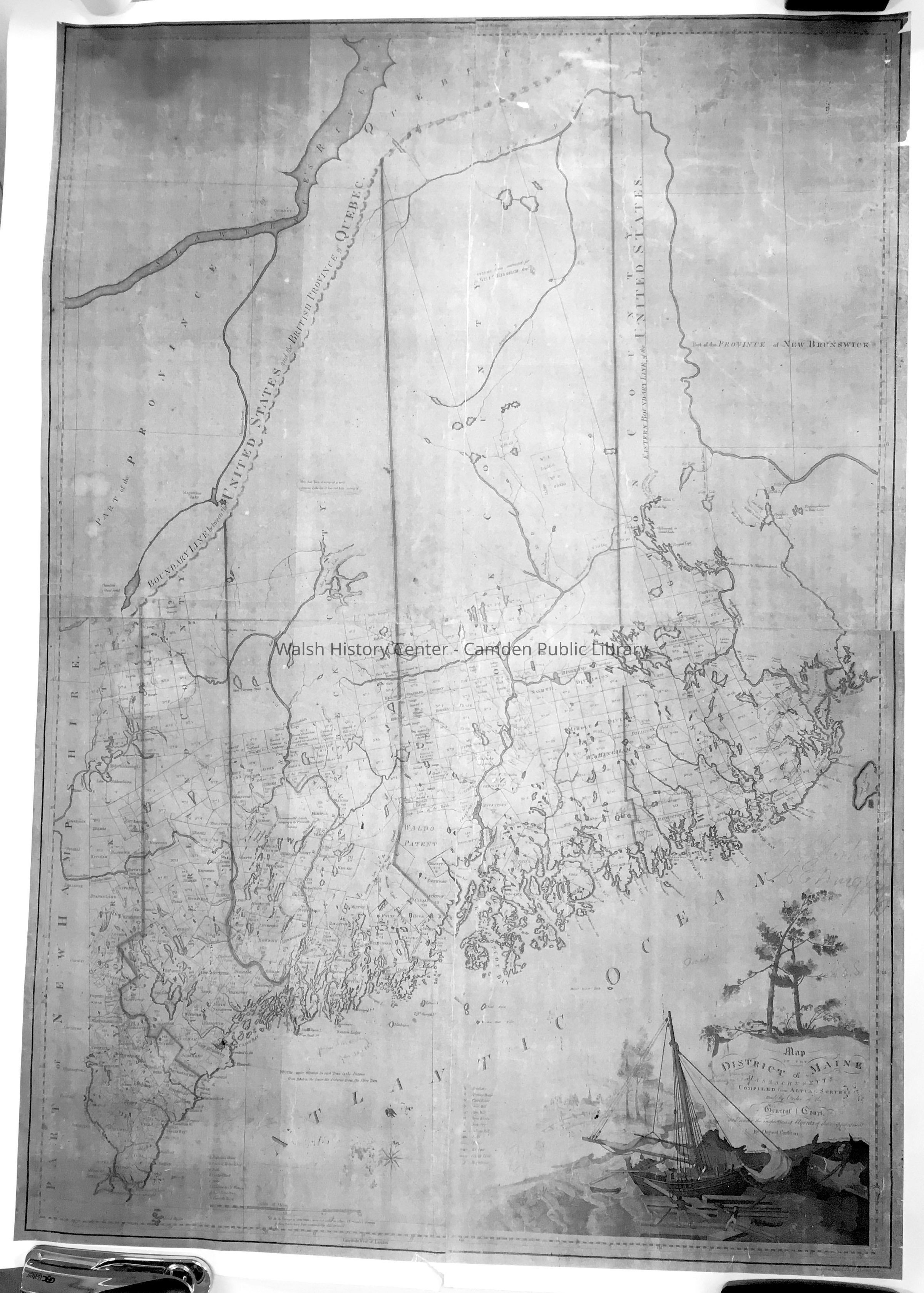
Map of the District of Maine, Massachusetts, compiled from the actual surveys made by order of the General Court, and under the inspection of agents of their appointment. By Osgood Carleton [1802] B&W reproduction.
This map is the first authoritative map of the State of Maine, made when it was the eastern district of Massachusetts, done from actual surveys. This copy is a somewhat reduced photocopy of the original prints in the Maine State Library's Special Collection. As the original was quite brittle, they kindly made a composite digital copy of the four separate sheets. That digital image was filtered by Richard Warner of Warner Graphics in Camden for Donovan Bowley, resulting in this print. Shown on this map are the towns and townships surveyed - the distance from Boston and distance from their shire towns indicated on each - as well as the roads and hydrography, together with a scale bar and marginal indicators of latitude and longitude, and a compass rose. There is also a key to the locations of Academies, Meeting Houses, Court Houses, Grist Mills, Saw Mills, Iron Works, Iron Ore, Fulling Mills, Falls, Roads, Bridges, County Lines, and Mountains. Counties of that date are York, Cumberland, Kennebec, Lincoln, Hancock, and Washington. Filling the area in the lower right corner is a large and distinctive cartouche showing a ship under construction on a costal river, and white pines,
Note: slight tear in bottom margin should be mended with acid free paper tape. Gift of Donovan A.R. Bowley.Collection
Camden Public Library Map CollectionCataloged By
Donovan BowleyAcquisition
Accession
WHC 2022.18Source or Donor
Unknown Accession Donor (ae4913b2-ae8a-11f0-a0b9-c7ce86d2caba)Acquisition Method
GiftLexicon
Nomenclature 4.0
Nomenclature Secondary Object Term
MapNomenclature Primary Object Term
CartographNomenclature Sub-Class
Graphic DocumentsNomenclature Class
Documentary ObjectsNomenclature Category
Category 08: Communication ObjectsSearch Terms
Maine, 1802, Osgood CarletonMap Details
Date Published
May 6, 2022Location
Location
Building
Mp case ROLLED MAPSCategory
PermanentDate
October 21, 2025Condition
Overall Condition
GoodDate Examined
May 6, 2022Examined By
Ken GrossGeneral Notes
Note
36x47.5"
Status: OK
Status By: Ken Gross
Status Date: 2022-05-06Created By
admin@catalogit.appCreate Date
May 6, 2022Updated By
admin@catalogit.appUpdate Date
October 27, 2025