Name/Title
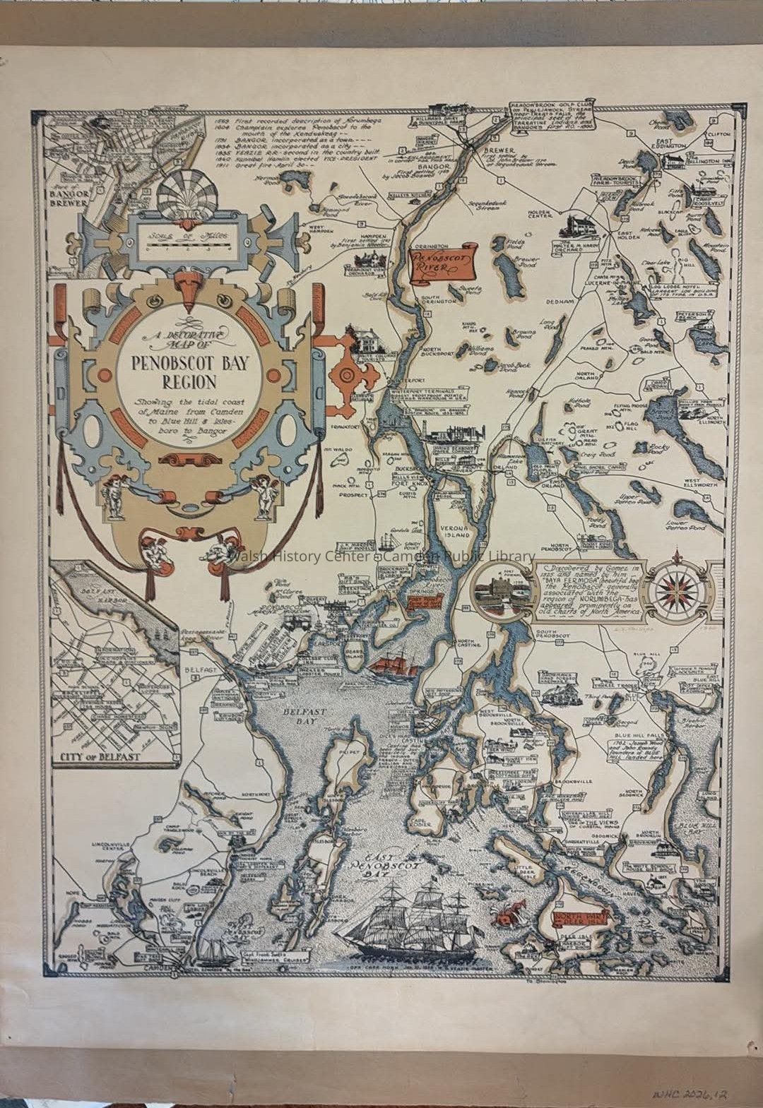
A Decorative Map of Penobscot Bay Region showing the tidal coast of Maine from Camden to Blue Hill & Islesboro to BangorEntry/Object ID
2026.12Description
From the David Rumsey Map Collection:
"Pictorial map of Maine’s Penobscot Bay and part of of the river Penobscot, by L. S. Phillips. Printed with textual explanations. The map covers from Bangor south as far as Camden and the northern part of Deer Island and east as far as Blue Hill Harbor. Includes historical notations. At the top margin notes the important events in the history of the regions – from the ‘first recorded description of Norumbega’ in 1569 to the ‘great fire – April 30’ in 1911, and a note near the compass rose reads, "Discovered by Gomes in 1525 and named by him ‘Baya Fermosa’ (beautiful bay), the Penobscot ..." Maps shows roads, rivers, lakes, highways, islands, ports, ships, buildings and landmarks. Relief shown by contours and spot heights. Includes decorative compass rose orienting north to the top of the map."Collection
Camden Public Library Map CollectionCataloged By
Wyatt PorterLocation
Location
Walsh History Center
Map Case Folder XDate
August 12, 2026Create Date
August 12, 2026Update Date
August 12, 2026