Name/Title
Plan of house lots by lime quarry in Camden, 1854Entry/Object ID
WHC 2009.135Scope and Content
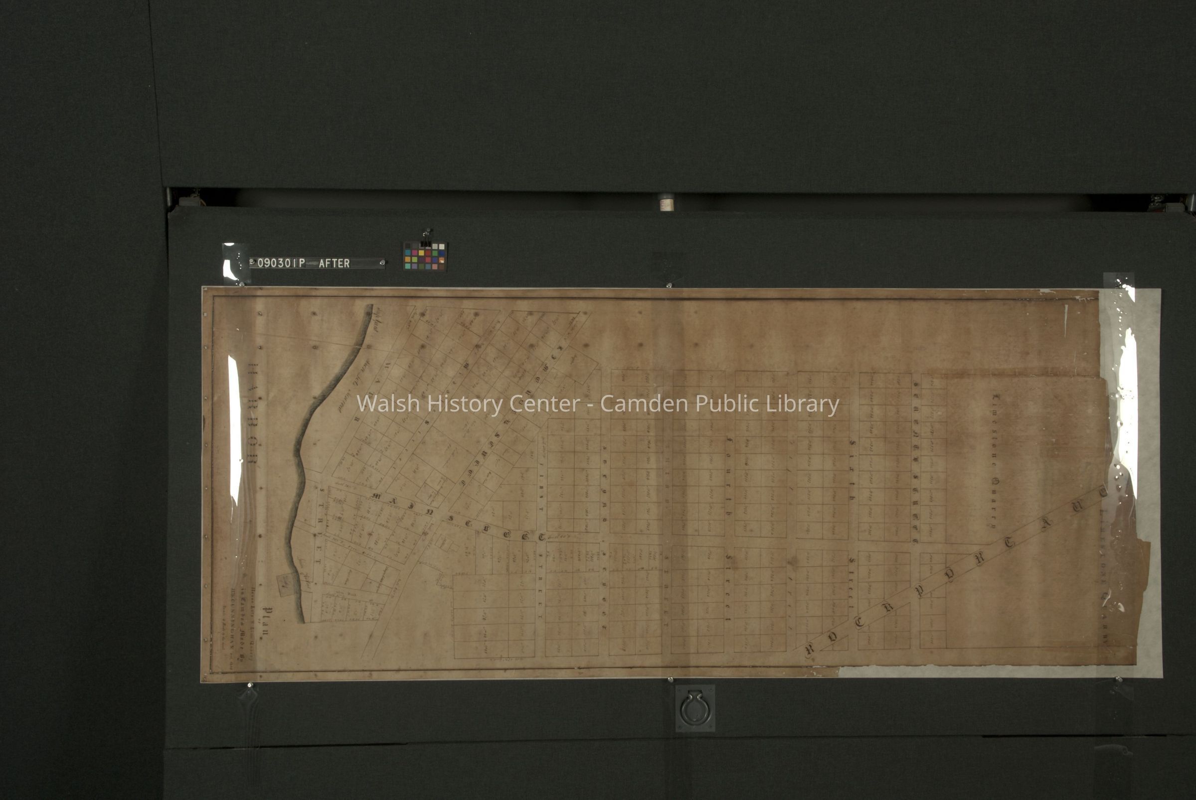
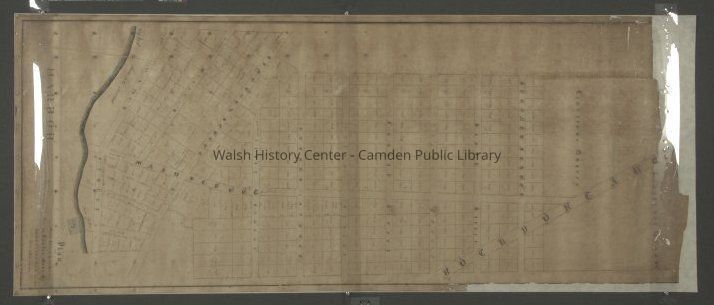
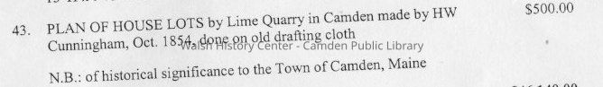
Plan of house lots by lime quarry in Camden, made by H.W. Cunningham, October 1854. Map is hand-drawn on starched linen using iron gall ink and watercolors and dimensions are 29" x 70." Map has been treated and stabilized at NEDCC.
The streets and lots were apparently never completely laid out.
"Before" and "after" photos were made at NEDCC to document the preservation work. The images are located on DVDs located in the vertical file under Lime.
The map is in a cardboard tube in the Storage Room.Collection
Camden Public Library Map CollectionCataloged By
Heather BilodeauAcquisition
Accession
WHC 2009.135Source or Donor
Mr. and Mrs. Douglas GreenAcquisition Method
GiftLexicon
Nomenclature 4.0
Nomenclature Secondary Object Term
MapNomenclature Primary Object Term
CartographNomenclature Sub-Class
Graphic DocumentsNomenclature Class
Documentary ObjectsNomenclature Category
Category 08: Communication ObjectsLOC Thesaurus for Graphic Materials
Land, Maps, QuarriesSearch Terms
Camden, Lime Industry, Maine, RockportArchive Details
Creator
H.W. CunninghamDate(s) of Creation
Oct 1854Archive Notes
Late Create Date: 1854
Date(s): October 1854
Location of Originals: Four photographs prior to conservation on DVD.Location
Location
Drawer
DVD is in Vertical FileRoom
Storage RoomBuilding
Walsh History CenterCategory
PermanentDate
October 21, 2025Location
Building
Northeast Document Conservation Center, Andover MADate
July 28, 2009Notes
Reason: Conservation assessment
Authorized By: Heather BilodeauInventory
Inventoried By
Heather BilodeauInventoried Date
Jul 28, 2009Condition
Overall Condition
StableDate Examined
Jun 16, 2011Examined By
Heather BilodeauNotes
Paper is extremely fragile and rolled around a wooden rod. Was found in donor's attic. Will need professional conservation.
Treatment performed: Surface soil reduced using dry cleaning techniques. Dowel was removed. Adhesive tapes and adhesives removed with heat and organic solvents. Map washed in filtered water/alcohol to clean and reduce acidity. Backed with Japanese paper to mend tears and provide support. Humidified and stretch dried on screen. Spray deacidified on the reverse with a non-aqueous solution (Bookkeeper).Valuations
Valuation Type
AppraisalEstimator
Veilleux, KajaDate
Jul 28, 2009Notes
Min. Value: 500
Description: Map is of historical significance to the Town of Camden. Appraisal was sought by donor prior to donation to the History Center. Appraisal document was photocopied.Valuation Type
InsuranceValue
$500.00Valuation Type
Aquisition ValueValue
$500.00Relationships
Related Person or Organization
Person or Organization
Cunningham, H.W.General Notes
Note
Status: OK
Status By: Heather Bilodeau
Status Date: 2011-06-16Created By
admin@catalogit.appCreate Date
July 28, 2009Updated By
admin@catalogit.appUpdate Date
October 27, 2025